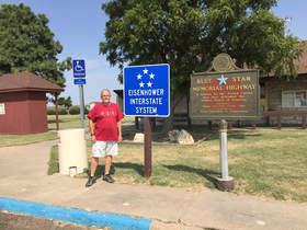
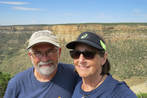
2017 Southwest Trip to Tucson, September 7-2017
September 7, 2017--Leave home and drive to High Plains Camping, Oakley, KS overnight. 345 Miles
September 8, 2017--Leave Oakley, KS and drive to Alamosa KOA, Alamosa, CO overnight. 380 Miles
September 9, 2017--Leave Alamosa , CO and arrive at Mesa Verde RV Resort, Mancos, CO 187 Miles
September 9-18, 2017--At Mesa Verde RV Resort. (8 full days) Checkout on September 18.
September 18, 2017--Leave Mesa Verde RV Resort and arrive at Goulding’s Campground, Oljato-Monument Valley. 144 Miles
September 18-20, 2017--At Monument Valley. (1 full day, 1 partial day) Checkout on September 20.
September 20, 2017--Leave Monument Valley and arrive at Spanish Trail RV Park, Moab, UT. 144 Miles
September 20-27, 2017--At Spanish Trail RV Park. (6 full days) Checkout on September 27.
September 27, 2017--Drive to J & H RV Park, Flagstaff, AZ overnight. 312 miles
September 28, 2017--Leave J & H RV Park in Flagstaff and drive to Rincon West, Tucson, AZ. 333 Miles taking Phoenix bypass.
September 28-October 19--At Tucson, AZ at Rincon West
October 19, 2017--Leaving our travel trailer in Tucson, driving truck back home with plans to visit Hatch, NM with 2 nights visit with cousins at Elizabeth, CO.
October 22, 2017--Home
September 7, 2017, On our way to Colorado
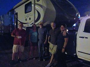
Seems like we've been getting ready for weeks but it's finally here and we're ready to begin the trip with our Jayco travel trailer. It was a little chilly leaving Kansas at 47 degrees. We stopped at Wamego Rest Stop and had breakfast of coffee cake that I had made the day before but we had to eat it in the truck because it hadn't warmed up much. We got gas at Salina, KS and lunch was at Ogallah, Ks where it was warm enough that we could eat outside. The first day was not much but driving and the only notable thing we saw were a lot of old historic churches along I-70. We arrived at High Plains RV Resort in Oakley, Ks mid afternoon and finally the weather was getting warm, around 80 degrees. We looked at the map to figure out our route for tomorrow. We had dinner at Cap'n Jack's Pub next to the RV Park where we met a couple from Georgia. Another couple we met on our way back to our trailer was from Neosho, MO, near Joplin where we used to live. What a small world and this is what we love about RVing...how easily you make new friends. Tonight the temp got down to 60 degrees and with our trailer windows open it was great for sleeping.
Our new friends from Georgia and Missouri
|
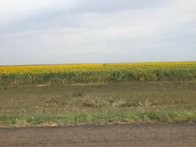
Sunflower fields in Kansas
|
Photos 1st Day
September 8, 2017, On our way to Colorado
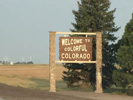
Our destination for today is Alamosa, Colorado. The weather was great with the temp at 55 degrees and clear. We started out the morning at 7 am. At the Colorado state line the time changed to Mountain time so we gained an hour so at 8:30 we changed our watches back to 7:30. Our next stop was at Burlington, CO at a nice Welcome Center. The staff was really helpful and gave us a lot of Colorado information. They advised us to take Highway 71 from Limon, CO, to Highway 10 turning into Highway 160 instead of the interstates. After driving this route, Mike and I decided that from now on we would stick to the interstates. The highways are narrow, no shoulders, no rest areas, and no gas stations. That works if you're in a car, not so much in the travel trailer. We ate breakfast at the Welcome Center in the truck as it was 60 degrees and still a little cool for outside eating. While at the Welcome Center we met a couple from Springfield, IL driving to the Phoenix area to winter in Arizona. They were getting ready to sell their home and move permanently to Arizona. Who knows, maybe that will be Mike and me in a few years.
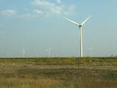
Again, most of the day was spent driving. There are lots of wind generators along the highway built right into the middle of farm land planted with crops. We were surprised to see lots of fields of cacti (cholla) and Yucca plants along the highway. When we were getting close to Highway 160 near Walsenburg, CO we began to see the mountains. We stopped for lunch at Lathrop State Park near Walsenburg. This was a nice spot to have our picnic lunch. We arrived at Alamosa KOA RV Park at 2:30 pm. We felt like it was later in the day though because of the time change plus we drove about an hour more today than yesterday. This is a much nicer park than last night’s park but still not worth the price. It’s a tourist destination so everything is expensive here. After we got our spot at the KOA RV Park Mike unhooked the truck and got gas at Alamosa. Wow the gas bills are killing us. So far we have spent over $200 but motels and eating out would be more expensive. Our total mileage today was 382 miles. We are looking forward to reaching Mesa Verde RV Park tomorrow. It will be fewer miles tomorrow but more driving in the mountains. We are ready to stay at one place for a while. September 9, 2017, to Mesa Verde RV Park and Mesa Verde NP |
|
We left at 8 am as we only had 187 miles to drive but we also knew it might be a hard drive pulling the trailer through some steep and curvy roads. We drove through the town of Monte Vista, a really cute town I would love to visit some time. Our first stop was near South Fork, CO at a rest stop where we had breakfast. This is the rest area where our car broke down in 1990 on vacation with Tim and Doug.
Shortly after driving through South Fork we ascended to Wolfe Creek Pass, elevation 10,850. When we reached the summit we crossed the Continental Divide. We wanted to stop but when you’re pulling a trailer it’s not always the best idea to pull off the main road without there being a plan! The ascent hadn’t been too bad but the descent was rough, 7% grade for 9 miles. We made it thanks to Mike’s driving. The only mistake he made was that while driving down the pass he related a story to me where a trucker lost control of his truck on this very pass. I told Mike timing was everything and right now was probably not the time! I was relieved once we got to Pagosa Springs because the rest of our drive, although steep and curvy, was nothing compared to the pass. The drive into Pagosa Springs leads you through a scenic valley of large ranches and farmland. Pagosa Springs is known as the world’s deepest hot springs and downtown has lots of shopping and restaurants. It’s on my to do list while we’re at Mesa Verde but I’m not sure our time is going to allow us a return trip here. After Pagosa Springs we could see Chimney Rock National Monument from the highway, another place we would like to visit while we’re near but again I’m not sure we will have enough time.
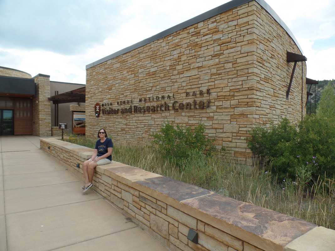
We drove through Durango, CO, one of the places we plan on returning to during the week we’re at Mesa Verde. We arrived at Mesa Verde RV Park around 1 pm and are pleased with our site. It is very level, quiet, and close to the Mesa Verde National Park. We logged about 190 miles on our drive to the RV Park. It took us a while to get set up so we ate a late lunch.
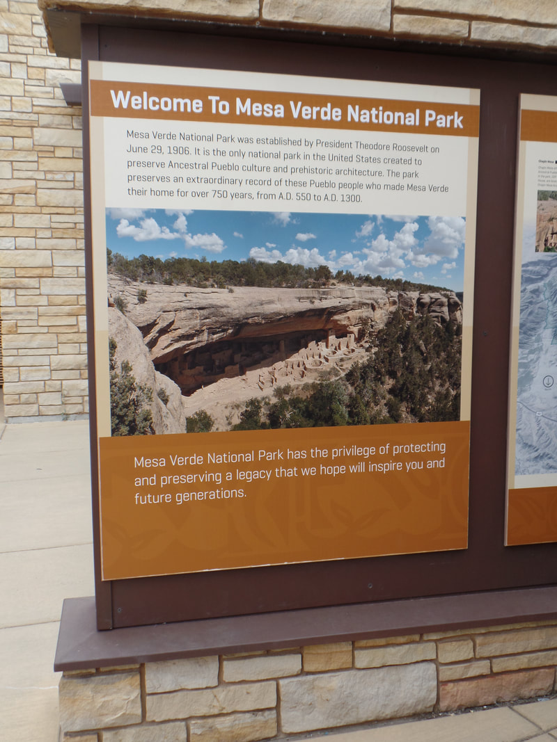
After lunch we drove to the National Park Visitor Center and got lots of great info from the park ranger. We bought a few items from the gift shop at the visitor center which included a passport book for the national parks, a sticker for Mesa Verde. Then we stamped the national parks book, kind of a fun thing to start doing at each national park. We then decided to drive part of the park and get our bearings. The Mesa Verde road is steep, hilly, and has lots of switchbacks. We’re glad we’re not pulling the trailer to the campground in the park. We visited a few of the park campgrounds and we are glad we are at Mesa Verde RV Park ½ mile from the National Park.
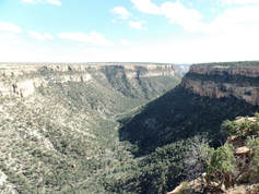
We made one stop at the Montezuma Valley Overlook. The scenery was spectacular and we can’t wait for tomorrow to really explore. We stopped briefly to the Far View Lodge area where we stayed for a night in 1990. We drove past the museum and decided to come back to this area tomorrow as we were losing daylight. We drove to Cortez to buy gas as there aren’t any gas stations close by. We got back to the trailer around 7pm and had dinner. It’s been a long day but now that we’re here the fun will begin.
Shortly after driving through South Fork we ascended to Wolfe Creek Pass, elevation 10,850. When we reached the summit we crossed the Continental Divide. We wanted to stop but when you’re pulling a trailer it’s not always the best idea to pull off the main road without there being a plan! The ascent hadn’t been too bad but the descent was rough, 7% grade for 9 miles. We made it thanks to Mike’s driving. The only mistake he made was that while driving down the pass he related a story to me where a trucker lost control of his truck on this very pass. I told Mike timing was everything and right now was probably not the time! I was relieved once we got to Pagosa Springs because the rest of our drive, although steep and curvy, was nothing compared to the pass. The drive into Pagosa Springs leads you through a scenic valley of large ranches and farmland. Pagosa Springs is known as the world’s deepest hot springs and downtown has lots of shopping and restaurants. It’s on my to do list while we’re at Mesa Verde but I’m not sure our time is going to allow us a return trip here. After Pagosa Springs we could see Chimney Rock National Monument from the highway, another place we would like to visit while we’re near but again I’m not sure we will have enough time.
We drove through Durango, CO, one of the places we plan on returning to during the week we’re at Mesa Verde. We arrived at Mesa Verde RV Park around 1 pm and are pleased with our site. It is very level, quiet, and close to the Mesa Verde National Park. We logged about 190 miles on our drive to the RV Park. It took us a while to get set up so we ate a late lunch.
After lunch we drove to the National Park Visitor Center and got lots of great info from the park ranger. We bought a few items from the gift shop at the visitor center which included a passport book for the national parks, a sticker for Mesa Verde. Then we stamped the national parks book, kind of a fun thing to start doing at each national park. We then decided to drive part of the park and get our bearings. The Mesa Verde road is steep, hilly, and has lots of switchbacks. We’re glad we’re not pulling the trailer to the campground in the park. We visited a few of the park campgrounds and we are glad we are at Mesa Verde RV Park ½ mile from the National Park.
We made one stop at the Montezuma Valley Overlook. The scenery was spectacular and we can’t wait for tomorrow to really explore. We stopped briefly to the Far View Lodge area where we stayed for a night in 1990. We drove past the museum and decided to come back to this area tomorrow as we were losing daylight. We drove to Cortez to buy gas as there aren’t any gas stations close by. We got back to the trailer around 7pm and had dinner. It’s been a long day but now that we’re here the fun will begin.
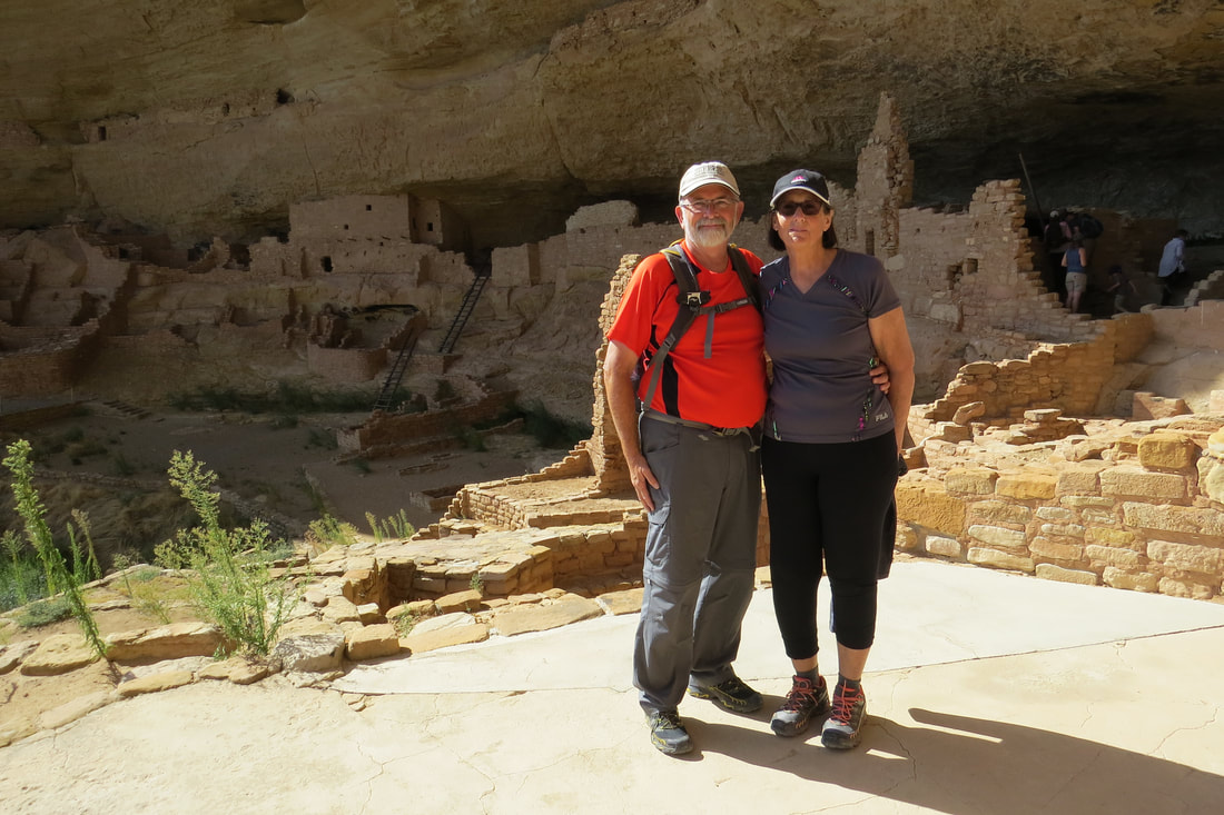
September 10, 2017, Mesa Verde NP and Cliff Palace Tour
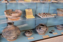
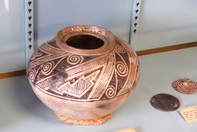
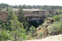
September 10, 2017—We intended to get up early this morning to get a head start visiting Mesa Verde but it rained hard last night and was cool this morning so we overslept a bit. We still made it to the park by 8:15 am and took our traditional photo of us at the entrance sign to the national park. Then we went to the Chapin Mesa Archeological Museum where we purchased Cliff Palace Tour tickets for later in the day. We also watched a film about the ancestral Pueblo people and the Mesa Verde ruins. It was a very interesting film. The museum displays dioramas illustrating Ancestral Puebloan life and exhibits of prehistoric artifacts, pottery, and clothing. My favorite is always the pottery, but we thought the museum was a little outdated.
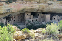
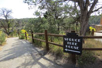
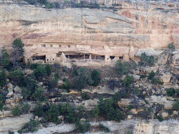
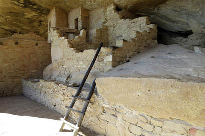
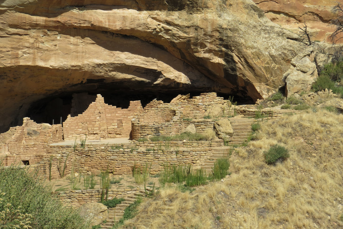
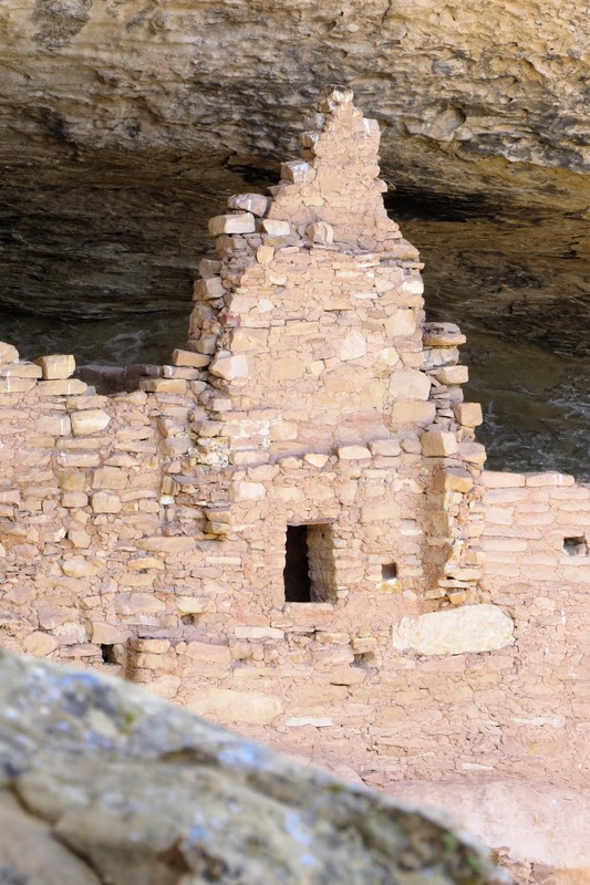
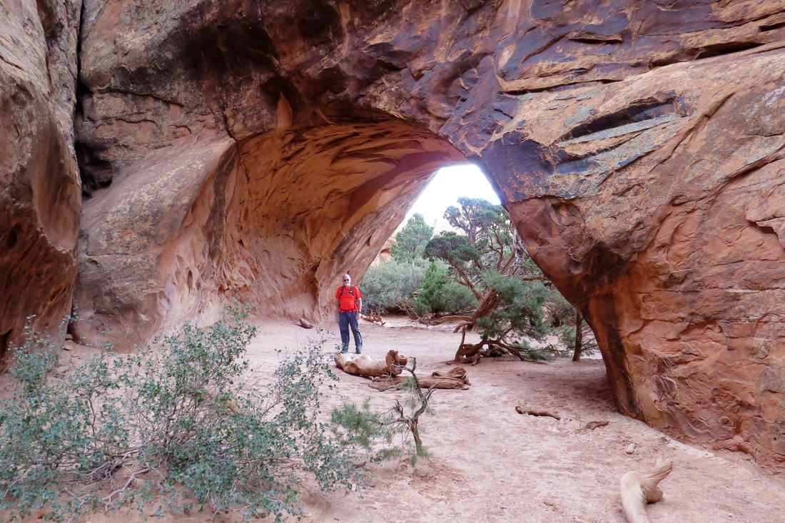
Just steps from the museum was the Spruce Tree House which unfortunately was closed due to falling rock. We could still see the House from the overlook and took quite a few photos. Spruce Tree House is one of more than 600 cliff dwellings within Mesa Verde NP but is much larger than most. Spruce Tree House was part of an extended community that included a few large cliff dwellings, small settlements in alcoves, and some mesa top villages, farms, and gardens. There are several hand and toe hold trails near the head of Spruce Canyon and the Ancestral Pueblo people used these to travel up and down the canyon walls. They climbed up to work their fields, gather food, and hunt on the mesa tops, then climbed down again, carrying whatever they needed back into Spruce Tree House. |
Chapin Mesa Museum
Chapin Mesa Museum
Spruce Tree House
|
Chapin Mesa Museum
Spruce Tree House
Spruce Tree House
|
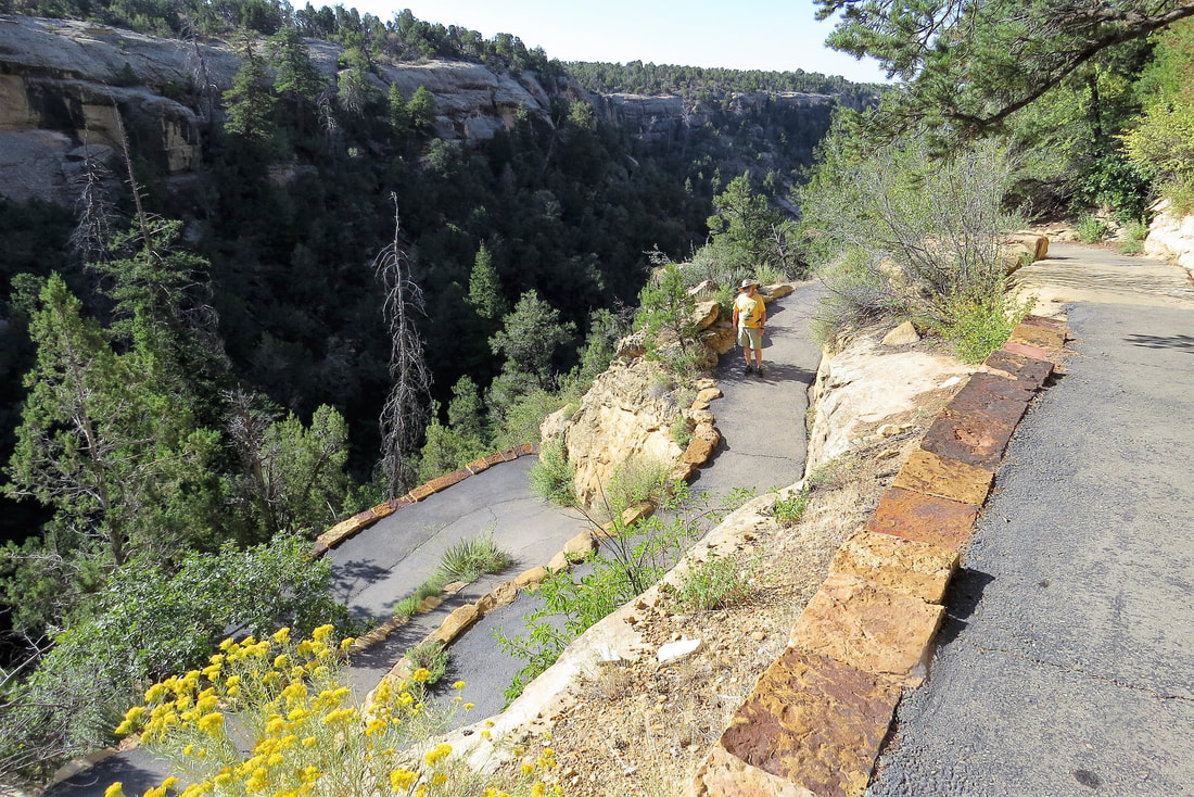
Mike and I walked a little off the paved trail onto a dirt trail. This is part of the Petroglyph Point Loop Trail which we intend on hiking another day. When we left the Spruce Tree House we stopped at a nearby gift store. I purchased some Southwest hand towels to use in the trailer. Since we had time before our tour started we drove on the Mesa Top Loop Road where we stopped at Navajo Canyon View, Square Tower House, the Pithouses and Pueblo Sites, and Sunpoint View overlooking Cliff Palace. There were a few more stops on this drive but we were short of time if we were going to make our Cliff Palace Tour. We’ll come back later to finish the Mesa Top Loop Road stops.
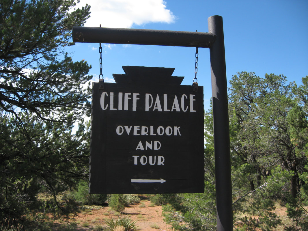
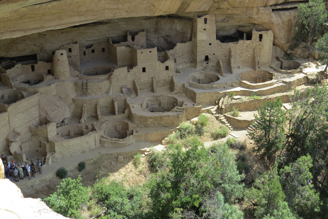
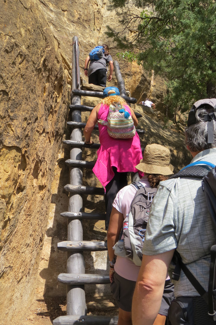
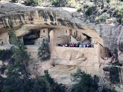
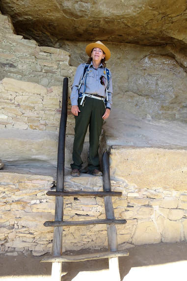
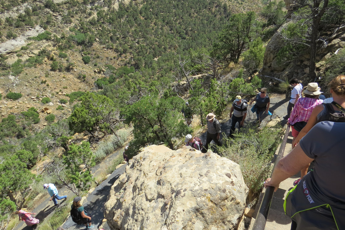
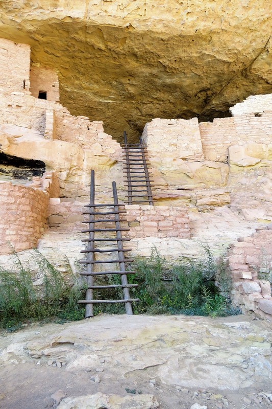
We were early for the Cliff Palace Tour so we ate a quick snack before the tour. We joined the tour and it was a large group of around 50 of us. We really enjoyed the tour and even though it was crowed it didn’t take away from our enjoyment. We took a set of metal steps down to a trail, and then climbed a 10 foot ladder to get to the ruins. The ladders were made from the pinyon pine trees just as the Pueblo people would have used.Cliff Palace is the largest cliff dwelling in North America. It has rimtop overlooks, collection of rooms, plazas, and towers along with 7 kivas. It is unknown why the Ancestral Pueblo people decided to move into the cliff side alcoves about 1200 AD and build elaborate and expensive structures. We’re guessing it was to protect themselves from both the cold and hot weather. Once the tour was through we took another set of ladders bringing us up to the top of the mesa. I continue to be amazed at the rudeness of people. The ranger asked our group three times to not sit or lean on the ruins and yet she had to remind people three different times to not sit on the walls of the ruins. In addition we had some kids and their mother who about ran us over trying to get to the front of the line.
We were early for the Cliff Palace Tour so we ate a quick snack before the tour. We joined the tour and it was a large group of around 50 of us. We really enjoyed the tour and even though it was crowed it didn’t take away from our enjoyment. We took a set of metal steps down to a trail, and then climbed a 10 foot ladder to get to the ruins. The ladders were made from the pinyon pine trees just as the Pueblo people would have used.Cliff Palace is the largest cliff dwelling in North America. It has rimtop overlooks, collection of rooms, plazas, and towers along with 7 kivas. It is unknown why the Ancestral Pueblo people decided to move into the cliff side alcoves about 1200 AD and build elaborate and expensive structures. We’re guessing it was to protect themselves from both the cold and hot weather. Once the tour was through we took another set of ladders bringing us up to the top of the mesa. I continue to be amazed at the rudeness of people. The ranger asked our group three times to not sit or lean on the ruins and yet she had to remind people three different times to not sit on the walls of the ruins. In addition we had some kids and their mother who about ran us over trying to get to the front of the line.
The afternoon got hot and humid so Mike and I decided to call it a day. Because it’s about an hour back to the trailer from the ruins and it was already 2:30 we decided to eat at the Far View Terrace for an early dinner. The meal was ok but I don’t think we’ll be back. We drove back to the trailer and caught up on my journal and photos. It’s been a great day!
The afternoon got hot and humid so Mike and I decided to call it a day. Because it’s about an hour back to the trailer from the ruins and it was already 2:30 we decided to eat at the Far View Terrace for an early dinner. The meal was ok but I don’t think we’ll be back. We drove back to the trailer and caught up on my journal and photos. It’s been a great day!
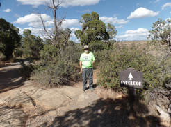
September 11, 2017 Petroglyph Point Trail at Mesa Verde NP
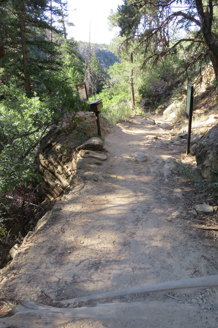
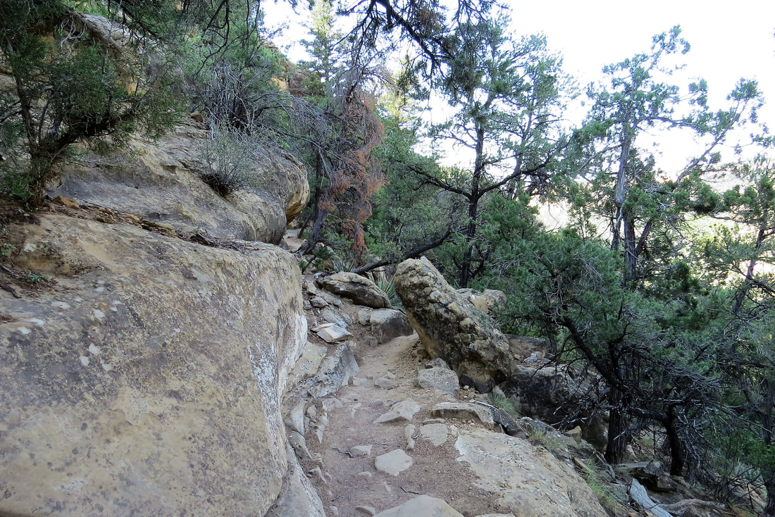
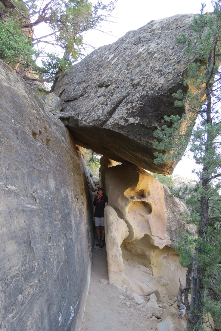
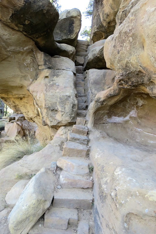
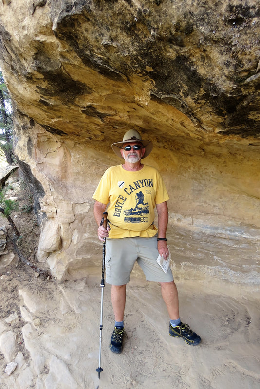
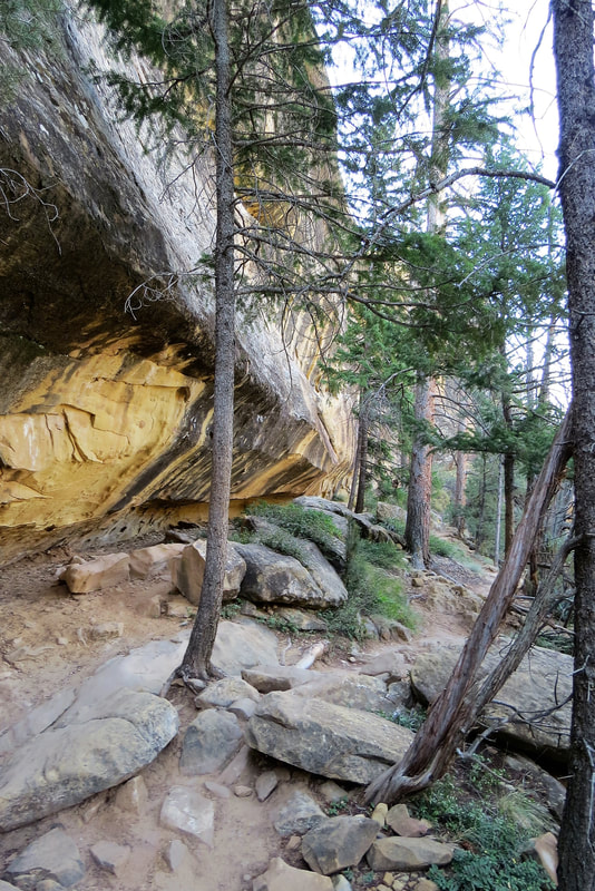
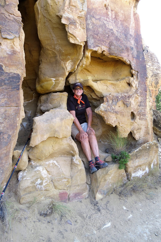
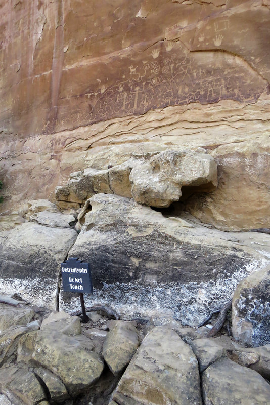
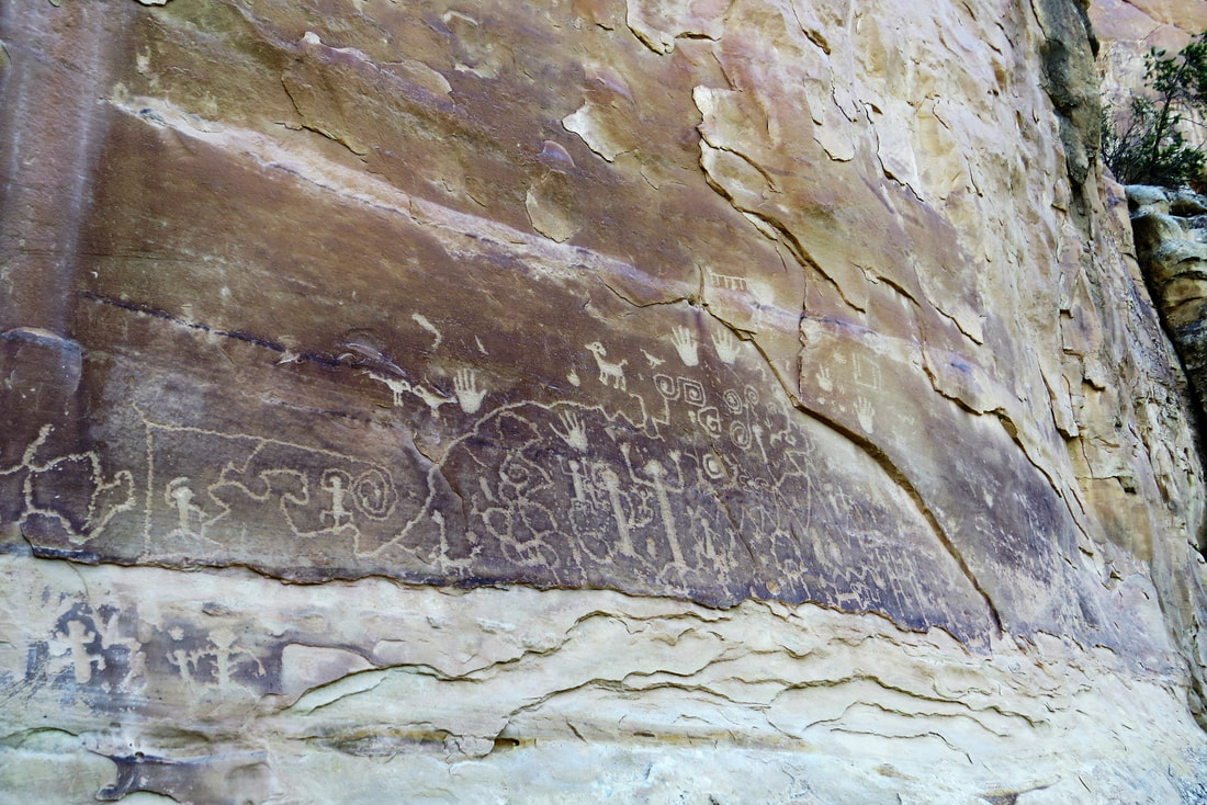
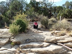
It seems Mike and I are getting a later start every day. Today we didn’t get out of the trailer until 8:45 am. We debated what to do but decided to go back to Mesa Verde today and hike the Petroglyph Point Trail. I thought this was about a 2 mile hike and not too hard. I thought it would be a good hike to test my knee to make sure it was healing. Boy, were we surprised. We later found out that the hike is rated strenuous and rather than the published 2.4 mile hike my GPS showed it was 3.75 miles. The trail scales the cliff of the mesa, overlooking high desert canyons. The tight spaces between rocks and boulders, along with rock formed stairs and ruins made this a fun hike. There is just enough rock scrambling to make it challenging. About half way through the hike we saw the petroglyphs carved into the canyon wall. Although there weren’t numerous carvings there were enough to satisfy us. The book that the ranger provided us told us what each of the carvings on the wall symbolized.
While on the trail we visited with some other hikers on their way also to the petroglyphs. One man was originally from St. Louis but lives in Denver now, another couple were from Glenwood Springs, Colorado. We enjoyed visiting with them. What always makes these hikes interesting are the various people you meet on the trail who come from different locations. The funny thing is we’ve had lots of people call us “Flat Landers” as we come from Kansas! Ha!
The hike took Mike and me about 3 hours as I didn’t push myself because of my knee. So we took plenty of time and rested frequently. As we came to the end of the trail we had a discussion with a ranger about inaccuracy of the published length of the trail. The ranger thought our GPS was wrong but I would still argue with him. He said several people have told him the length of the trail is misrepresented but he still says the stated length is correct. Well, whatever!
It was really hot by the time we got through with the hike around 1 pm so we ate at Spruce Tree Terrace Restaurant. Mike and I split smoked brisket which was surprisingly good. We met another couple at lunch that had also just hiked the Petroglyph Trail and were from Florida. They said they were considering moving to the southwest because Florida was getting too crowded. Hurricane Irma had come through just a day before and they didn’t know whether their house had sustained damage or not as they couldn’t get through to anyone on the phone system. After our late lunch we returned to the trailer. After dinner at the trailer we took a short walk around the RV Park but it’s pretty quiet around here. We came back to the trailer and spent the rest of the evening watching TV and catching up on our journal. This has been another fun day!

September 12, 2017, San Juan Skyway Loop driving the Million Dollar Highway
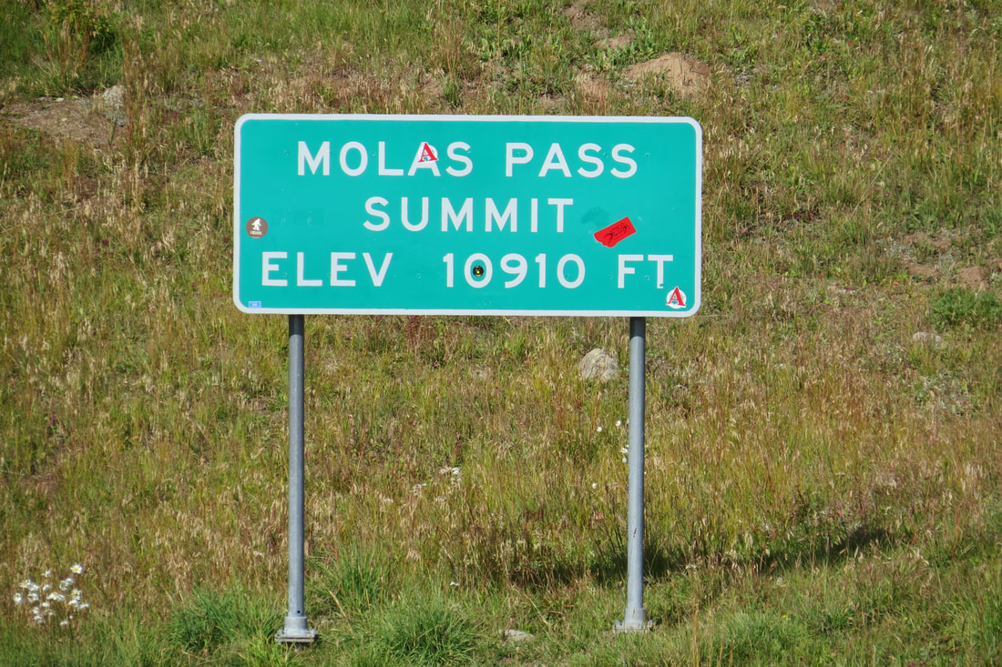
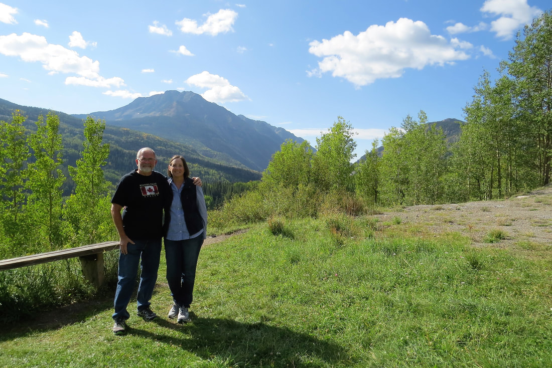
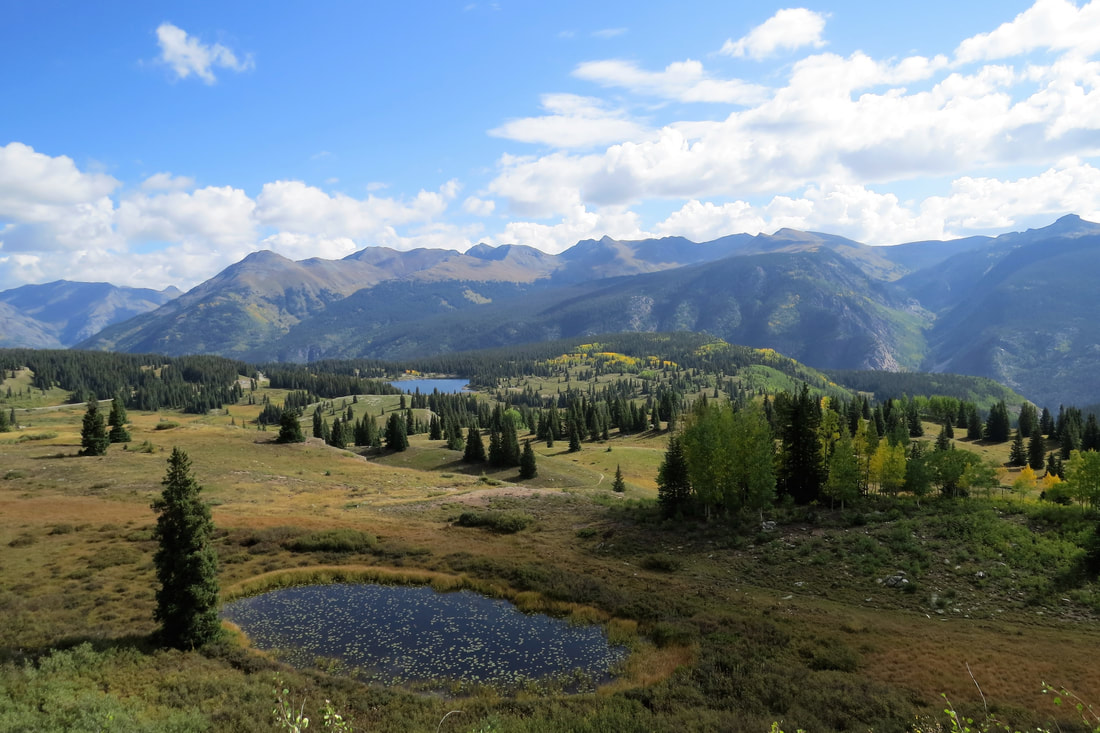
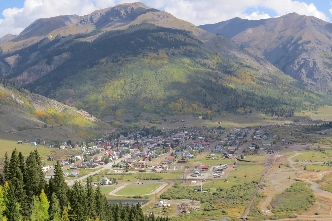
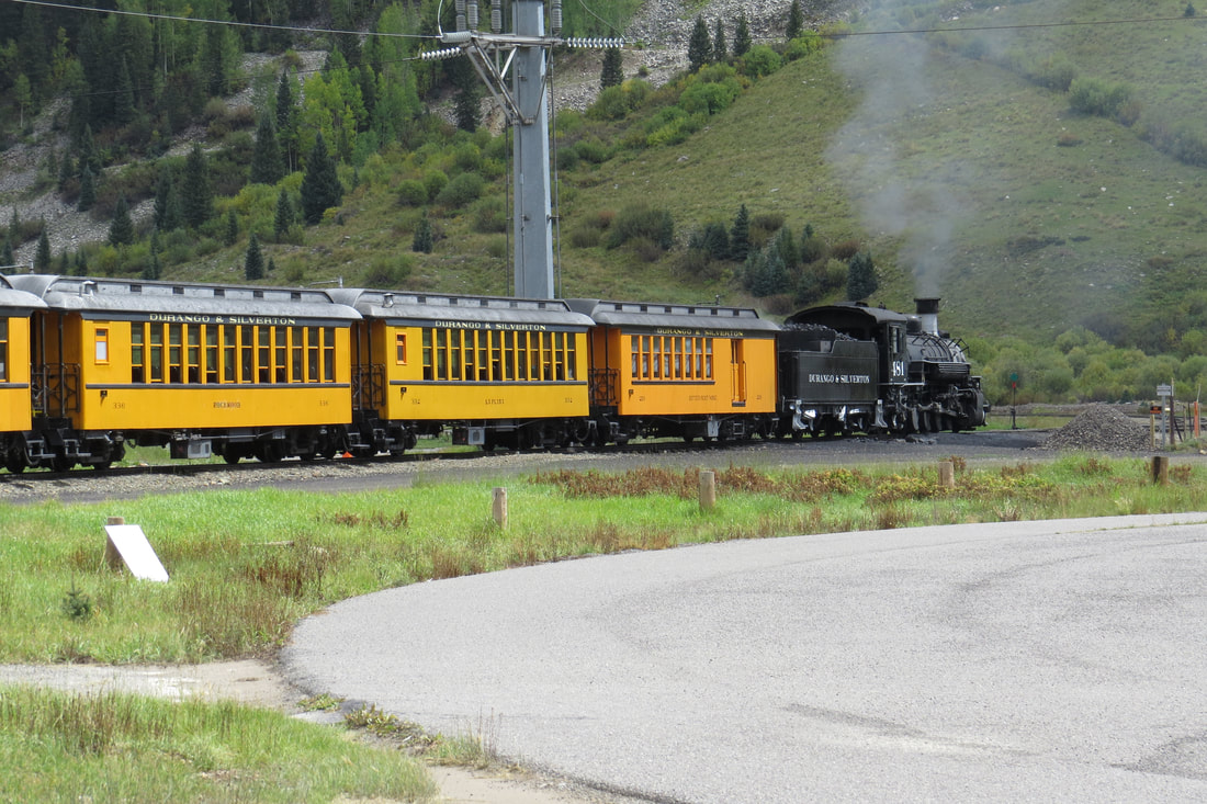
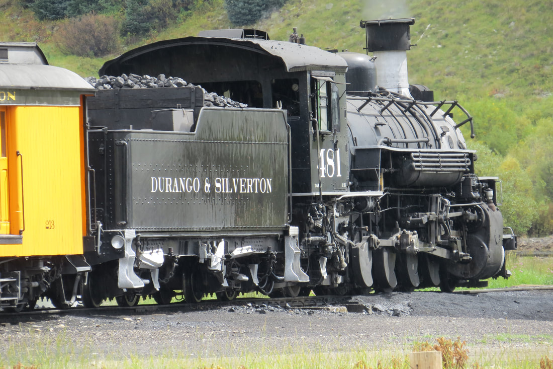
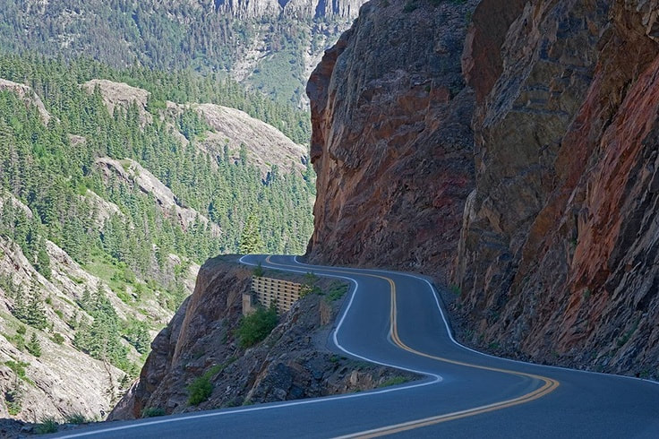
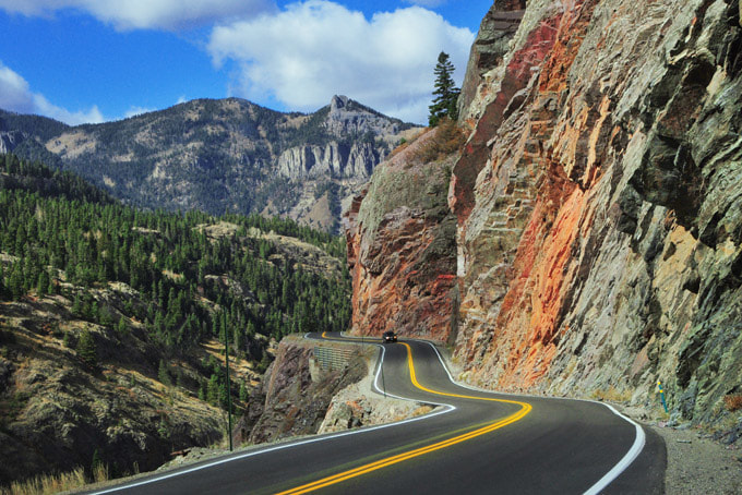
Another late start today, it keeps getting later and later as it was 8:45 am. We decided to give my knee a rest and drive what they call the San Juan Skyway Loop, from Durango to Silverton to Ouray to Ridgeway to Telluride to Cortez and back to Durango. We hadn’t intended on driving the loop but in the end that is what we did. We didn’t want to take the steam train from Durango to Silverton for various reasons but mainly because we had done the train ride many years ago. We did drive through Durango where people catch the train to Silverton. We didn’t think there would be much in Durango that interested us so we drove on to Silverton and it was a gorgeous drive. We stopped at Molas Pass 10,910 feet in elevation. It was gorgeous up there as the fall colors were exploding so we took some photos of the area. From there we drove on to Silverton on the steep and winding Highway 550.
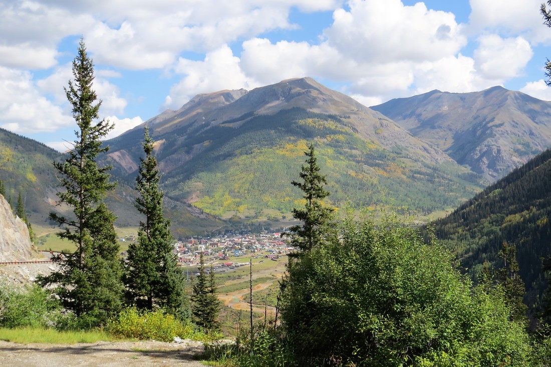
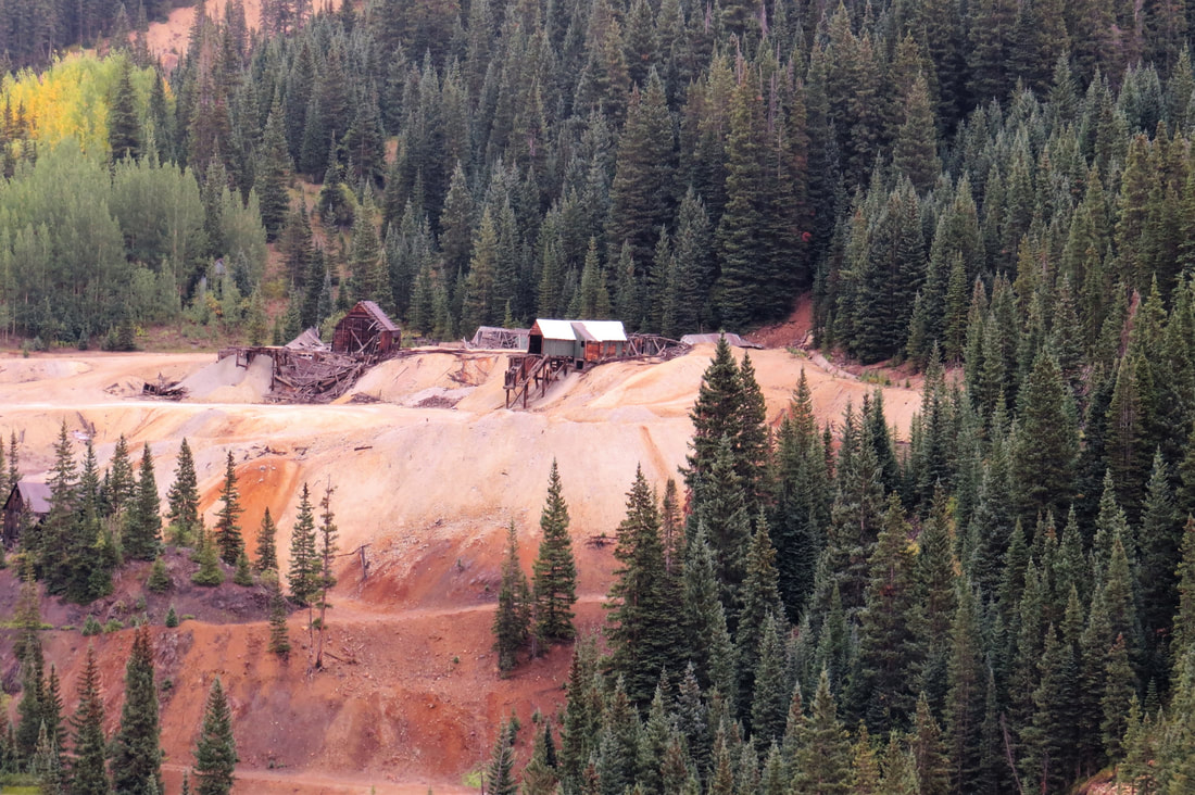
Looking down on Silverton
We were disappointed in Silverton as it was several blocks of shops and restaurants and we could have been anywhere, USA. It was very commercial and it seemed like it was there to serve the tourist trade and keep the Durango-Silverton train in business. We ate at the Bent Elbow Restaurant which had good reviews but we thought the food was so so. After a bit of shopping where we bought Abigail a sack of colored rocks (her most recent interest) and a couple of Day of the Dead coasters for Emily we got back in the truck and headed for Ouray via the Million Dollar Highway. It started raining as we left Silverton so good timing on our part as it rained on us off and on throughout our drive on the Million Dollar Highway.
We were disappointed in Silverton as it was several blocks of shops and restaurants and we could have been anywhere, USA. It was very commercial and it seemed like it was there to serve the tourist trade and keep the Durango-Silverton train in business. We ate at the Bent Elbow Restaurant which had good reviews but we thought the food was so so. After a bit of shopping where we bought Abigail a sack of colored rocks (her most recent interest) and a couple of Day of the Dead coasters for Emily we got back in the truck and headed for Ouray via the Million Dollar Highway. It started raining as we left Silverton so good timing on our part as it rained on us off and on throughout our drive on the Million Dollar Highway.
The Million Dollar Highway is really the 12 miles south of Ouray along the Uncompahgre Gorge. It is challenging and potentially hazardous to drive according to everything we’ve read. It is characterized by steep cliffs, narrow lanes, and a lack of guardrails. It also includes a number of hairpin curves to gain elevation and narrow lanes for traffic cutting directly into the sides of the mountains. We’re really glad we drove it going north from Silverton because we had the lane that hugged the inside of the curves. If we had taken this road goingsouth back to Silverton from Ouray we would have been on the outside of the curves. We only made two stops, one at the Idarado Mine Overlook and the Bear Creek Falls Overlook. Because of all of the challenging roads we’ve been on recently the drive didn’t bother us as much as it might have had we driven this at the first of our trip. I’m glad though that it wasn’t any longer than it was and it is a gorgeous drive, one not to be missed!
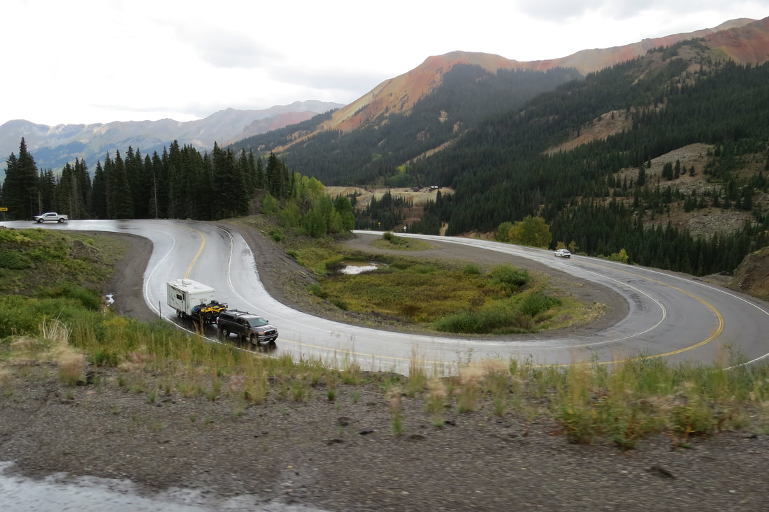
Once we got to Ouray we were once again disappointed with the town…lots of shops and restaurants. We walked the couple of blocks down main street and then decided we’d better leave to give us plenty of daylight to get back to our RV Park. We left Ouray passing through Ridgeway then west to Placerville, past Telluride on to Cortez. We originally were going to stop at Telluride, a former mining community now a ski resort, but thought it would probably just be more of the same. This route was much easier than the Million Dollar Highway but still had its challenges. This road was mainly along the valley floor rather than along the edge of a mountain.
Looking back we think the attraction of most of these towns is more the hiking, skiing, and off roading along with Ouray’s hot springs. If we do this again, I will do more research on each separate town to know what each has to offer with our interests in mind. We have been told the hiking is amazing in these areas and although we don’t do off roading there were plenty of jeep tours we could have taken. In addition we could have checked out the hot springs in Ouray. Many years ago when we were through this area I wanted to come back and take a jeep tour and I guess it will still be on my wish list for next time!
Once we reached Cortez we ate dinner at La Casita de Cortez. Great Mexican food, great service and if we have a chance we will be back. After dinner we returned to the trailer and were more tired than when we did our hiking. We drove 239 miles today and were gone for almost 10 hours. Early bed time for us.
September 13, 2017, Anasazi Culture Center and Canyons of the Ancients
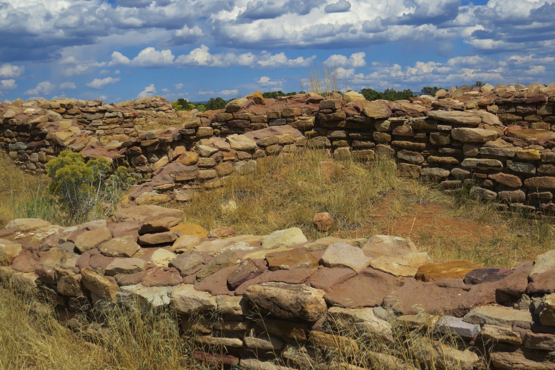
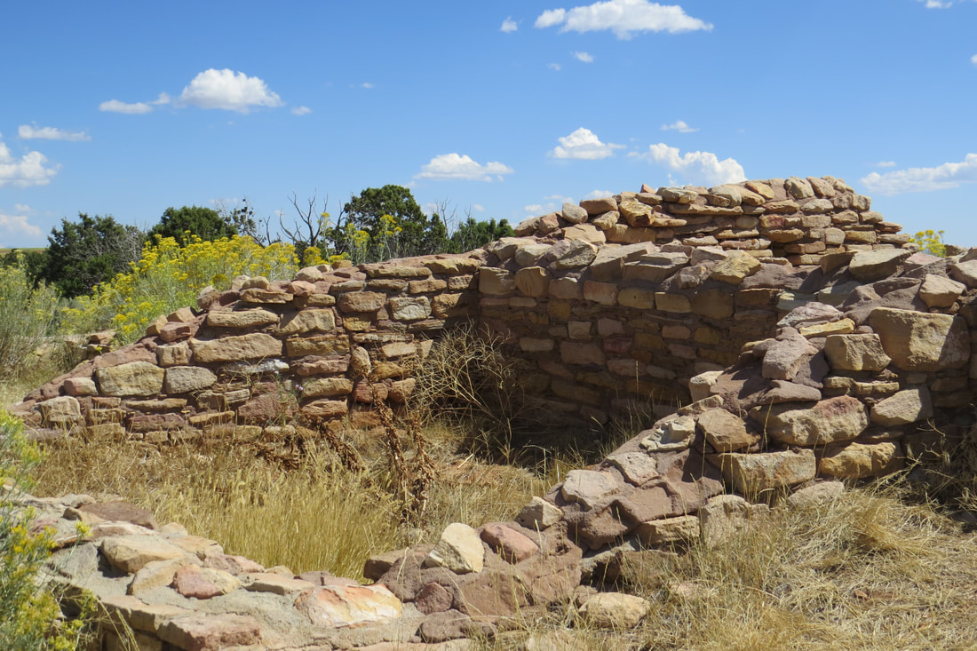
Another late day, leaving at 9:15 am. Our first stop was at Anasazi Culture Center and at least this drive was pretty short compared to previous days, around 15 miles from the RV Park. This was an amazing museum interpreting the history and culture of the Canyons of the Ancients National Monument and the Four corners region. The site was run by the Bureau of Land Management (BLM) as are several other nearby sites. A lot of the emphasis at the museum was on the Anasazi People and their traditions, with emphasis on respecting the ruins and the Anasazi culture. We watched a couple of great films and then spent a couple of hours in the museum. There was also a nice gift shop where we bought a couple of items, a t-shirt, some stickers, and a few postcards.
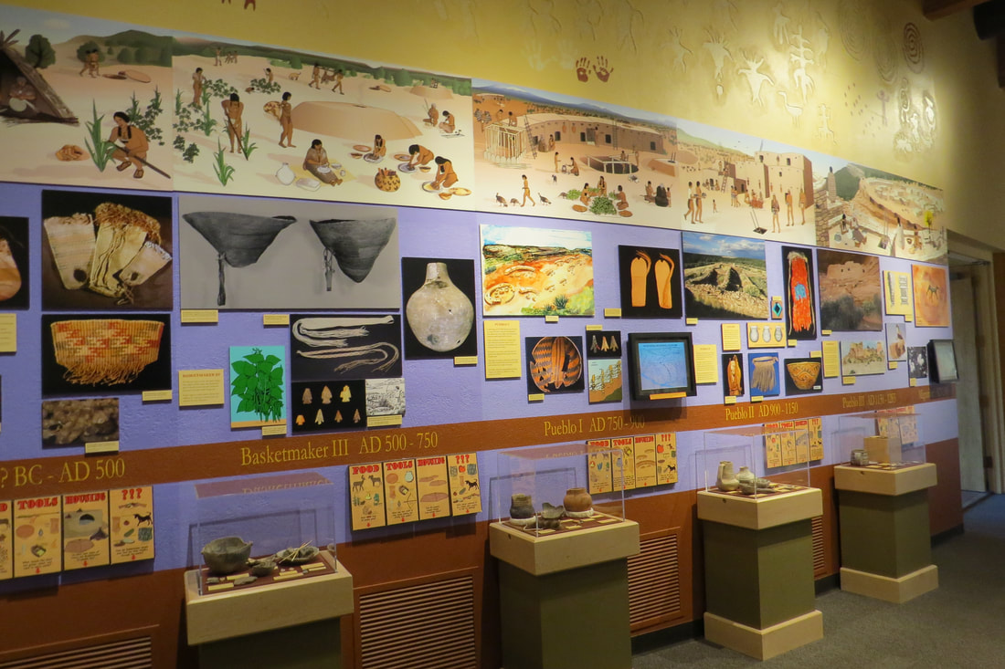
Behind the museum was a short ½ mile paved trail that took us to the Escalante Pueblo, named after Spanish friars who explored this area in 1776. In front of the museum is the Dominguez Pueblo, the remains of four rooms and a kiva which represents a typical family unit of its time.
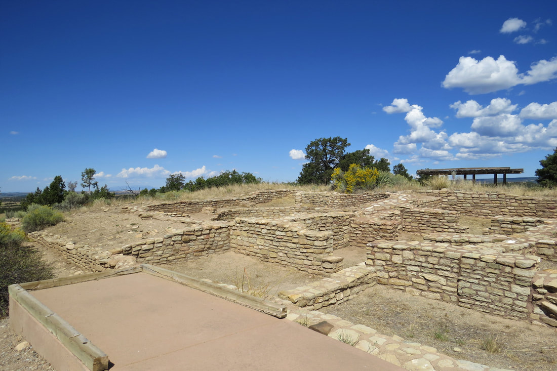
Escalante Pueblo behind the museum
We spent so much time in the museum that it was already almost lunch time so we drove to the town of Dolores, a few miles away, and had lunch at Montezuma Mexican Restaurant. It was probably the best Mexican we have ever had. I hope we get to go back here, it was that good.
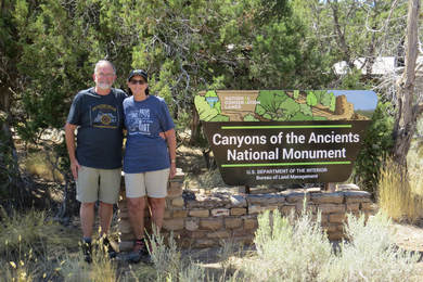
After lunch we drove to Canyons of the Ancients. We stopped to get our usual photo by the sign and met a nice couple from Wisconsin who loved the National Parks like we do. We had quite a conversation with them about all the places we had been in the past. It was funny because all day we kept running into each other.
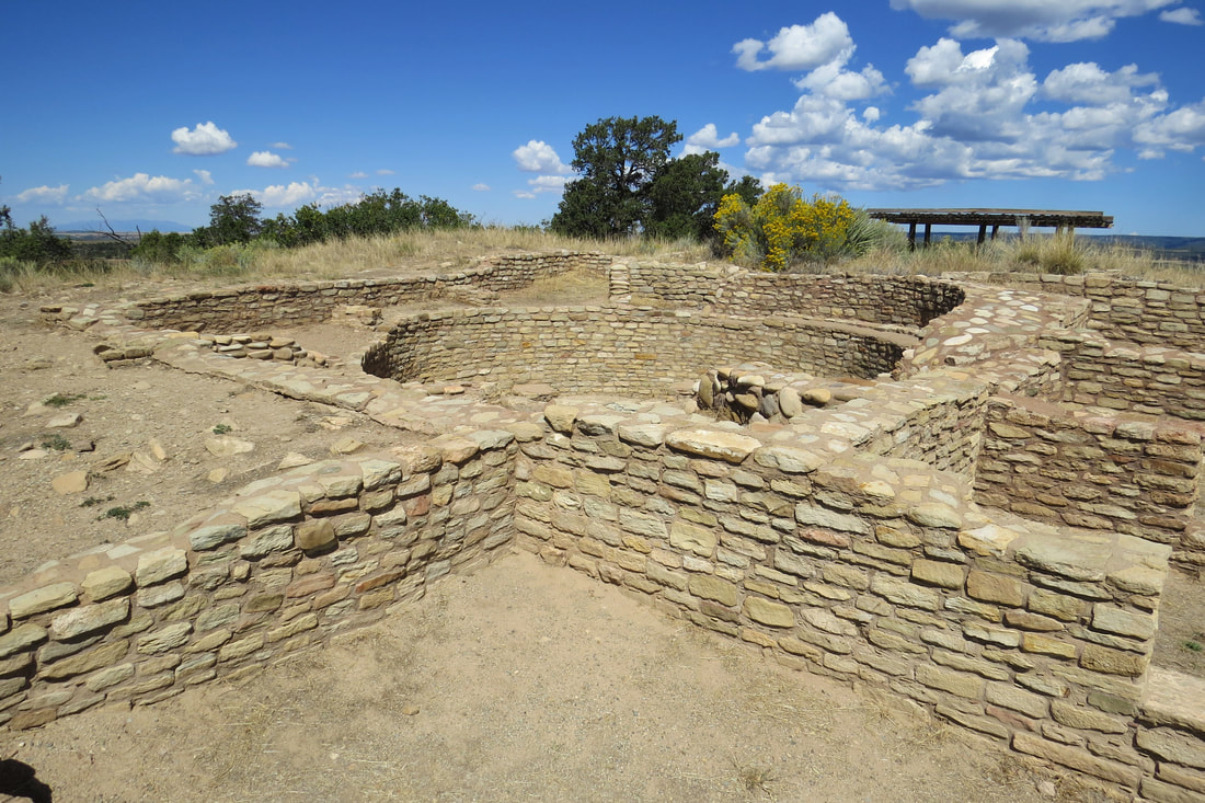
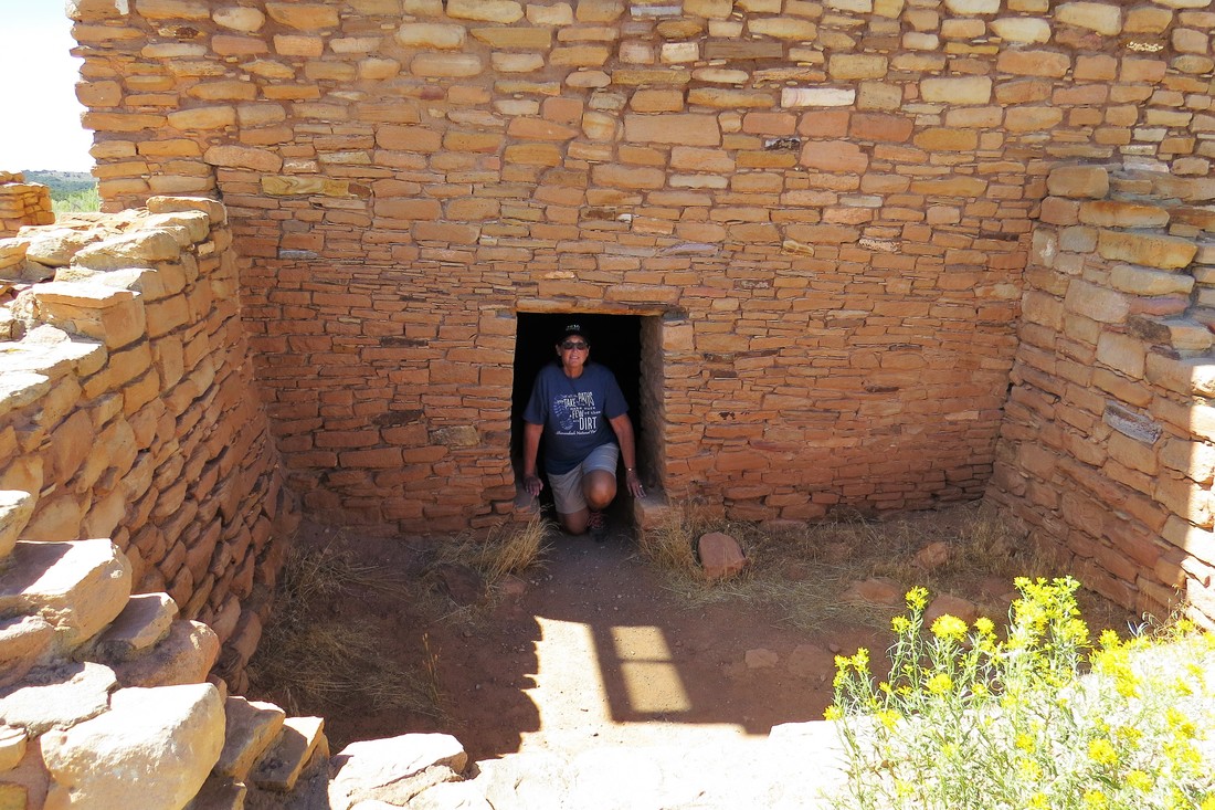
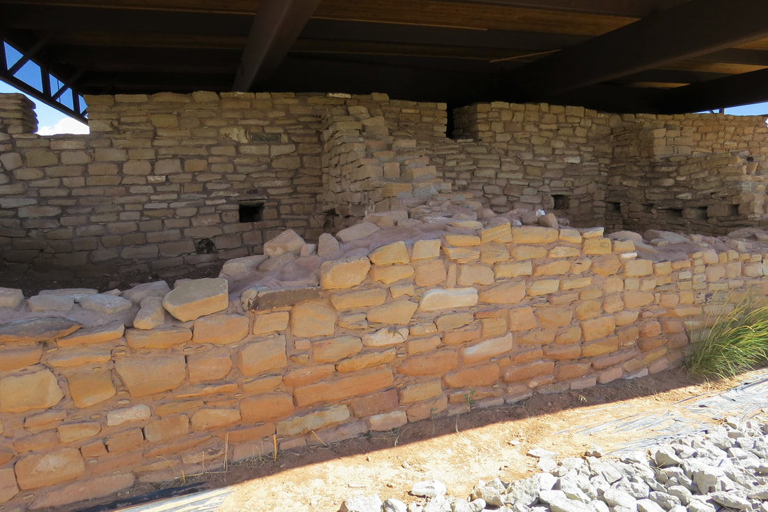
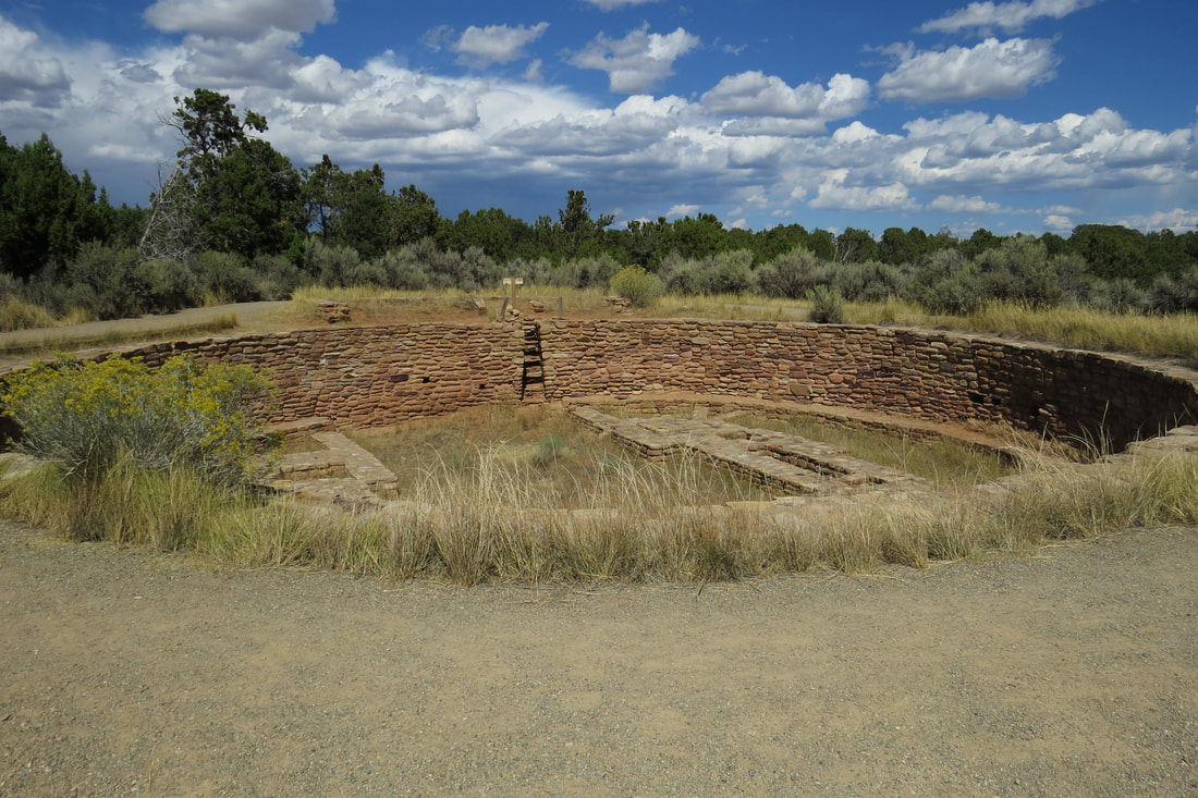
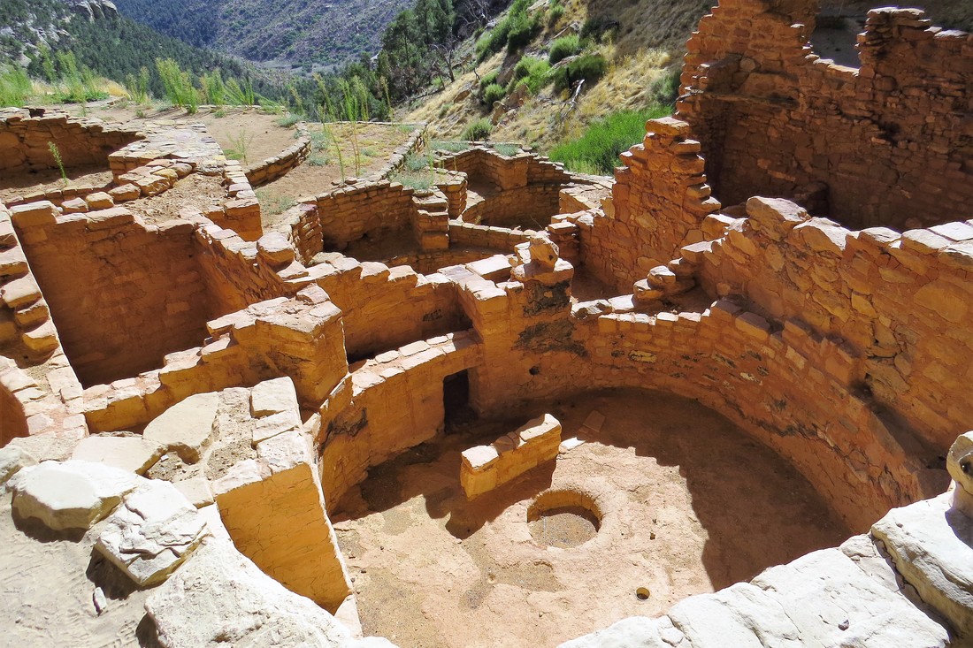
We stopped at Lowry Pueblo in Canyons of the Ancients which is located within steps of the parking lot so we didn’t have to walk far. Lowry Pueblo has stabilized standing walls, 40 rooms, eight kivas, and a Great Kiva. There was a section that you could enter to view the interior of the Pueblo. The main building is covered by a steel roof to help preserve the ruins.
After lunch we drove to Canyons of the Ancients. We stopped to get our usual photo by the sign and met a nice couple from Wisconsin who loved the National Parks like we do. We had quite a conversation with them about all the places we had been in the past. It was funny because all day we kept running into each other.
We stopped at Lowry Pueblo in Canyons of the Ancients which is located within steps of the parking lot so we didn’t have to walk far. Lowry Pueblo has stabilized standing walls, 40 rooms, eight kivas, and a Great Kiva. There was a section that you could enter to view the interior of the Pueblo. The main building is covered by a steel roof to help preserve the ruins.
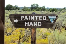
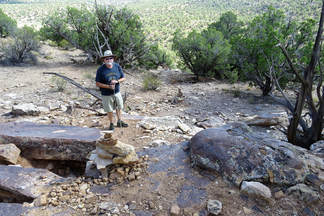
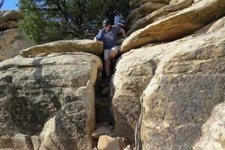
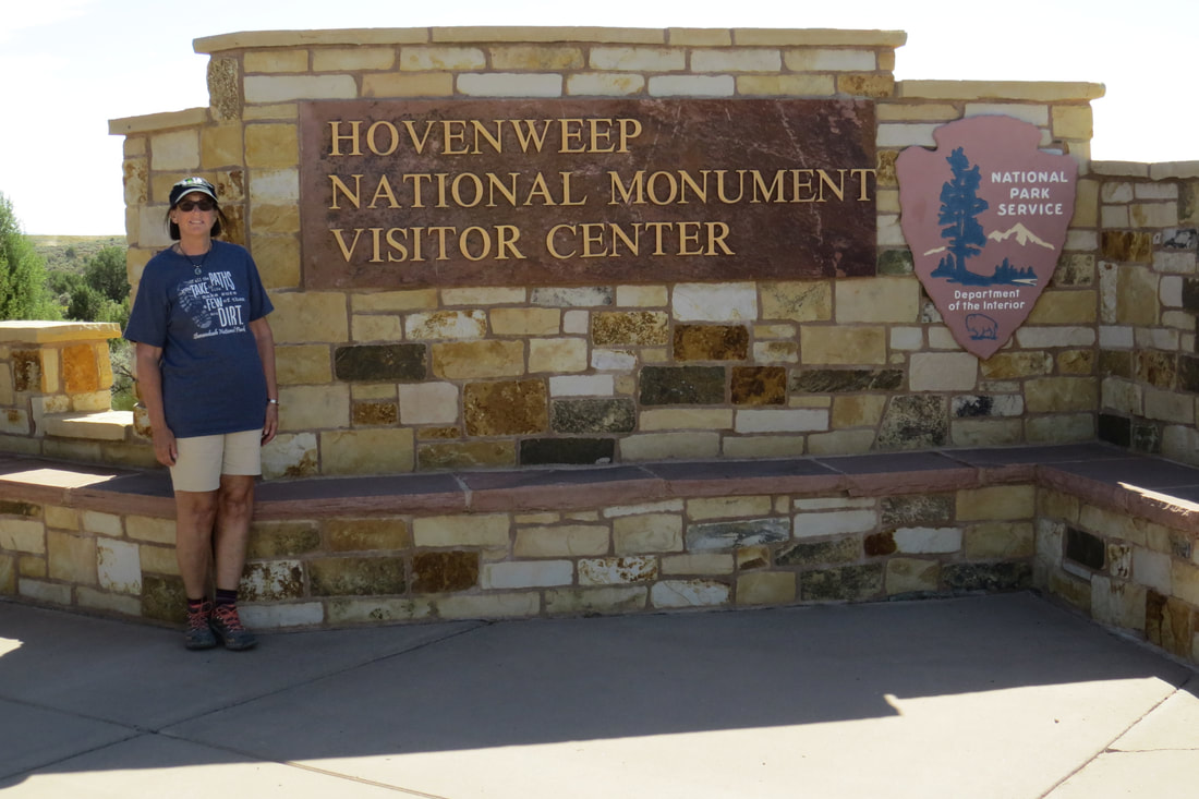
Our next stop was going to be Painted Hand Tower but we accidentally overshot the turn off and ended up at Wovenheep National Monument Visitor’s Center. We spent a few minutes there but decided to go back to Painted Hand. The road to Painted Hand was a rutted, dirt road and was difficult to drive on but we made it to the trailhead. We’re really glad we did as this trail was a fun one involving some rock scrambling. Painted Hand is a ¼ mile trail but the descent to the tower was challenging. Mike and I decided to try it and we were able to go down to the tower without much difficulty. Painted Hand is a tower perched on a boulder. The site has never been excavated, but stone rubble shows where rooms were built against the cliff face and on boulders. The site gets its name from outlined hands on a boulder but we never could find them. However, after doing some reading when we got back to the trailer we discovered we were looking in the wrong place.
|
|
By the time we finished the Painted Hand Trail it was after 5pm and time to get back to the trailer. It was an hour trip to return to the trailer and by the time we stopped for gas it was close to 7 pm..
September 14, 2017, Four Corners and Hovenweep
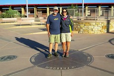
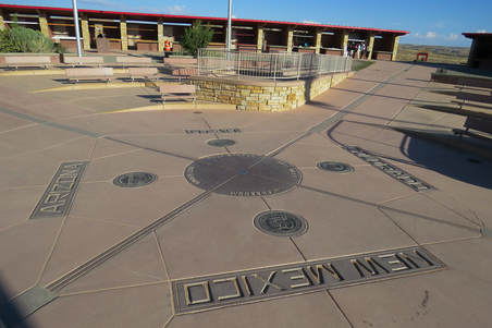
Finally a day that we got up early and were on our way to Four Corners by 7:30 am. Four Corners Monument marks the spot where four states, Utah, Arizona, New Mexico, and Colorado, share a single point on the compass. The original marker was placed in 1912 as a simple cement pad but has recently been rebuilt in granite and brass. We knew when we were going that this really wasn’t a big deal but since we were this close we wanted to at least say that we stood on four states all at once. There weren’t many people there when we got there so we didn’t have any trouble getting our photo taken. We all helped by taking photos of each other. There were also Native American artisans selling their handiwork of jewelry, arrows, beads, pottery, and dream catchers. I bought a couple of very inexpensive bracelets.
|
|
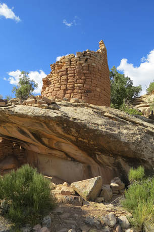
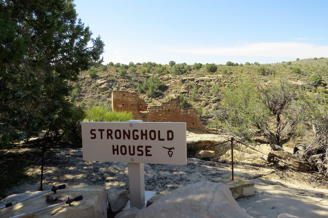
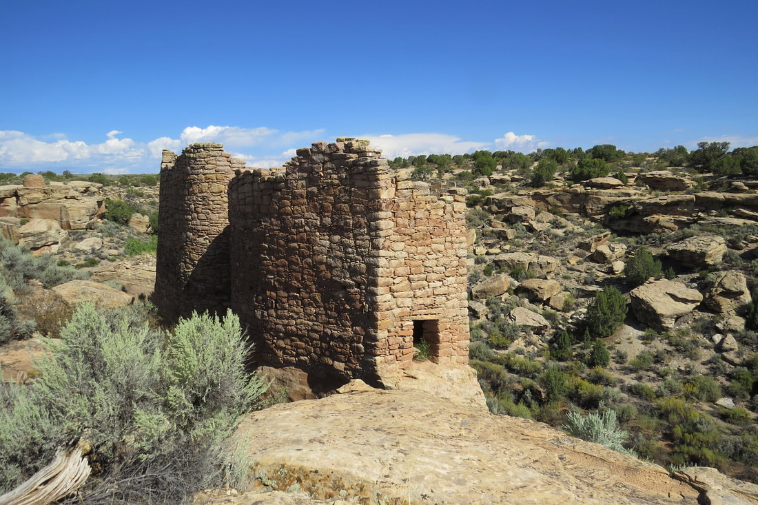
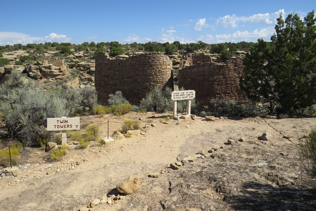
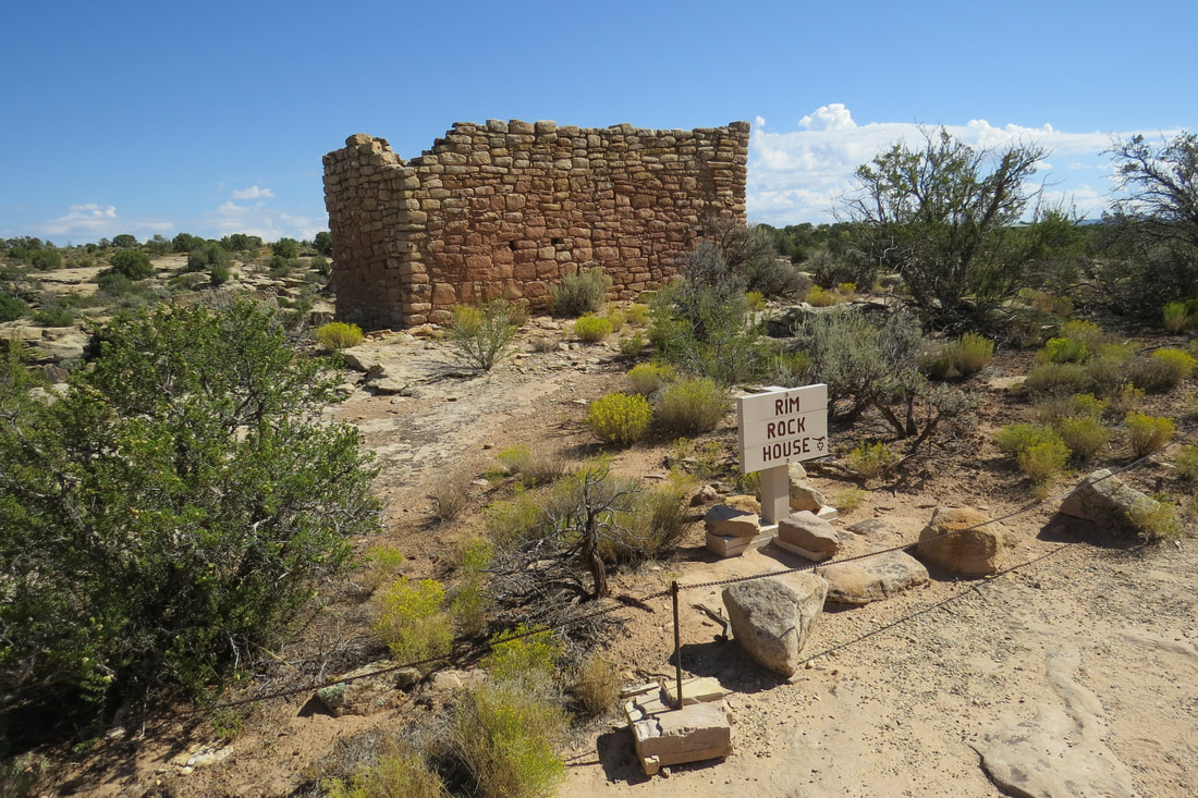
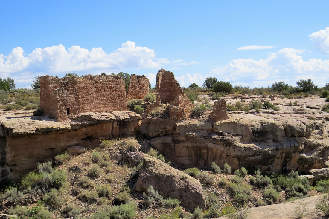
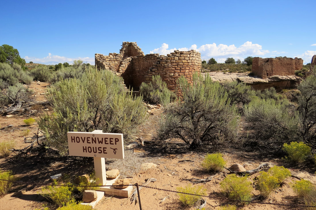
We spent more time at Four Corners than we had planned so when we got to Hovenweep at 9:30 it was already getting hot. We hiked the 2 mile Little Ruin Trail that went by a number of Ancient Puebloan structures of pit houses, pueblos, kivas, and towers. It is not known the reason why the towers were built but there are a number of theories. Some believe they were built for celestial observatories, defensive structures, storage spaces, community buildings or homes. The structures we passed on the trail were Stronghold House, Twin Towers, Eroded Boulder House, Rim Rock House, Hovenweep House, Square Tower, Hovenweep Castle, Tower Point, and Unit Type House. The masons at Hovenweep were among the best among the Puebloans and the work is as skillful as it is beautiful. The buildings, perched on top of boulders remain standing after more than 700 years.
After our hike Mike and I ate our lunch at the picnic area at Hovenweep. It was already hot and the hike had worn us out so we decided to call it a day. It was a good thing as shortly after we got back to the trailer it started raining and rained most of the night. This was a good afternoon to get caught up with our wash so we did laundry at the RV Park. Good thing as we were running out of clothes. For a change we cooked our dinner at the trailer. It tasted good and it felt good to have an early start to our evening.
September 15, 2017, Wetherill Mesa, Long House Loop, Step House, and Soda Canyon Overlook Trail
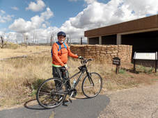
his morning we left at 8:30 am to ride bikes at Mesa Verde on the Long House Loop bike and hiking trail at Wetherill Mesa. It takes a long time to get to Wetherill Mesa so we didn’t get there until about 9:45 am. The Loop itself is 6 miles but it is another mile to get to the Loop. The Loop goes by several dwellings and pueblos that you can walk to from the road after parking your bike. The first stop was at Nordenskiold’s Site# 16 that leads to an overlook of the Nordenskiold Site # 16 cliff dwelling. This trail was 2 miles round trip so Mike and I chained our bikes and hiked the fairly level trail.
Here is the interesting story about Nordenskiold that we found: In 1891. Guided by members of the Wetherill family for whom Wetherill Mesa was named, Gustav Nordenskiold photographed and documented many archeological sites by numbers. (He added Long House as # 15). He eventually concluded that the modern Hopi and the ancient Mesa Verde inhabitants were closely related.
Nordenskiöld’s investigations in the Southwest accelerated archaeological practice and laid a foundation for our current preservation ethic. His extensive photographic documentation of archaeological sites and the materials he collected, along with his detailed descriptions of his finds, brought new discipline to the relatively young field of archaeology. Although the collections from Nordenskiöld’s 1891 investigations ultimately ended up at the Finnish national museum in Helsinki, his well-illustrated and thorough research report was published in both Swedish and English in 1893 and remains in print today. It endures as a valued resource on Mesa Verde archaeology and its early development.
In September 1891, Nordenskiöld attempted to ship his artifact collection back to Europe but was delayed in Durango and temporarily arrested on charges that he had illegally excavated the artifacts. The artifacts were impounded for the next month until the court ruled that no law had been broken. The publicity surrounding this episode and the increasingly wholesale excavation of sites throughout the region over the next decade led to the enactment of the Antiquities Act in 1906 and, thereafter, to the establishment of a national park to protect Mesa Verde.
Nordenskiöld’s scientific contributions and his indirect but significant role in historic preservation legislation are all the more remarkable given that he died only four years after his visit to Mesa Verde, at age twenty-six. So I guess it’s up to us to decide if he was a villain or a hero! At first I thought it was horrible to ship all these artifacts out of the country where they were found but Mike reminded me that our country has done the same thing in other countries. It still doesn’t seem right either way.
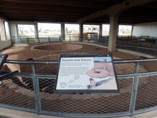
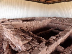
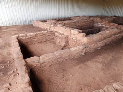
After the Nordenskiold stop we biked to the Badger House Community Trail, a series of homes and kivas. Between the house and one of the kivas was a tunnel, the longest one in Mesa Verde. We walked our bikes through the paved path and then returned to the main loop. I wanted to bike to the nearby Two Raven House but to get back to the main loop I would have had to go up a steep hill and I thought that might be pushing it.
|
|
|
|
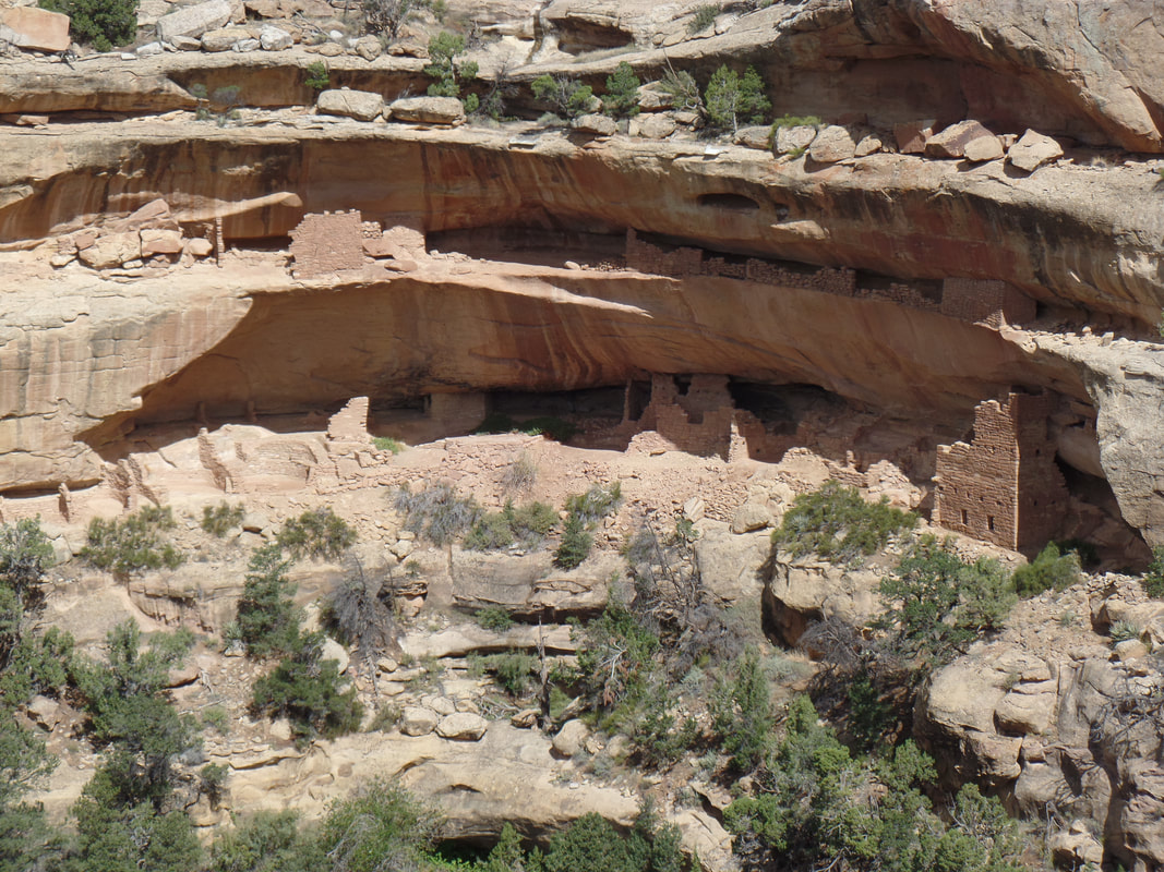
Next stop was the Long House Overlook. The overlook was just a few steps from the road so we got off our bikes and walked to the overlook. The ruins were at a distance but it’s wonderful to see all of these dwelling across the valley in the cliff walls.
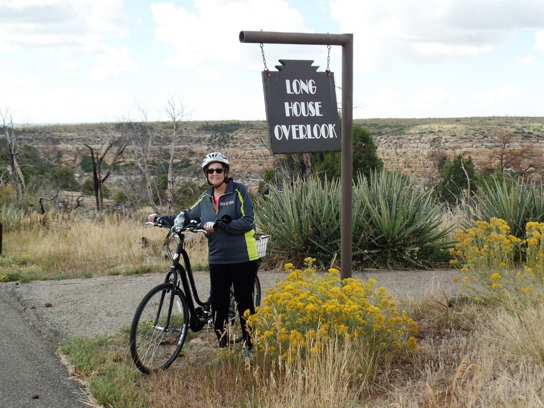
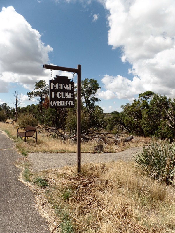
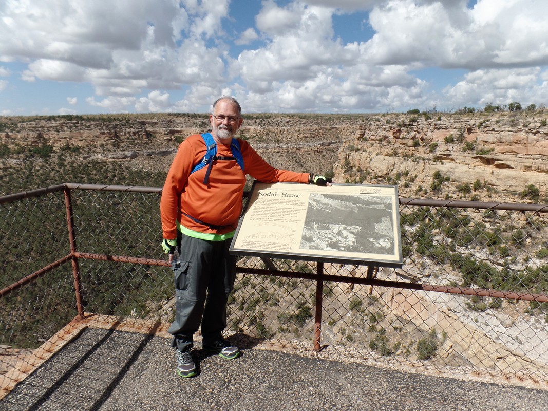
I was having trouble going up some of the steep hills of the loop and didn’t want to put extra pressure on my knee so Mike was concerned about going on. I wanted to do the loop though and so there were a few hills that I walked my bike up. On the way to our final stop, the Kodak House, we startled two wild horses in the field next to the road. I’m not sure who was more scared, me or the horses. Luckily, as soon as the horses saw us they snorted loudly and ran away.
Kodak House Overlook was a few steps off the road and I was glad because by this time I was getting tired. The trail back had more steep hills but we finally made it to the end of the trail. I’m not sure we should have attempted this trail on bikes but I’m glad I accomplished this without damage to that darn knee.
Kodak House Overlook was a few steps off the road and I was glad because by this time I was getting tired. The trail back had more steep hills but we finally made it to the end of the trail. I’m not sure we should have attempted this trail on bikes but I’m glad I accomplished this without damage to that darn knee.
It was about noon when we got back to Wetherill Mesa and ate lunch at the picnic area. Since we had time we decided to take the Step House Trail. I’m glad we decided to do this, it is an interesting dwelling and we almost skipped it. Step House sits in a shallow alcove in Wetherill Mesa where there are two structures, a reconstructed pithouse built around 620 AD alongside a small multi story pueblo built centuries later. We took a paved loop trail and several stairways to get down to Step House. It was about a mile round trip. At the top of the trail we had picked up a brochure and since this was a self guided trail we read in the book at each numbered stop.
In most of the Mesa Verde cliff dwellings there are hand and toe hold trails chipped into the rock but here there is a rock and stone stairway that was constructed by the Ancients. These stairs gave Sept House its name. Without horses, the Ancestral Pueblo people walked everywhere from their homes up onto the rim to work the field, gather plants, hunt and visit their neighbors, and back again. I can only imagine how grateful they were to have those stone steps. In 1891 Nordenskiold inscribed No. 21 into the rock here, his site number for Step House, and we were able to see this inscription in the rock. About the same place we saw grooves in the rock where the people made their tools from local stone: axes, knives, spear and arrow points, choppers, hammers, scrapers, and grinders. We ran into a couple of rangers who kept looking at the ground that was chained. I asked them what they were looking at. One of the rangers told us that she was an archeologist and said if we looked closely in the ground at the chained off area we would see the garbage pile of the Pueblo people. Sure enough, once we inspected it closer we saw small corn on the cob, charcoal, and pottery shards, one kind they called the black and white. Crazy and amazing! Next we climbed a short ladder taking us further into the dwelling. They believe that only 30-40 people lived here. To exit Step House we took a rather steep paved trail to get back to the rim. The favorite saying there is if you go down you have to come back up! |
|
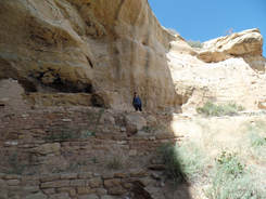
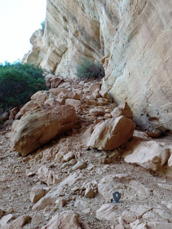
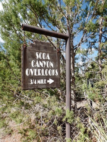
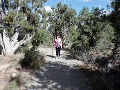
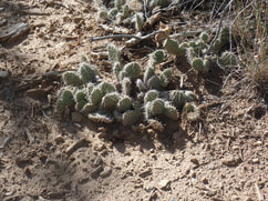
We decided we were going to try two tours for tomorrow, Balcony House in Chapin Mesa and Long House in Wetherill Mesa. We had to drive back to Chapin Mesa to the Spruce Tree Museum where we purchased the tickets. Since we were nearby we decided to hike the Soda Canyon Overlook Trail, roundtrip 1 ½ miles. The end of this trail overlooked the Balcony House, one of the tours we scheduled for tomorrow. The Mesa Verde newspaper said this was an easy level trail. It was a nice trail but it wasn’t as level as we thought it would be. I guess this is Colorado level not Kansas level! Along the path we saw lots of cactus.
We decided we were going to try two tours for tomorrow, Balcony House in Chapin Mesa and Long House in Wetherill Mesa. We had to drive back to Chapin Mesa to the Spruce Tree Museum where we purchased the tickets. Since we were nearby we decided to hike the Soda Canyon Overlook Trail, roundtrip 1 ½ miles. The end of this trail overlooked the Balcony House, one of the tours we scheduled for tomorrow. The Mesa Verde newspaper said this was an easy level trail. It was a nice trail but it wasn’t as level as we thought it would be. I guess this is Colorado level not Kansas level! Along the path we saw lots of cactus.
|
|
|
We decided to go out for dinner at Lot’sa Pasta,That’za Pizza Restaurant. I’m not cooking as much as I thought I would but this was another restaurant that got good reviews on Tripadvisor. I’ve been wrong on picking restaurants too many times to count but this one we got right. Great pizza and salad and the pasta on the menu looked great. Wish we had time to come back and taste their other entrees!
We got back to the trailer at 7 pm, and were tired as can be.
September 16, 2017, Balcony House Tour, Long House Tour
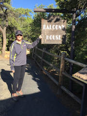
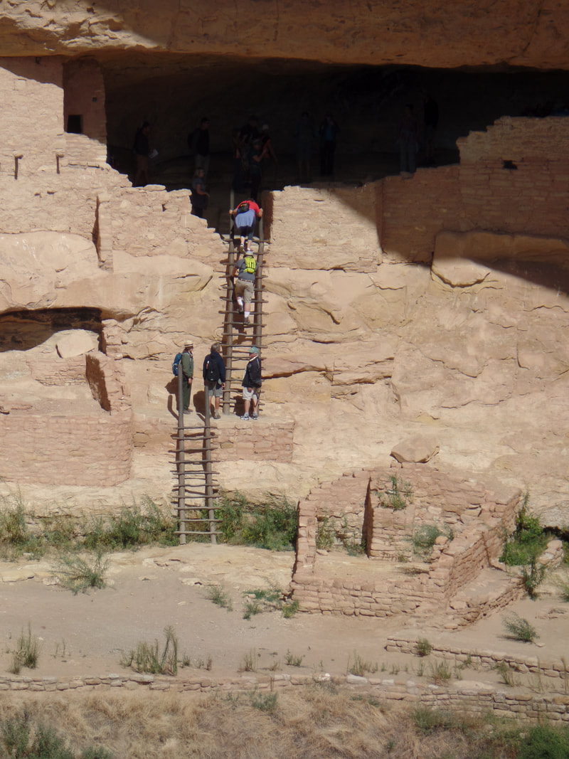
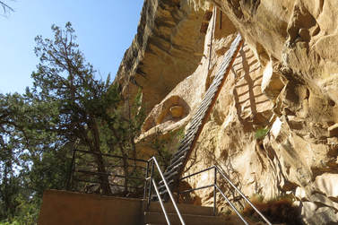
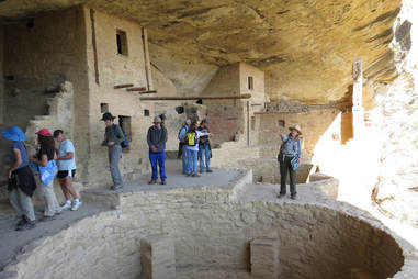
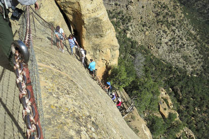
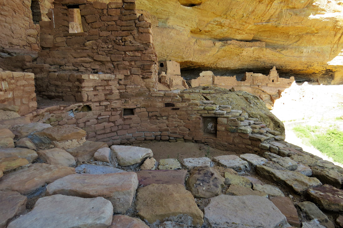
We had purchased the tour tickets yesterday so we arrived in Mesa Verde, Chapin Mesa, for the Balcony House Tour at around 8:30 am. The tour was scheduled at 9:30 but without traffic it didn’t as long to get here as usual. The tour was great and the ranger was very informative. The first thing on the tour we did was descend along a steep paved pathway which included a set of stairs. Right away we climbed a 32 foot ladder that took us into the north end of Balcony House. This made me really nervous but I kept my eyes straight ahead as I was climbing the ladder and I made it!
The ranger talked about what it would have taken to survive during the ancient Pueblo time…water, food, and shelter. She pointed out a spring that runs through Balcony House providing water that helped with the survival of the Pueblo people. After that we walked down a narrow, low set of steps to the Kiva area. The ranger said that the kivas were used for various reasons, ceremonial, religious, social, and utilitarian such as pottery making and basket weaving. The ranger pointed out a pictograph of a hand on a side wall. Close to that is the #10 etched in the wall that Nordenskilod used to identify the pueblo. In one of the rooms on a wall was a painted mural. The ranger said that some of this is what connected the Puebloans…art music, pottery making, basket weaving, and oral history. The oral history is what has helped researchers to verify that modern Pueblo people of the Hopi villages in northern Arizona and the peoples of Zuni, Acoma, Laguna, and the Rio Grande pueblos of New Mexico and Texas are the descendents of the Ancient Puebloans. The ranger emphasized the Puebloans had to have a great sense of community and common goals to survive including the same religious beliefs. By this time we had about enough from one of our tour participants. He filmed documentaries for a living and he was an obnoxious know it all who kept interrupting the ranger…there’s always one in a crowd! Next, we crawled through an 18 inch wide, 12 foot long tunnel. Mike had to push his backpack in front of him to get through the tunnel as did the ranger. Then, to exit the Balcony House, we climbed up a 60 foot cliff face using a number of stone steps and climbing up two ten foot ladders. The ranger pointed out the hand and foot holds going up the side of the cliff that were used by the Poebloans. The stone steps we climbed were also the original steps used by the Poebloans but the area had been widened for safety reasons. I can only imagine what it was like in 1200 AD for these people to climb up and down the sides of the cliff to obtain and bring water and food from the rim back to the alcoves. At the end of the tour the ranger told us that the reason that the Puebloans left the area is unknown but their guess is it was drought, colder temperatures, change in rainfall patterns, and depleted resources (soil for crops and building materials such as trees). There might have also been social and religious motivations. |
|
|
|

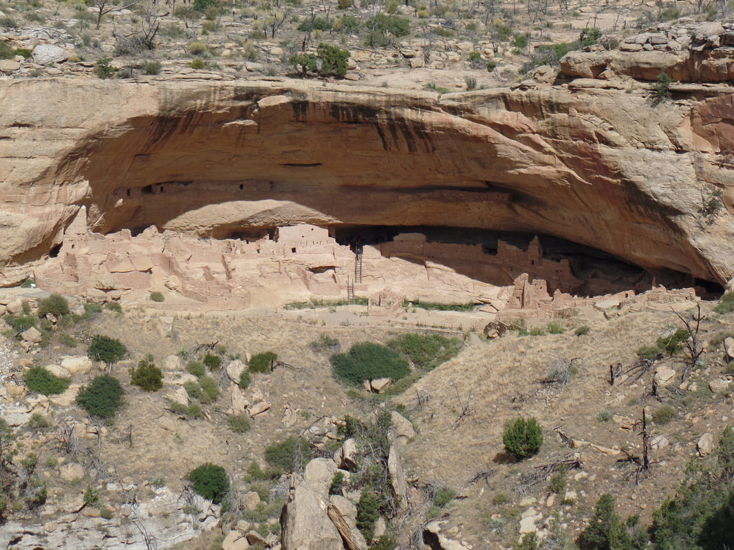
After the Balcony House tour we drove to Wetherill Mesa and had lunch at one of the picnic areas. Then, we met for our 2 pm tour of Long House. The Long House Tour takes about 2 hours and is about 2 ¼ miles long. To get to the dwelling we hiked a section of the Long House Loop, the paved trail we had biked on yesterday. When we got to the Long House trailhead we walked down stairs and steep switchbacks leading to the dwelling.
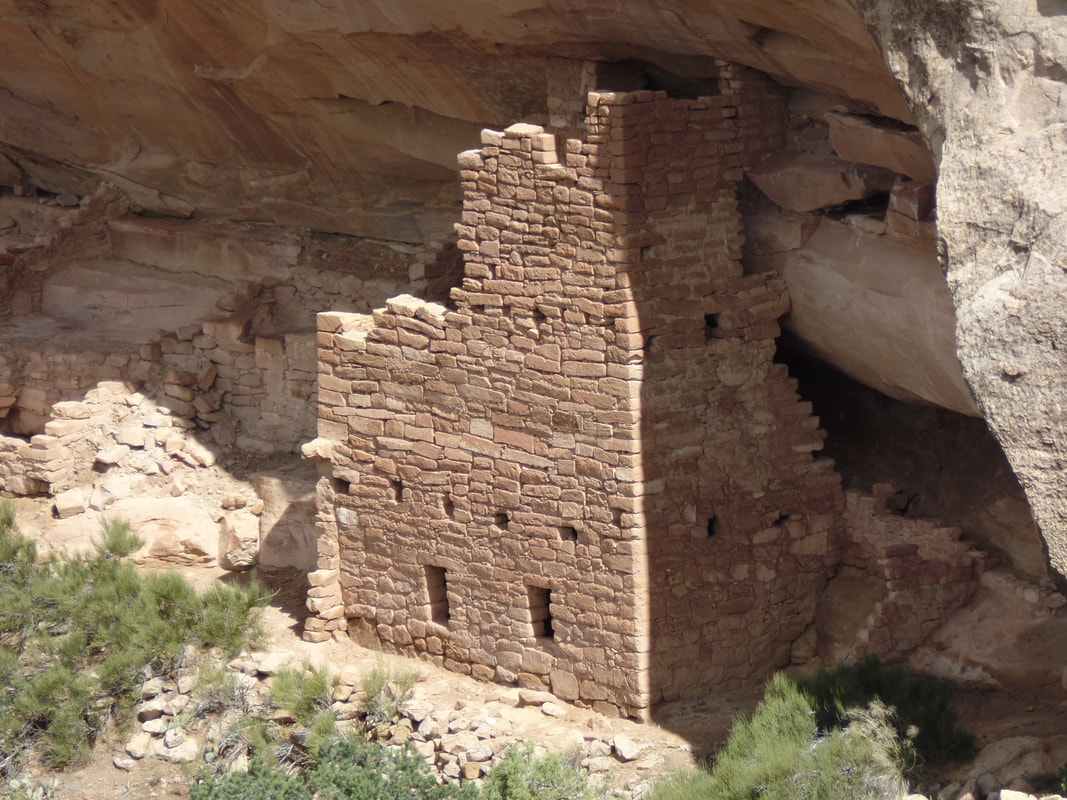
Once we were at Long House we climbed two 15 foot ladders, a piece of cake after Balcony House! Long House had 150 rooms, 21 Kivas, and a row of upper storage rooms. There may have been as many as 175 people who lived there. They also believe that this dwelling was a public place where people from all over Wetherill Mesa gathered to trade or hold community events serving both civic and ceremonial functions.
It was a lot harder returning to the trailhead because it was so steep. I went ahead of most of the group because I was taking it slower due to recovery of my knee surgery. On the way back to the trailhead I met up with Barry, another member of the tour. We had met him earlier at Balcony House Tour and had a nice conversation with him. Barry had also had a knee replacement surgery a couple of years ago so both he and I were taking the walk back at a more leisurely pace. We had a nice conversation and made the walk back go quickly. We didn’t even notice that our knees might be hurting.
The ranger who led the tour was young and new to the job. She did a nice job but definitely needs more experience. Mike and I are glad that we took both of these tours as they were each different in their own way and we really enjoyed our day.
We drove out of Mesa Verde for the last time, hoping we can return some day. It’s been a great stay near Mesa Verde. We went to Dolores to Montezuma Mexican Restaurant anticipating another great meal. We’re not sure why but the food was definitely not as good as when we had been there for lunch earlier in the week. After dinner we came back to the trailer, got showers, and were ready to call it a night. We had originally planned on a ranger led starry night program back at the Morefield Campground but decided not to go. We were tired and I was a bit nervous about driving those winding, steep roads at night.
September 17, 2017, A Day of Rest
We took this day to pack up and get ready for our drive to Monument Valley the next day. Originally I wanted to go to Sand Canyon Trail that is located in the Valley of the Ancients for a short hike. After reading about it though it looked like more of a day hike. I’m disappointed but ready for a more relaxed day giving us time to clean and pack the trailer.
September 18, 2017 Monument Valley
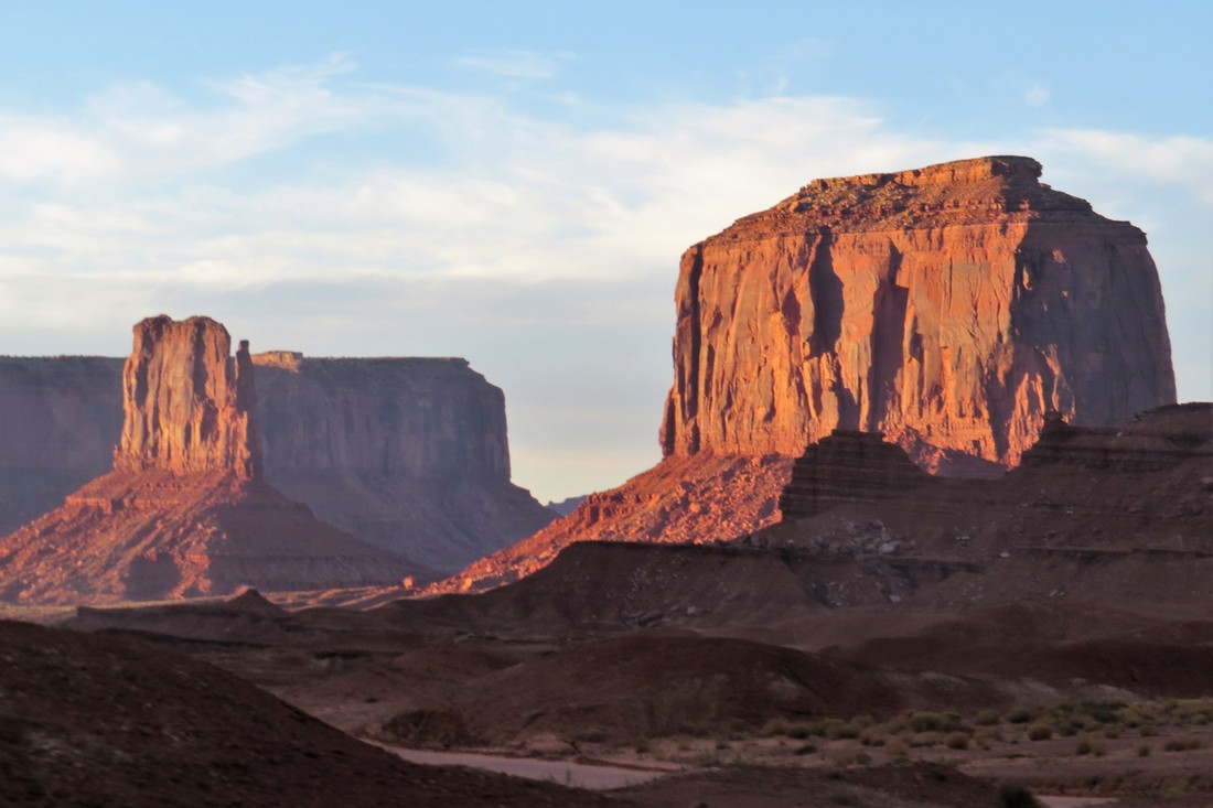
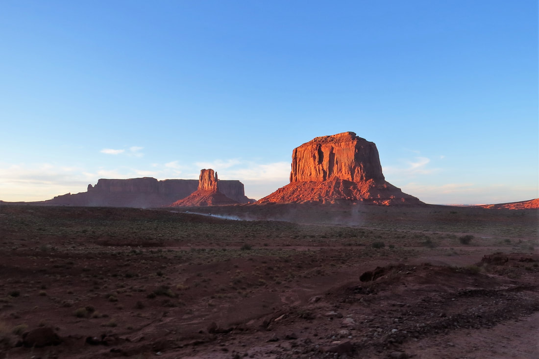
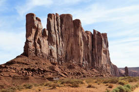
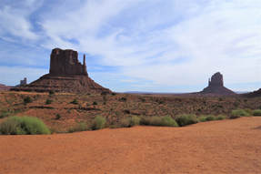
We got up this morning and finished getting the trailer ready for the drive to Monument Valley. On our way to Monument Valley we saw some goats, wild horses along the road, and a bobcat cross the road in front of us, wow! We arrived at Monument Valley around 11:15 am. It’s pretty spectacular with all of the mesas, buttes, and spires. We realize we wasted washing the truck yesterday as the ground is nothing but orange clay and lots of dust here. I don’t know why but I thought Monument Valley would be remote, which it is, but it’s also crowded with tourists!
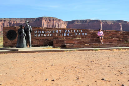
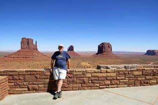
We are staying two nights at Gouldings RV Park. Although it’s more expensive than we like to pay the views from our travel trailer are spectacular. As the saying goes, you get what you pay for! Once we set up the trailer on our very unlevel site, we got gas at Gouldings Gas Station in Monument Valley. Gas was $2.81/gal, talk about taking advantage of the tourists with no place else to go. Once the truck was filled up we headed to the Navajo Visitor’s Center. The fee to get in to the park was $20 and our senior park passes were no good as this is Navajo land. There is a very large lookout as we entered the visitor’s center so we took some photos immediately.
We are staying two nights at Gouldings RV Park. Although it’s more expensive than we like to pay the views from our travel trailer are spectacular. As the saying goes, you get what you pay for! Once we set up the trailer on our very unlevel site, we got gas at Gouldings Gas Station in Monument Valley. Gas was $2.81/gal, talk about taking advantage of the tourists with no place else to go. Once the truck was filled up we headed to the Navajo Visitor’s Center. The fee to get in to the park was $20 and our senior park passes were no good as this is Navajo land. There is a very large lookout as we entered the visitor’s center so we took some photos immediately.
|
|
|
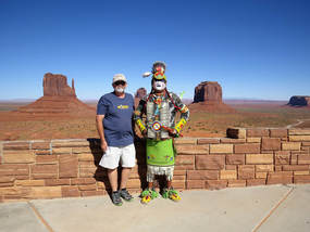
Monument Valley is well known for the area where the old Western and some new movies were made and after seeing this place we can understand as there are beautiful spires, buttes, and mesas in the background with wide open spaces in the foreground. It would be perfect for movie making. While we were at the outlook we took photos of a Navajo in full dress with ourselves. He was a nice guy and we had a great conversation with him. He talked about his traditional dress and the eagle feathers in his headdress. We didn’t ask if he does this for a living or if he just enjoys doing this for the visitors. Now, I wish we had asked but it seemed like asking would be a rude thing to do.
While we were at the visitor’s center we made reservations for a 2 ½ hour sunset jeep tour with Monument Valley Safari Company. At the visitor’s center gift shop we bought our usual sticker and magnet for the trailer. I bought a t-shirt even though I promised myself I wouldn’t buy t-shirts on this trip. I just can’t help myself!
At 4 pm we met in the lobby of The View Hotel for our tour. The hotel is located next to the Visitor’s Center, quite a hotel overlooking all the rock formations at Monument Valley. It’s kind of pricey, around $300 a night depending on the type of room, but what a view! The tour was great taking us on a large section of the 17 mile Valley Road where the largest and most well known rock formations are. Later I’ll go into more detail on the “monuments”. There were 10 of us on the tour in a 4 wheel drive open aired flat bed pickup with a canopy. One family was from Australia, a couple from Italy, and a couple from North Carolina, quite a mix on this tour. Our tour guide, Jean, is an Educator and does this only when her family who runs the business needs her. At first we were disappointed as she seemed not completely familiar with the tour stops. However, once we talked to her we realized she knew the area well and although not particularly entertaining she was very knowledgeable and a real people person. She drove us on private Navajo back roads that requires a guide and we were able to see things that aren’t available to the public without a guide. She took us to two arches, Eye of the Wind and Sun’s Eye. At Sun’s Eye she uncovered an Anasazi grinding stone, pointed out numerous petroglyphs, and a partial wall of an Anasazi ruin. On the tour, we also stopped at a few more rock formations looking somewhat like animals such as a sleeping dragon and an eagle with swooping wings.
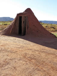
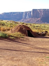
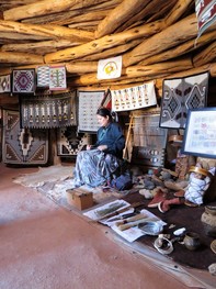
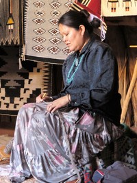
We also went to an area where several Hogans (Navajo homes) were located. There is female and male Hogan designs. The male Hogan is a temporary home and is pointed like a teepee. The female Hogan is rounded to symbolize fertility, with nine support poles (for the months of gestation) and is used year round. Inside a main Hogan was a Navajo woman who gave a talk on the materials used in everyday life of her ancestors. She and her family are master weavers and she had some of their blankets on display. They were beautiful but expensive as some of the larger blankets took 6 months to weave. The small blankets took two months to weave and were around $300; I’m not sure how much the large blankets were.
|
|
|
|
The tour was supposed to last 2 ½ hours but ended up taking 3 hours as there was so much to see and learn. As the sun set on our tour the rock formations seemed to glow. Amazing! Overall the tour was great and we would do it again even though it it was a little pricey.
The tour was supposed to last 2 ½ hours but ended up taking 3 hours as there was so much to see and learn. As the sun set on our tour the rock formations seemed to glow. Amazing! Overall the tour was great and we would do it again even though it it was a little pricey.
It was after 7 pm when we got back to the trailer. We ate a late supper and stayed in for the night. Each night at 8 pm our RV Park offers a free John Wayne movie. I’m not sure we’re going to make it to any of them since I’m not crazy about the old Westerns and Mike has seen them all!
September 19, Monument Valley
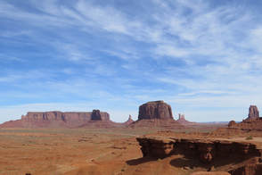
Today we decided to have breakfast at Goulding’s Restaurant. This is unusual as we don’t really like breakfast very well. Breakfast was good, Mike got a green chili omelet and fry bread, I got the usual French toast. Mine was typical but Mike’s was a great southwest breakfast and the fry bread was wonderful! This morning Mike and I went back to Monument Valley and drove the 17 mile Valley Road so we could see the remainder of the stops that we missed yesterday on the tour. The road is bumpy and rough in Mike’s truck but we made it. It’s really windy today and the dust is blowing everywhere. We’re really glad we took our tour yesterday when the dust wasn’t as bad, people today taking tours look miserable.
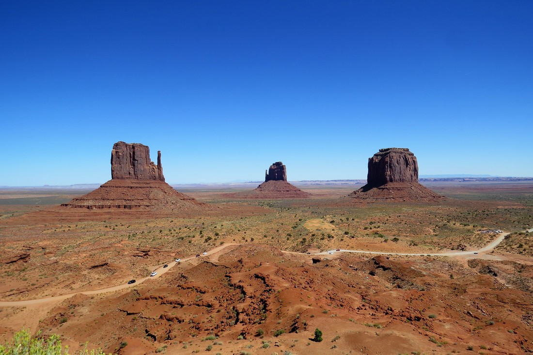
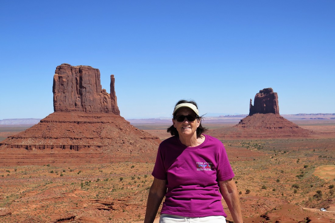
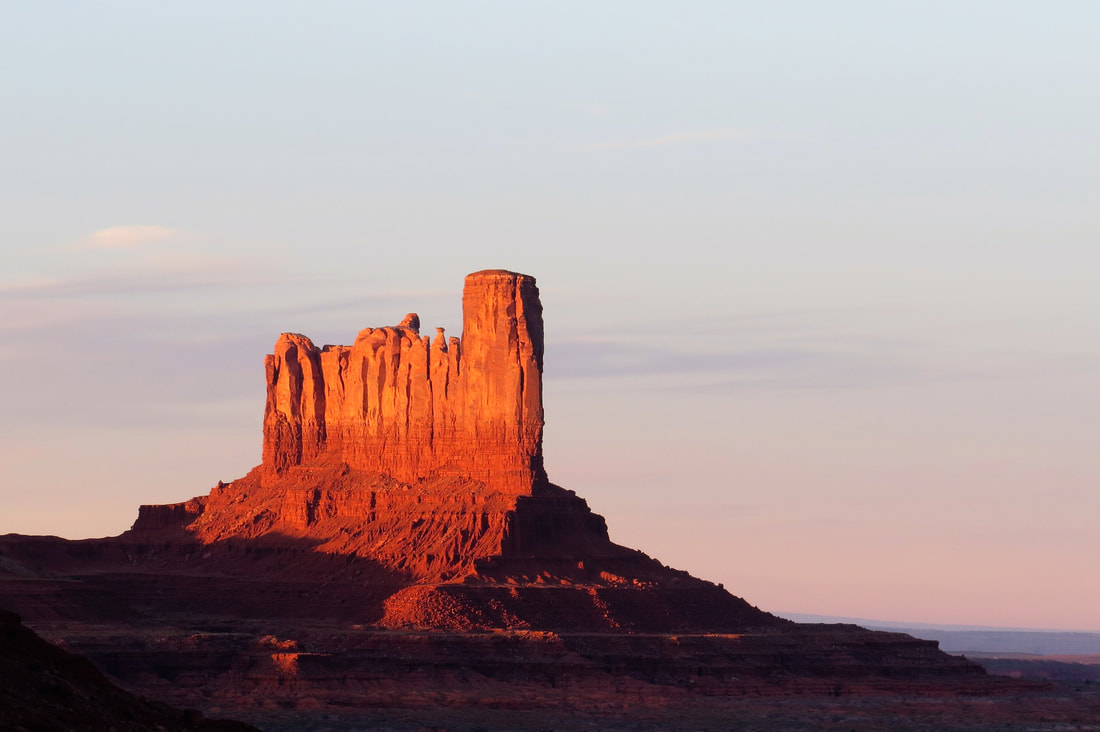
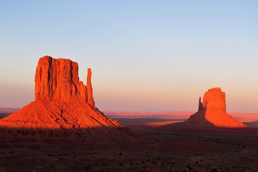
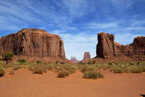
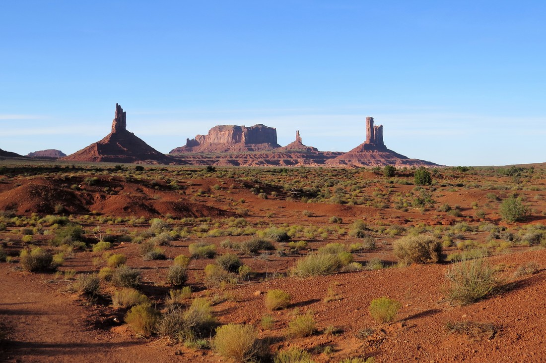
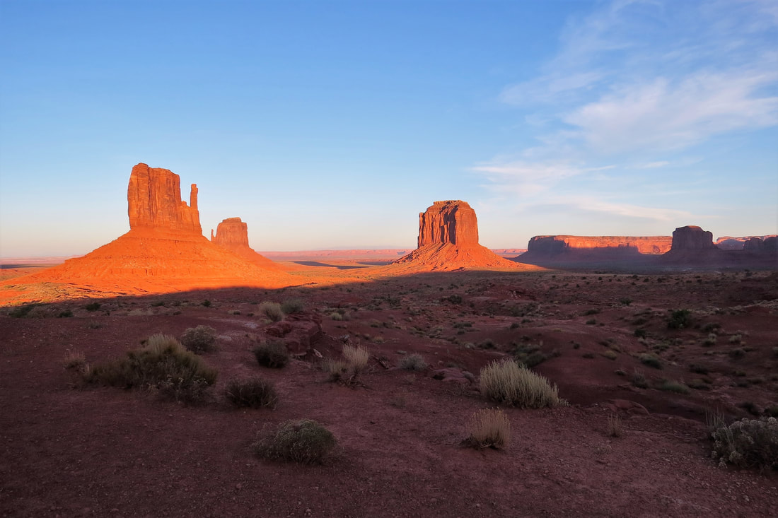
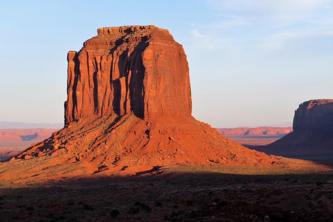
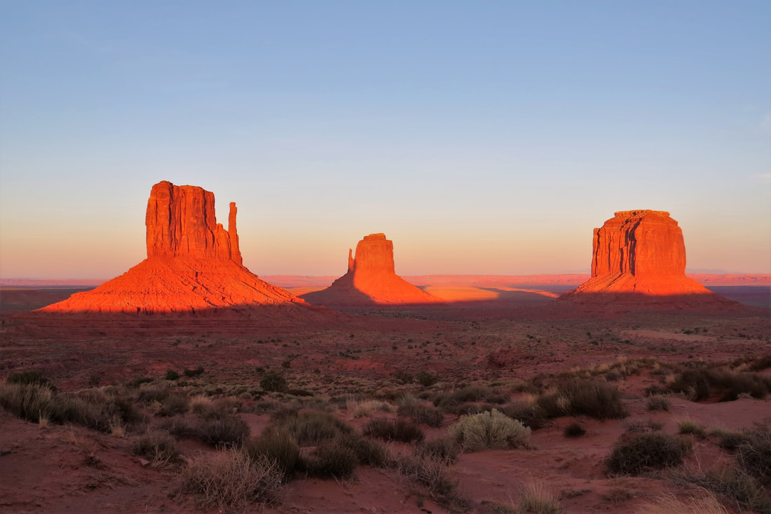
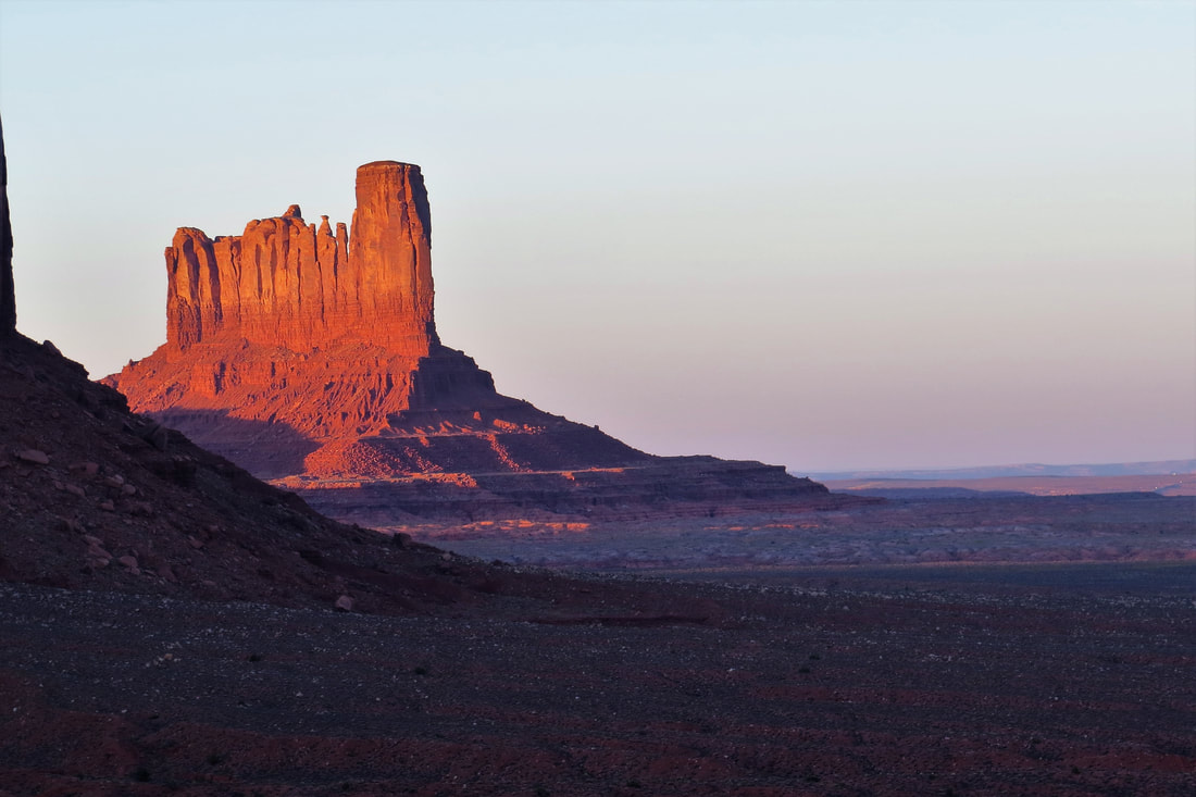
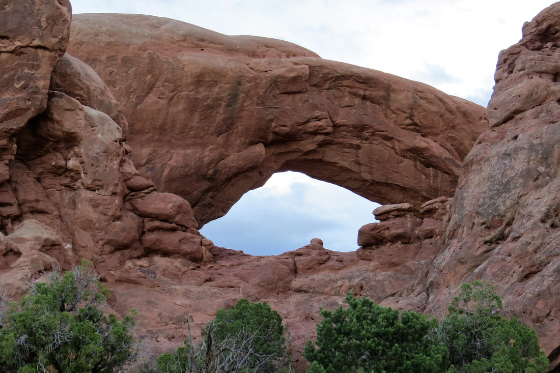
So here’s the list of the stops we made today and took photos at each one: East and West Mitten Butte, Elephant Butte, Camel Butte, Three Sisters, John Ford’s Point, The Hub, Totem Pole, Artist Point Overlook, North Window, The Thumb.
The East and West Mitten Buttes look like hands, yet it signifies spiritual being watching over the valley. Elephant Butte looks like a gigantic elephant facing west of the southwest desert. The Three Sisters are 3 Catholic nuns. John Ford’s Point is named after a Hollywood director who made a number of western movies making John Wayne famous. Camel Butte is the image of a camel facing the west. The Hub symbolizes a hub of a wagon wheel. Navajos see it as a fire place in the center of a gigantic Hogan. Totem Pole, a spire monument is an example of what erosion does to a butte. A totem pole is a historical or mythical marker created by Northeastern tribes, usually carved out of wood. Artist’s Point is a place where artists can create landscape and bring them to life on their canvas. North Window overlooks the northern view of the lower valley. The Thumb is a free standing spire apart from Camel Butte.
Artist Point
Elephant
The Thumb
|
Camel
John Ford Point
North Window
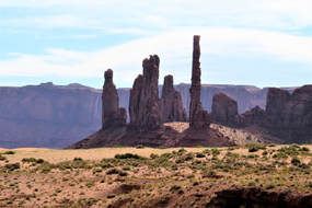
Totem Pole
|
East and West Mitten
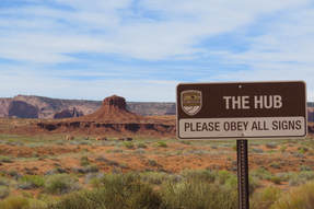
The Hub
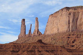
The Three Sisters
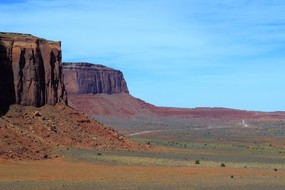
Valley Drive
|

One of my favorite photos was at the John Ford Point. Every now and
then one of the local residents would go out on the edge of the canyon
on his horse and pose for photos. We benefited from someone else
paying the fee and we were able to take photos.
He would pose with just himself and the horse or you could
pose with them for an additional fee. It was easy to imagine
why so many western movies were filmed here (12 total movies)
and we could visualize John Wayne sitting on that horse.
(At the same time it's kind of sad that this is the way the locals
need to make money.)
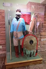
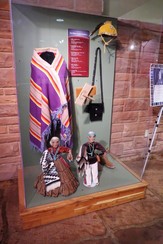
After driving the Valley Road we went back to the trailer, had lunch, and rested for a while. We drove back to the Visitor’s Center because they had a display about the Native American Code talkers which was really interesting. Along with the information on the code talkers there were other kinds of displays of clothing, artwork, and jewelry.
|
|
|
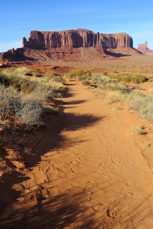
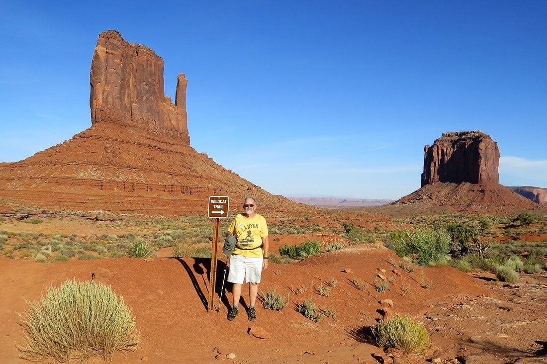
|
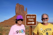
After the museum we wanted to hike part of the 4 mile Wild Cat Trail near the Visitor’s Center. Of course, as usual, once we got started we didn’t want to stop so we ended up hiking the entire trail around West Mitten Butte. On the trail, about half way we had a great view of the two Mitten Buttes and Merrick Butte. Some sections of the trail were very sandy and were a bit challenging on our way back especially at the end of our hike. We ended our hike at sunset and the monuments in the background were gorgeous. We took lots of photos and then sat on some rocks at the end of the trail to watch the last of the sunset.

We drove back to the trailer and one of our neighbors started talking to us and we discovered that they are from Overland Park, Ks and they are going to winter in Tucson. It’s a small world. We exchanged phone numbers and emails so we will see if we connect again in Tucson.
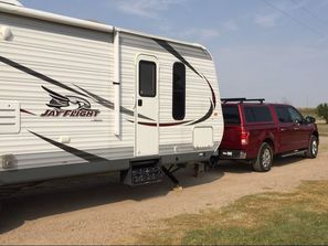
Because we’ve been so busy we haven’t got the trailer ready for our trip to Moab tomorrow. It will wait until morning!
September 20, 2017, On our way to Moab, UT
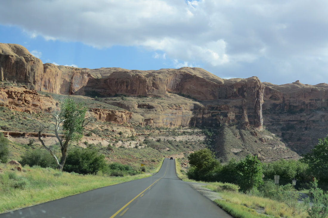
We weren’t in any hurry this morning so we got up around 7 am and were ready to leave around 8:30. We had a hard time getting the trailer out of the site as we were all so crammed in there it was hard for Mike to make the turn. With the help of a couple of our neighbors Mike backed the trailer up and away we went, time 9:45 am. On our way to Moab on Highway 163 we saw both horses and cows as this area is open range. We even had to dodge some cows that had wandered onto the highway. As we were passing the town of Mexican Hat we saw a balance rock on top of a spire that looked just like a Mexican hat.
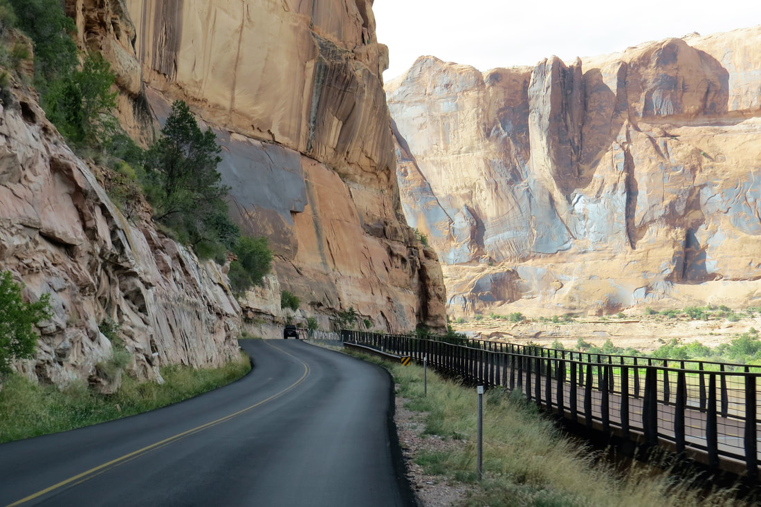
Highway 164 is narrow, hilly, and has lots of curves and steep grades; one was a 10% downgrade. I was glad when we turned onto Hwy 191 close to Bluff, UT because this highway was wider and the road isn’t as steep or curvy. We passed the exits to Valley of the Gods, Natural Bridge, and Gooseneck State Park, all places we wanted to visit but couldn’t find the time while in Mesa Verde and Monument Valley.
The landscape is changing drastically from sandstone to harder rock more like Zion NP or Bryce NP. We are not seeing buttes and spires but are seeing large mesas. It’s kind of a nice change that we won’t be bringing in all the red, sandy soil into the trailer.
We got to Spanish Trail RV Park about noon. We are very pleased with Spanish Trail, we had to do some leveling on the trailer for the site that we were on but otherwise it's a great RV park. Once we ate lunch at the trailer we drove to the Moab visitor’s center where we got information about Arches and Canyonlands particularly the hikes inside the parks, and we also stamped our National Parks passport book. Then, on we went to Arches NP entrance. We stopped right away at the visitor’s center and got more information from a park ranger. We drove part of the main road that runs into the national park. We only wanted to generally explore the park so we didn’t make many stops but drove by many of the points of interest that we’d like to come back to see in the next couple of days.
It was getting close to 5 pm; we had had a long day so filled up with gas at Moab. We ate dinner at a restaurant near the RV Park. Susie’s Branding Iron was good standard food. Mike and I drove by a couple of RV parks we wanted to check out which made us glad we were staying at Spanish Trail RV Park. We called it a night, planning on tomorrow’s itinerary.
September 21, 2017, Arches Visitor's Center and Moab
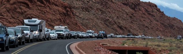
Today we had heavy winds, with gusts up to 50 mph. Mike anchored the trailer a little better just for precaution and then we headed out to Arches Visitor Center to sign up for Monday’s ranger lead tour of Fiery Furnace. We watched the film there, and then looked around a little. It was so windy that Mike and I decided today wasn’t a good day to do much viewing at Arches. Darn, one less day to do all the hiking we want.
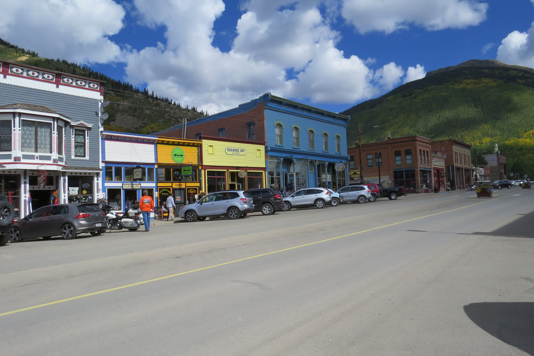
We decided to go to the town of Moab. It’s a really cute town with lots of great shops and restaurants. We did a lot of window shopping but we also bought a few t-shirts, sweatshirts, and Mike bought me a turquoise bracelet that I fell in love with. Good husband! We ate at Pasta Jay’s for lunch. It was really good, the best minestrone soup I’ve ever had, and the portions were huge, so we’re taking home leftovers. After lunch we did some more window shopping and since the wind prevented us from doing much else we headed back to the trailer to do some wash, and take care of a few bills. The wind never subsided so we stayed inside the trailer the rest of the day. Sometimes it’s kind of nice to get a break from our hectic schedule.
We decided to go to the town of Moab. It’s a really cute town with lots of great shops and restaurants. We did a lot of window shopping but we also bought a few t-shirts, sweatshirts, and Mike bought me a turquoise bracelet that I fell in love with. Good husband! We ate at Pasta Jay’s for lunch. It was really good, the best minestrone soup I’ve ever had, and the portions were huge, so we’re taking home leftovers. After lunch we did some more window shopping and since the wind prevented us from doing much else we headed back to the trailer to do some wash, and take care of a few bills. The wind never subsided so we stayed inside the trailer the rest of the day. Sometimes it’s kind of nice to get a break from our hectic schedule.
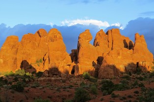
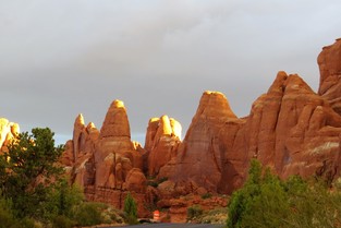
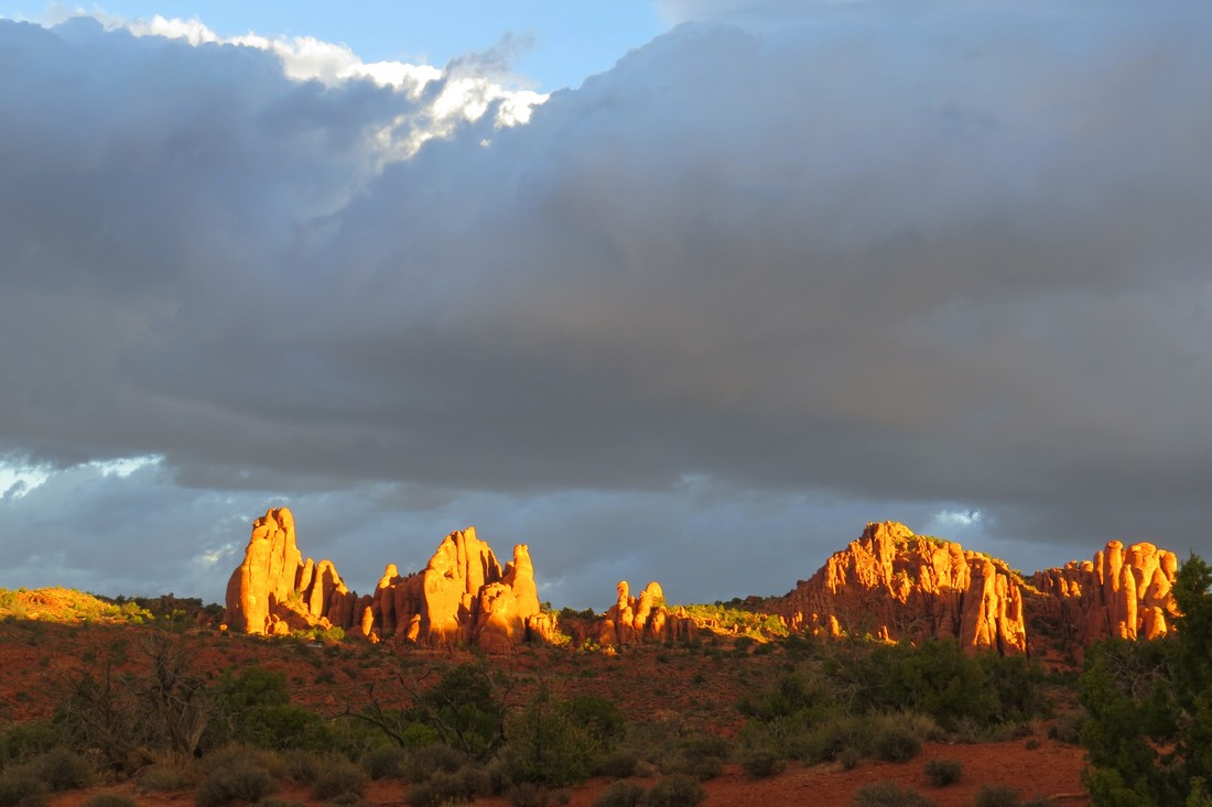
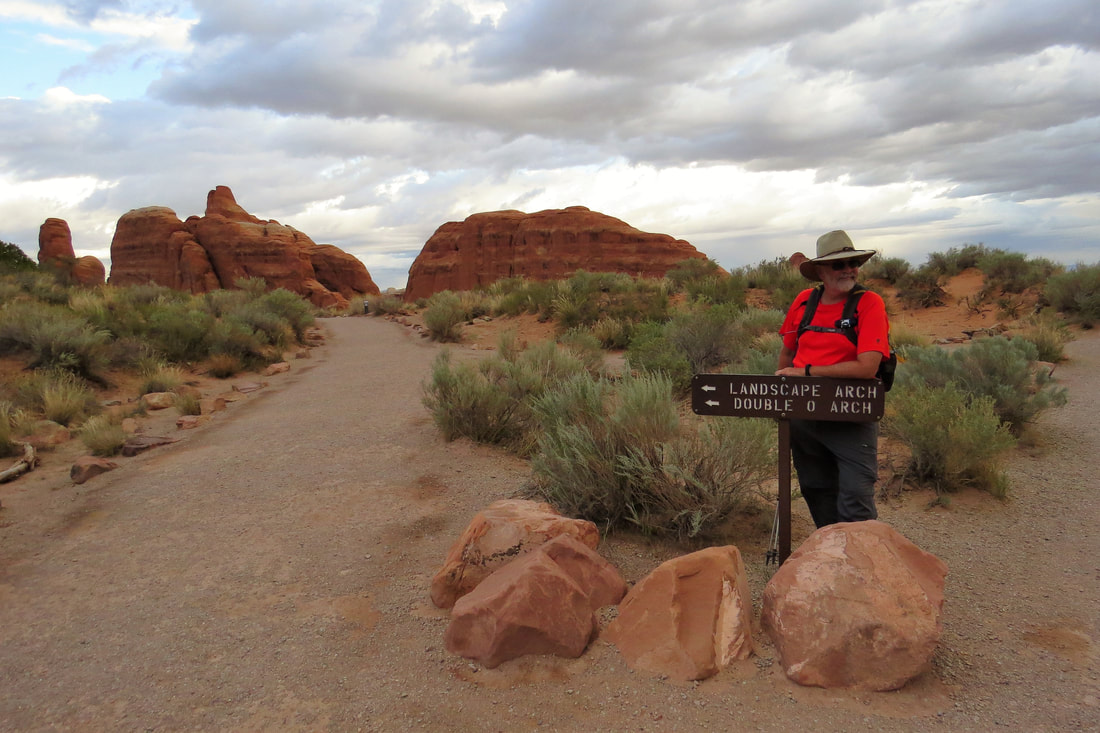
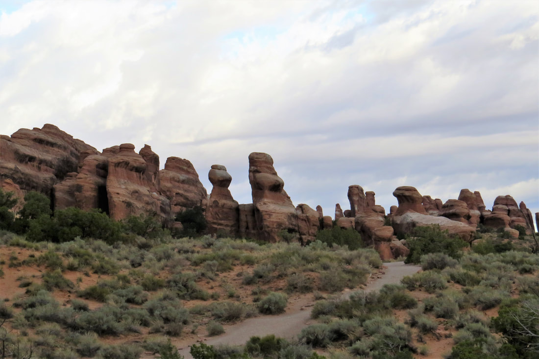
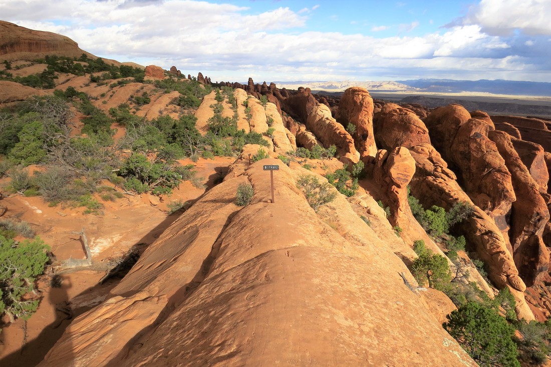
September 22, 2017, Devil's Garden Area, Landscape Arch, Double O Arch, and Highway 128
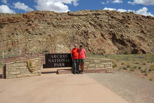
We got up early today so we could get to the park by 7 am to avoid some of the crowds. Our plan is to go to Landscape Arch and Double O Arch in the Devil's Garden area. We took our traditional photo at the Arches NP sign and then drove in to the park. Devil's Garden area is at the back of the park so it took us a while to get there. However because we were there so early we were able to see the sun reflected on the mountains, gorgeous!
|
|
|
Mike and I hiked to Landscape Arch without any trouble. It was about .8 mile from the trailhead. Landscape Arch is the largest arch in the entire world. Landscape Arch spans about 290 feet. It is amazingly thin and delicate looking and we took lots of photos. This was a great first arch for us to see.
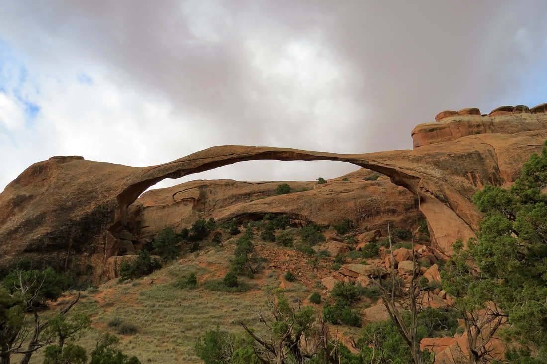
Landscape Arch at Devil's Garden Trail
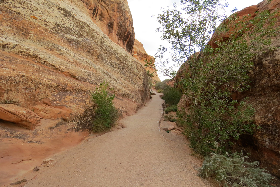
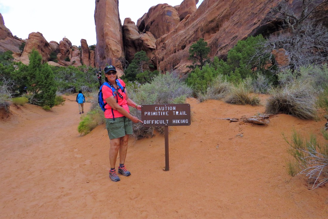
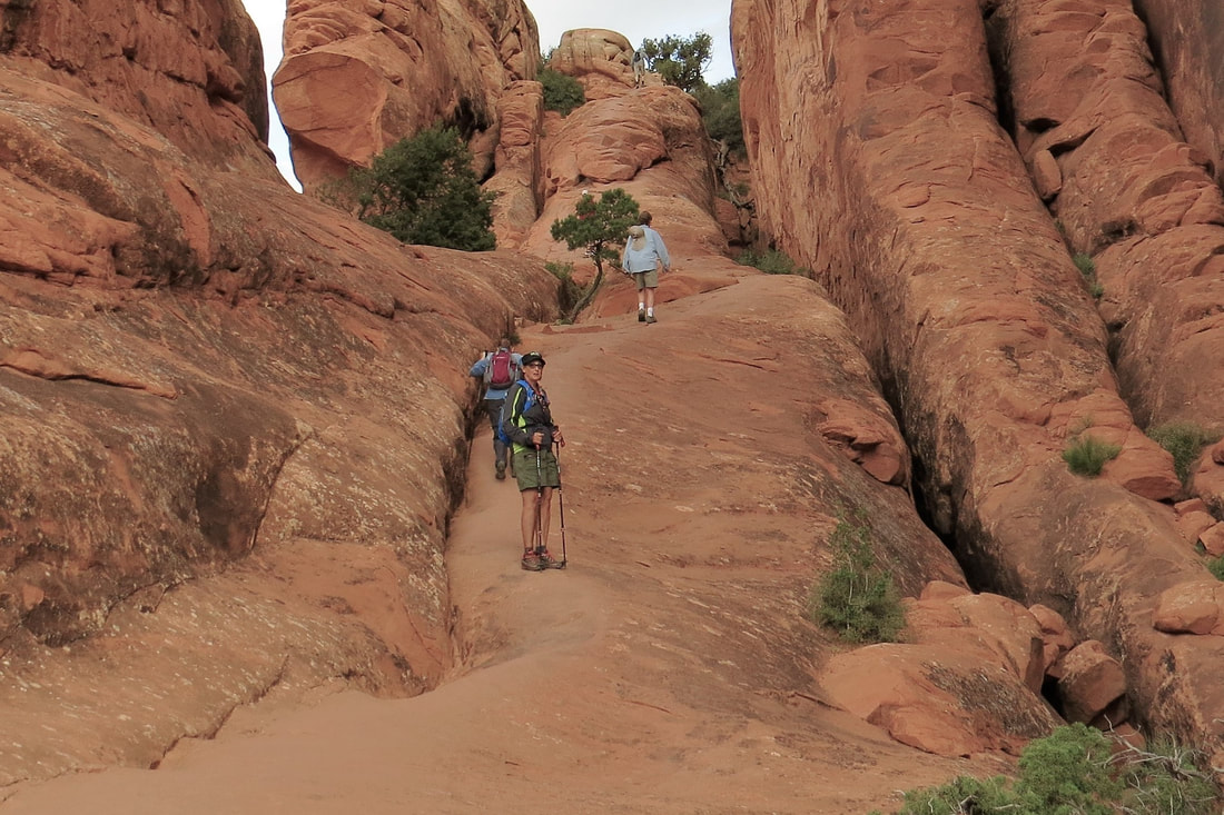
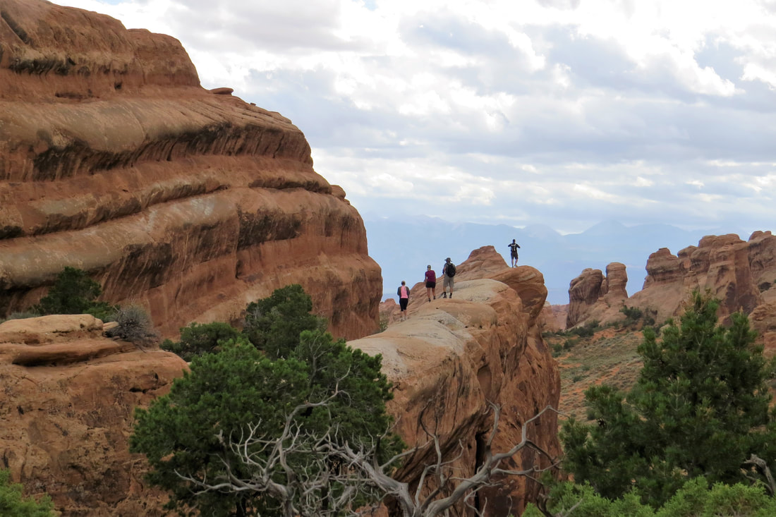
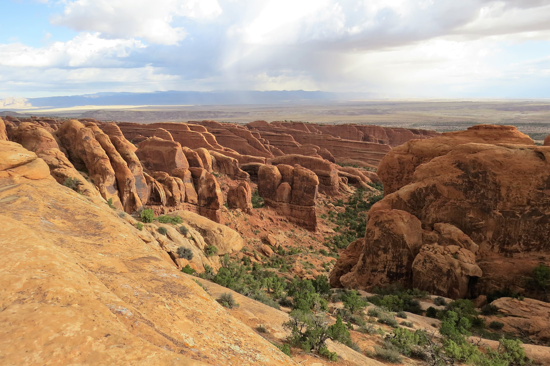
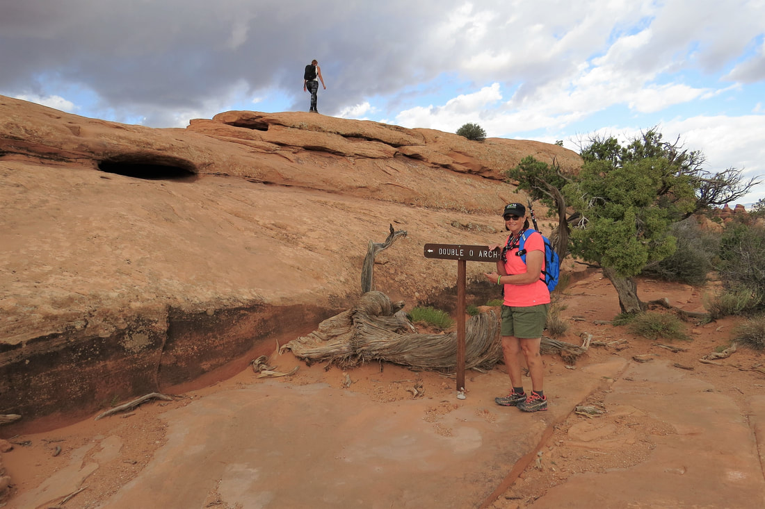
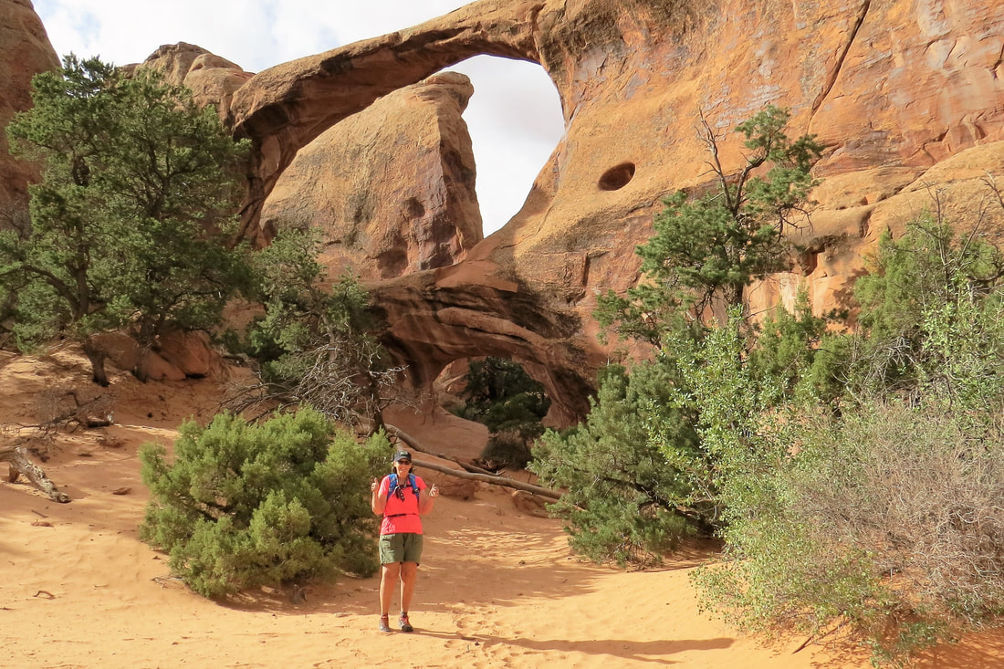
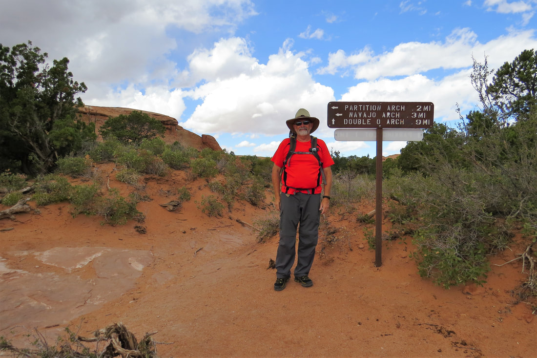
The trail to Double O Arch is considered difficult with steep, sloping surfaces and close proximity to drop offs. It’s a 4.2 mile roundtrip to Double O and that doesn’t include any side trips to other arches along the way. The beginning of the trail from Landscape Arch was very steep, narrow, and included a lot of rock scrambling. We did fine but you had to really concentrate on what you were doing. Once we made it to the top of the first section, the trail leveled off and was easy to hike. However it wasn’t long before we were having to do a lot more rock scrambling, and then had to hike over a long, narrow ridge with long drop offs on each side. I didn’t like this part but I just kept my eyes on my feet and got through it ok. After that challenge, it wasn’t long before we arrived at Double O Arch. The arch was pretty cool but we think more than the arch it is the hike that is the best part of this trail. We could have gone on and hiked the Dark Angel Trail. However this trail is considered primitive and challenging so we turned around at this point.
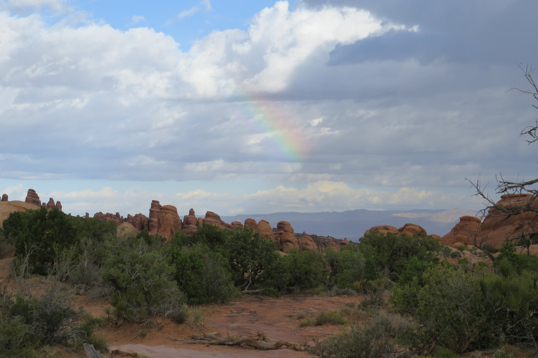
The weather was kind of crazy as we were hiking, rain, sunshine, wind, and some lightening in the distance. On our way back as we were climbing on the ridge the wind picked up to the point we had to stop walking, crouched down, and let the wind subside. The rock scrambling we had done at the beginning of the hike was even harder going down. I was really glad when we got down to more level ground but was also really glad we had made this hike. We also took a side trail to Navajo Arch on our way down. Navajo Arch isn’t really very spectacular but it wasn’t far off the trail so it was a good one to see. On our hike we met a nice man from Zurich, Germany. It is amazing all the people you meet while hiking and he hiked with us on our way down the trail. I never did get the hang of his name but that didn’t seem to bother him and told us to call him Marcus. The trail took us about 3 ½ hours and we had walked a total of about 6 miles. The hike was a lot more difficult than I anticipated even after doing a lot of research.
The weather was kind of crazy as we were hiking, rain, sunshine, wind, and some lightening in the distance. On our way back as we were climbing on the ridge the wind picked up to the point we had to stop walking, crouched down, and let the wind subside. The rock scrambling we had done at the beginning of the hike was even harder going down. I was really glad when we got down to more level ground but was also really glad we had made this hike. We also took a side trail to Navajo Arch on our way down. Navajo Arch isn’t really very spectacular but it wasn’t far off the trail so it was a good one to see. On our hike we met a nice man from Zurich, Germany. It is amazing all the people you meet while hiking and he hiked with us on our way down the trail. I never did get the hang of his name but that didn’t seem to bother him and told us to call him Marcus. The trail took us about 3 ½ hours and we had walked a total of about 6 miles. The hike was a lot more difficult than I anticipated even after doing a lot of research.
Double O Arch at Devil's Garden Trail
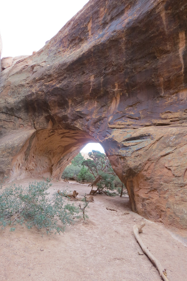
Navajo Arch at Devil's Garden Trail
Mike and I had lunch in the truck that we had packed as there aren’t many picnic areas in the park. We were going to hike to a few other arches but the crowds were horrendous so we returned to the trailer, and changed our plans for the day.
We decided to take Highway 128 for a scenic drive. Highway 128 was a beautiful drive, and a lot like Monument Valley. We said if we had known what Moab was like we might have skipped Monument Valley and just concentrated on the Moab area. Highway 128 ran along the edge of the Colorado River and had lots of curves but we’re beginning to get used to that around here. We stopped at Fisher Towers which reminded us of Bryce Canyon. This would be a great place to hike if you wanted to get away from the Arches crowds. It had a 2 ½ mile hike and the trail is through quite a few buttes and spires. This was really a gorgeous area. We drove on to Dewey’s bridge and then turned around to return to Moab.
We ate dinner at Fiesta Mexicana recommended to us by Peggy at our RV park. The food was ok but we were disappointed. We always expect more from Mexican Restaurants in the southwest. We returned home and planned for the next day.
September 23, 2017, Windows Section, Double Arch, Skyline Arch, Sand Dunes Arch, Broken Arch, and Canyonlands
Mike and I got up today at 5:45 am so we could be at the gate to Arches by 7 am when they opened. While we were visiting hours for the park were 7 am - 7 pm due to construction. This photo was taken this morning when we were leaving the park.
At some of the trailheads parking was hard to find but we discovered by getting to the park early and leaving late morning we could avoid most of the traffic. The other advantage to getting there early is there are no park rangers collecting admission fees until later in the morning, not sure what time. However, we have the senior passes so we wouldn't have had to pay the entrance fee, anyway.
At some of the trailheads parking was hard to find but we discovered by getting to the park early and leaving late morning we could avoid most of the traffic. The other advantage to getting there early is there are no park rangers collecting admission fees until later in the morning, not sure what time. However, we have the senior passes so we wouldn't have had to pay the entrance fee, anyway.
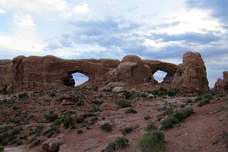
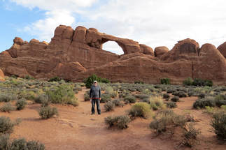
After driving through the gate we went directly to the Windows Section. Yesterday we tried to park at this section but it was so crowded we gave up. I can see why this section is so popular. It was an easy walk to view North and South Windows and then viewed Turret Arch along the same pathway. We walked up to the North Arch where we took some photos of each of us in the center of the arch. This is an iconic photo and we’ve seen it in numerous publications. We had to do a little rock scrambling to get there but it was pretty easy and fun.
North and South Windows
|
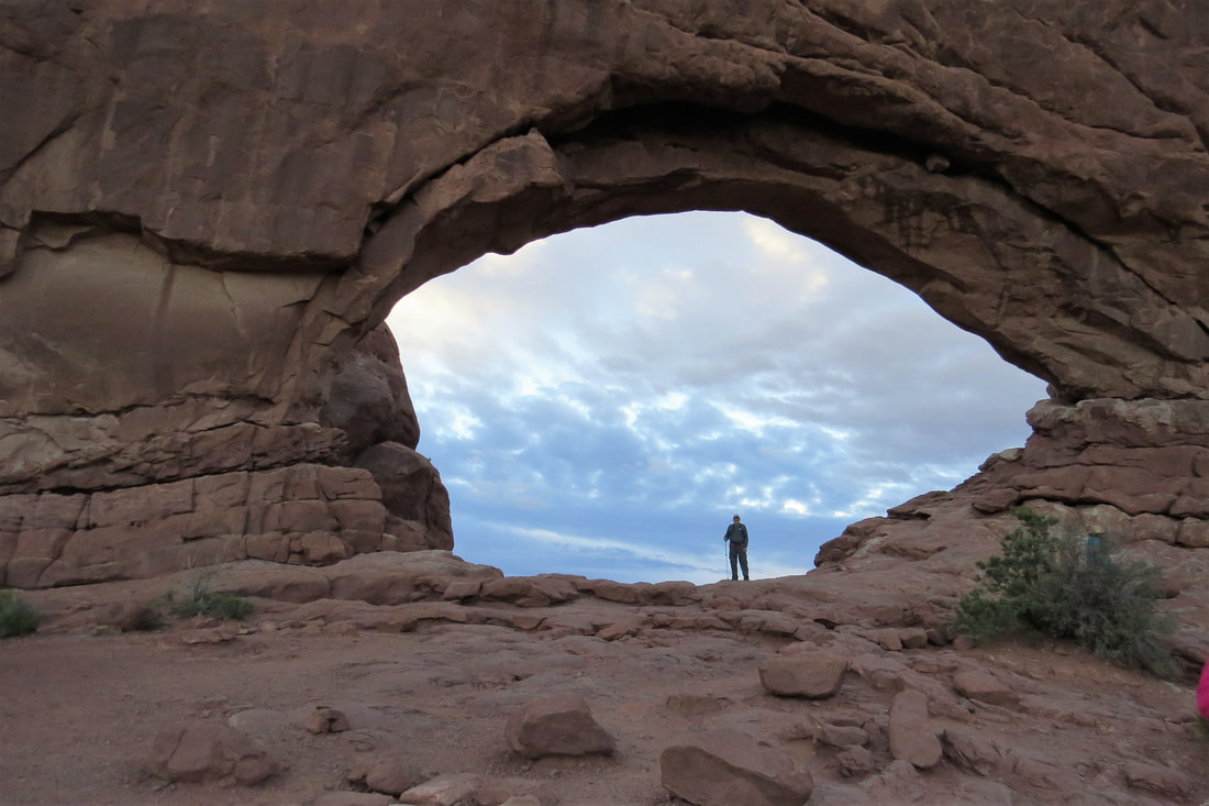
North Window
|
South Window
|
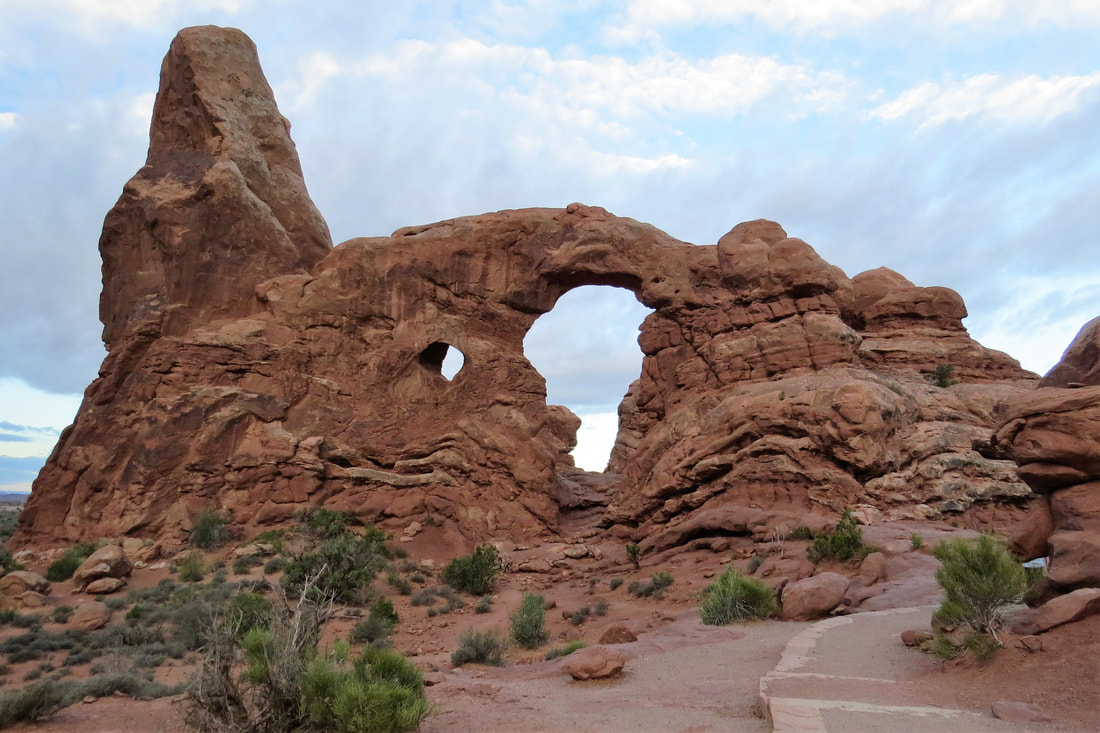
Turret Arch
|
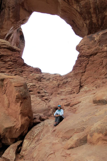
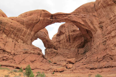
After viewing all three arches on the Windows Trail we hiked the Double Arch Trail near the Windows arches. It was a really short, easy hike and we did more rock scrambling to sit near the top of the rocks at the arch. Again it was really fun and an easy scramble with lots of photos taken. The larger opening has a span of 144 feet and a height of 112 feet. In the past Double Arch was called Double Windows, Twinbow Bridges, and the Jug Handles.
After viewing all three arches on the Windows Trail we hiked the Double Arch Trail near the Windows arches. It was a really short, easy hike and we did more rock scrambling to sit near the top of the rocks at the arch. Again it was really fun and an easy scramble with lots of photos taken. The larger opening has a span of 144 feet and a height of 112 feet. In the past Double Arch was called Double Windows, Twinbow Bridges, and the Jug Handles.
|
|
After Double Arch we drove to Skyline Arch. There really wasn’t much to this arch but the good thing was this was a super short trail. Nearby was Sand Dunes Arch and Broken Arch Trails so we decided to hike them. Sand Dunes trail was a really short trail through a sandy area. The arch is in a shady area between two sandstone fins. Mike and I had fun pretending to climb those walls. From the Sand Dunes Arch Trail we walked about a 2 mile round trip to Broken Arch. The trail took us through an open grassland so it was a very level trail. It’s not really broken but a crack through the top gives it its name. We did more rock scrambling here and got more great photos It was so much fun and we are proud of ourselves for all of the rock climbing we have been doing. We also think that a lot of these arches that don’t get a lot of attention are a whole lot of fun!
Sand Dunes Arch
|

Broken Arch
Skyline Arch
|
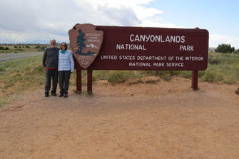
By this time it was around 10:30 and it had been a great morning in Arches NP but it was beginning to get crowded. Mike and I decided to go to Canyonlands and see if it might be less crowded. Canyonlands has an interesting history. The first interest in this area was for the development of a dam just below the confluence of the Colorado and the Green Rivers. However where others saw it as a reservoir, Secretary of the Interior, Stewart Udall, saw it as a national park. With Udall’s encouragement, President Lyndon Johnson signed the Wilderness Act in 1964 making this area a national park, now known as Canyonlands.
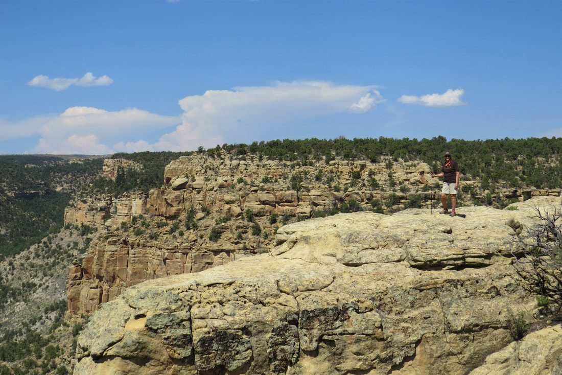
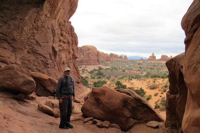
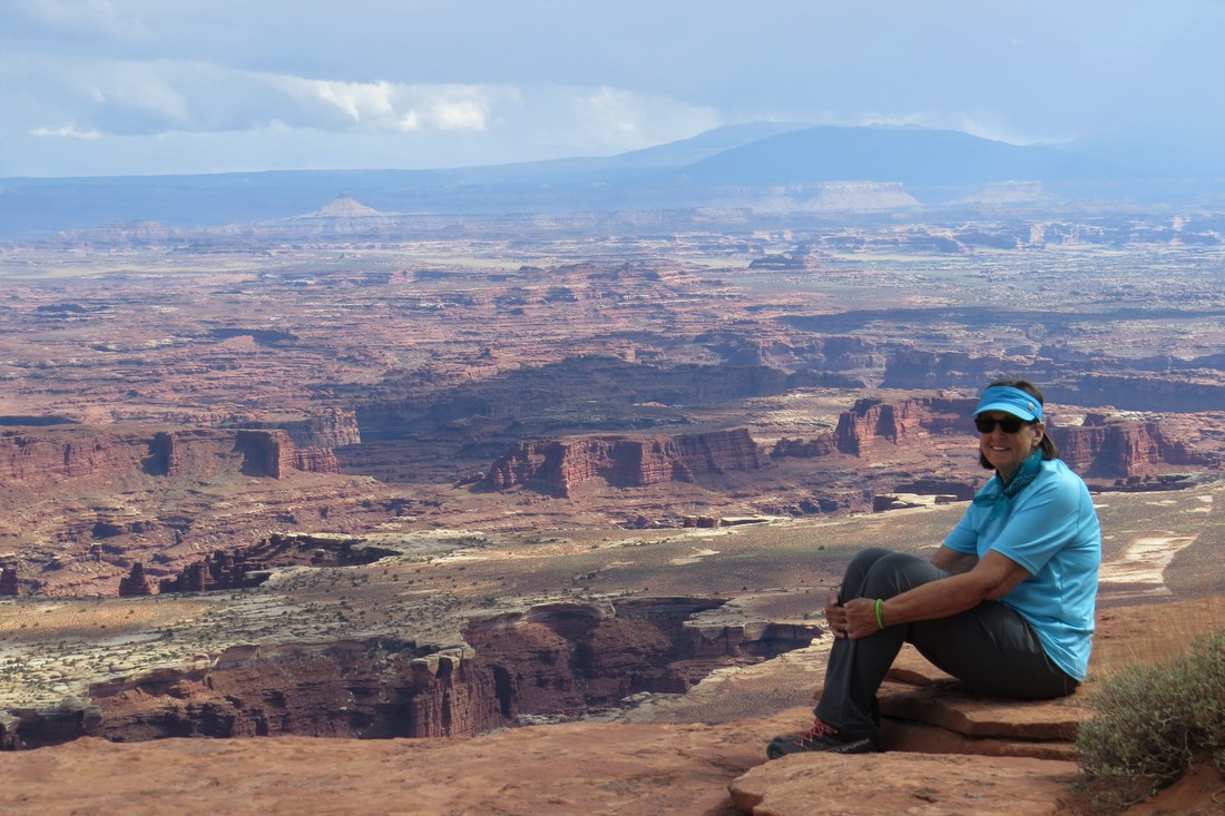
First thing in arriving in Canyonlands NP we stopped to get our photo near the park sign and then drove to the visitor’s center. There we had a ranger give us advice as to the trails to take. Canyonlands was busy but not as bad as Arches although there weren’t many parking places at any of the trailheads. We bought a sticker and magnet as usual at the visitor’s center and then had lunch at one of the picnic tables nearby. After lunch we drove to the Buck Overview, snapped a few photos and drove on. Some of the trails that the ranger thought might not be too busy didn’t have any available parking spaces but we were able to snag a place down the road from Grandview Point. We walked to the Grandview Point Overlook and then took the two mile trail. I think by this time Mike and I were getting tired but we wanted to do this hike. The trail follows the canyon’s edge is mainly on slickrock so it was a little hard on our feet and knees. Nevertheless, when we got to the end of the trail we did more rock scrambling to get us to the top, and we were rewarded by panoramic views of the canyon. Mike and I spent a little time here and then headed back to the trailhead.
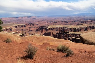
Grandview Point Overlook
|
Grandview Point Overlook
|
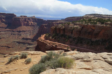
Visitor's Center Overlook
|
By the time we got back to the trailhead we had hiked 7.5 miles total for the day. We headed back to the trailer, had dinner, and stayed in for the night. About the time we got back to the trailer it started raining and hailing. It stopped after an hour or so. We’ve had it all while we’ve been here, sun, rain, hale, and strong winds. We’re hoping it will clear up so we can go back to Canyonlands tomorrow for more hikes and views!
September 24, 2017, Canyonlands hiking Mesa Arch, Upheaval Dome Trail, and Wilhite Trail
Off today for an early start at Canyonlands. Our first stop was at Mesa Arch since we couldn’t see it yesterday due to the crowds. We didn’t really expect much from this short trail but once we got to the arch it was pretty amazing. Because it was shortly after sunrise the reflection of the sun rays made the arch look almost golden. We spent some time here taking photos. At the end of the day when I looked at our photos I couldn’t believe that the camera had picked up those golden highlights and it almost looked like I had photo shopped the images.
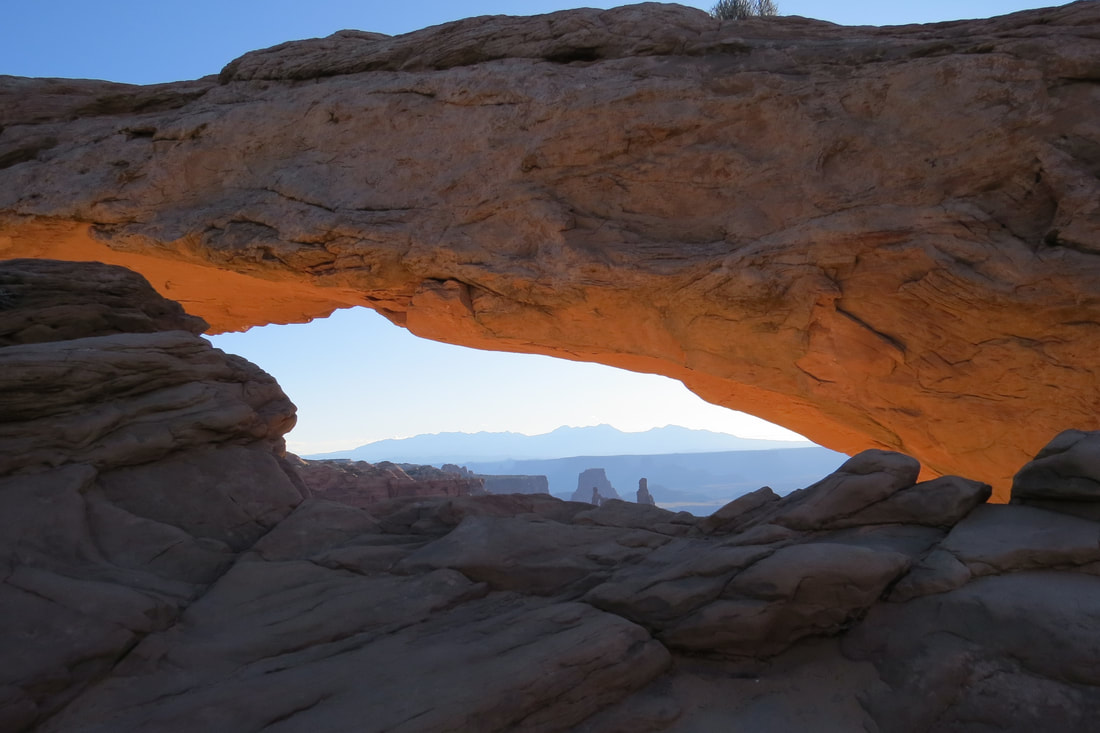
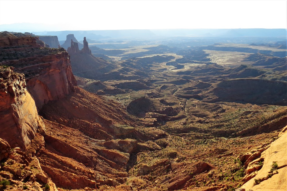
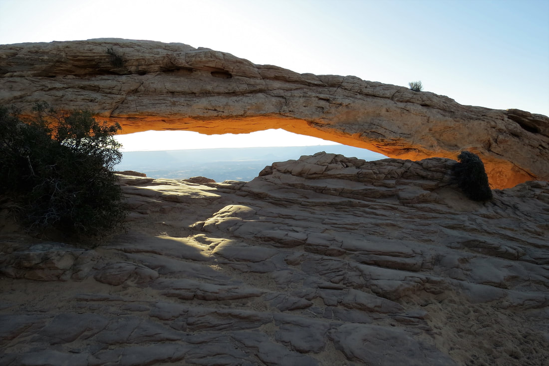
Next stop was at the Upheaval Dome Trail. The circular depression is two miles wide and is a mystery that has not been solved yet. The theories are that it is either a salt dome that cracked or a meteorite strike. I’m not sure why but we thought this 2 mile hike would be easy and it was to the first overlook. However, as usual, Mike and I decided to go farther to the second overlook. The trail was steep and very rocky and included some rock scrambling at times. Also there was a section of the trail that was cut into the side of the cliff that was a bit scary especially going down. Talk about wall huggers, that was us. Once we got past this section the trail got easier. It wasn’t so much what we saw at the end of the trail but the hike itself that was thrilling. Mike and I stayed at the second overlook to get our breath before climbing back up the trail. It seemed like it was an easier hike going up than it was going down. The hike took us about 2 ½ hours.
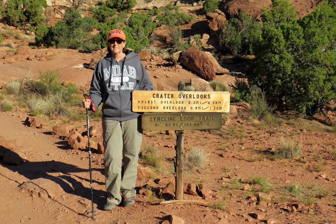
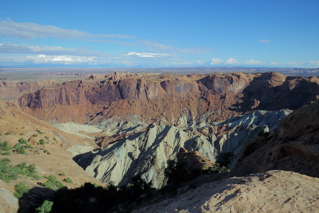
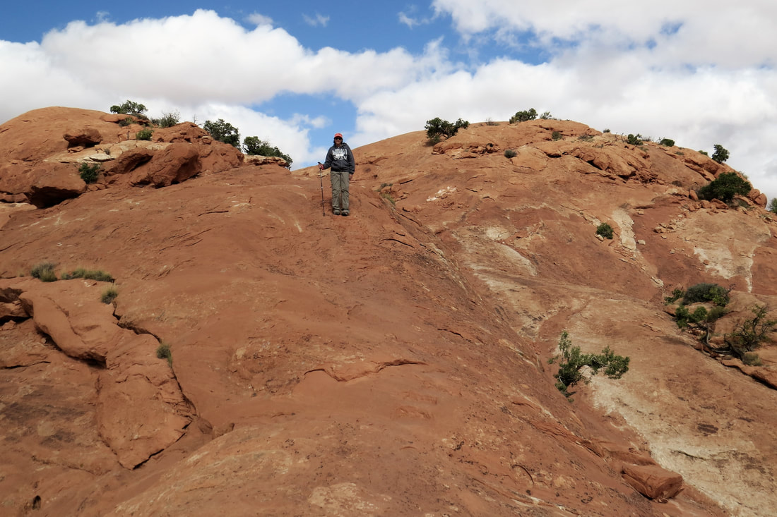
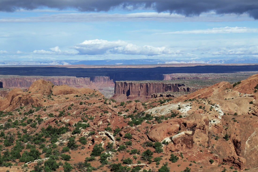
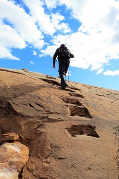
|
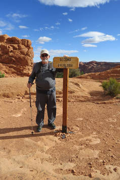
|
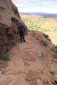
|
On our way down from the Upheaval Dome Trail we visited with a park volunteer and she suggested another hike on Wilhite Trail. She told us about a Pueblo Grainery that was built in the side of the ridge and to be on the lookout for it. Mike and I hadn’t planned on taking another hike but we thought we’d check it out.
Since we were going on another hike Mike and I refueled ourselves with lunch that we had packed and ate at a picnic table right outside the Upheaval Dome Trailhead.
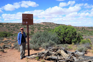
After lunch we drove to Wilhite Trail to start our hike. This trail is considered difficult because after 1 ½ miles it changes to rough switchbacks to hike to the cliff floor. Mike and I didn’t intend to do the switchbacks but the park volunteer told us it was one of her favorite hikes in the park and to return to the trailhead once we got to the switchbacks. The trail started nice and smooth but like all the other trails in this park it changed soon to a rough, rocky path with some rock scrambling. Mike and I kept looking for that Pueblo Grainery which the park volunteer said not many people knew about and shortly on our hike we found it tucked under an alcove. We went on, following the cairns which at times were hard to see. The trail eventually ended for us at the switchbacks. I can’t imagine going on but some people do. The switchbacks were narrow and covered with rock leading down the cliff wall. If it hadn’t been for the cairns we wouldn’t have known it was the trail. Mike and I rested for a little bit and then hiked back to the trailhead. It seemed like a hard hike to us but I think we were already tired from our earlier hikes. The entire hike was 3 miles long and took us 2 hours and 15 minutes, not bad considering the rocky trail.
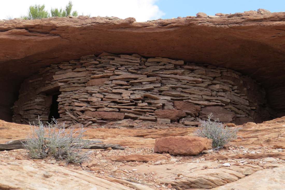
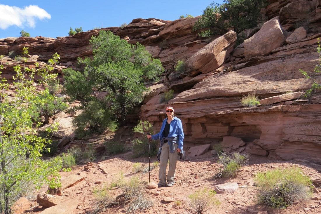
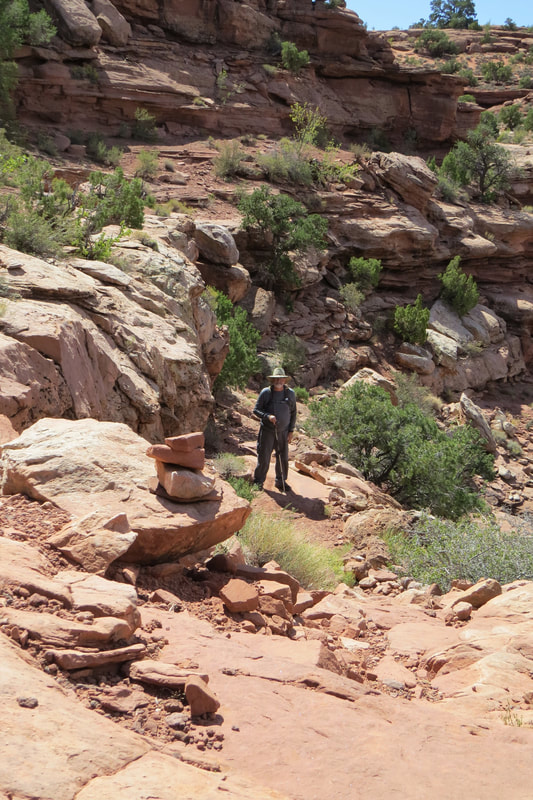
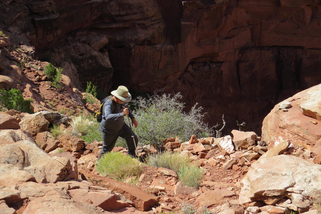
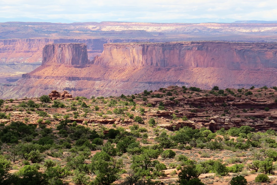
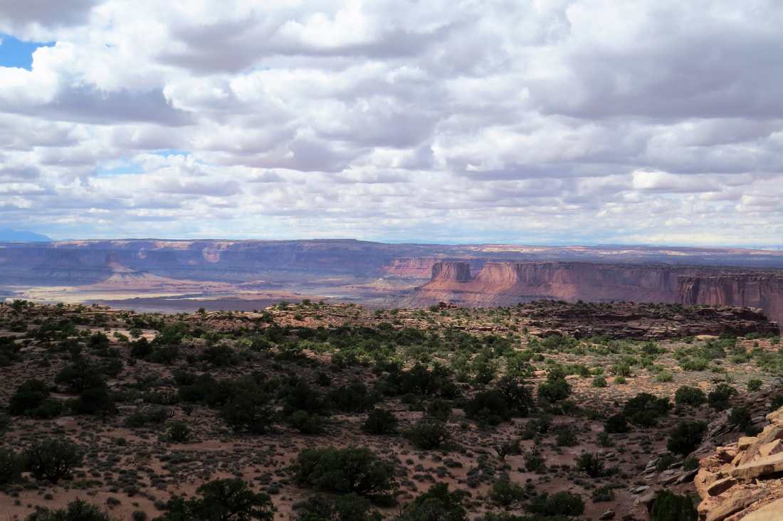
We got back to the trailer around 3:30 pm and we were tired. Mike was so tired he even took a nap and Mike never takes naps. We went out for dinner at Zax’s Restaurant and Watering Hole. It was a fun, funky place and serves pizza and pasta. Mike and I shared a pizza and it was wonderful, maybe the best pizza we’ve ever had. After that we returned to the trailer getting ready for our hike at Fiery Furnace in Arches NP the next day.
September 25, 2017, Arches NP, Fiery Furnace Ranger Led Hike
We were up early and left the trailer at 7:30 am. Our ranger led Fiery Furnace tour today didn’t start until 9 am but we weren’t sure what the traffic would be like and the visitor’s center had advised us to allow 1 ½ hours to get there. As it turned out we didn’t need all that time and so had about 45 minutes to spare when we got to the trailhead.
Near 9 am the ranger met us for the trail. His name was Travis and this was his last Fiery Furnace tour at Arches NP before going to his next assignment. He went through all the safety rules before we began the trail. There were 14 of us in the group, including a family with two young children, ages 7 and 9. Right away we got into some pretty serious rock climbing and we were wondering what the heck we had gotten ourselves into. At the first stop he gave us another chance to back out of the tour. He explained that there were going to be some difficult climbs, gaps that had to be jumped over, and some narrow ledges with steep drop offs. No one backed out but there were a few who had some doubts. In the end there might have been two people who shouldn’t have continued. One had a bad knee and the other elderly man had trouble ascending some of the rocks and boulders. If it hadn’t been for Mike I’m not sure I would have made it but he gave me lots of hand holds keeping me on the trail! As we went further on the trail it didn’t get any easier, in fact there were three really difficult passages. At each difficult passage, Travis, the ranger, would show us where to put our feet and hands for an easier climb up the rock. It was up to us though to get through, no helping hand from the ranger!
At one place we had to brace our feet against one side of the rock wall and our hands against the other side, walking sideways through the narrow passage. At another place we had to put our backs against the angled rock wall and our feet against the other side, and shuffle sideways until we could get to the level pathway. All in all, it was much more difficult than Mike and I anticipated. Mike kept helping the elderly gentleman through passages by giving him hand holds. We had to cut the tour short by a little bit because of time constraints but were still able to tour 80% of the trail. Travis said that this was not uncommon depending on the agility and speed of the group he had. He said the main thing was that we all made it without injuries and that everyone had had a good time. I’m not sure we’ll ever attempt this again but glad we can add this to our accomplishments at Arches NP.
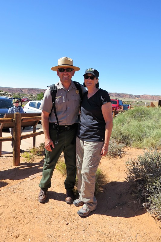
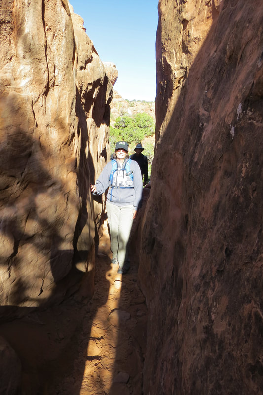
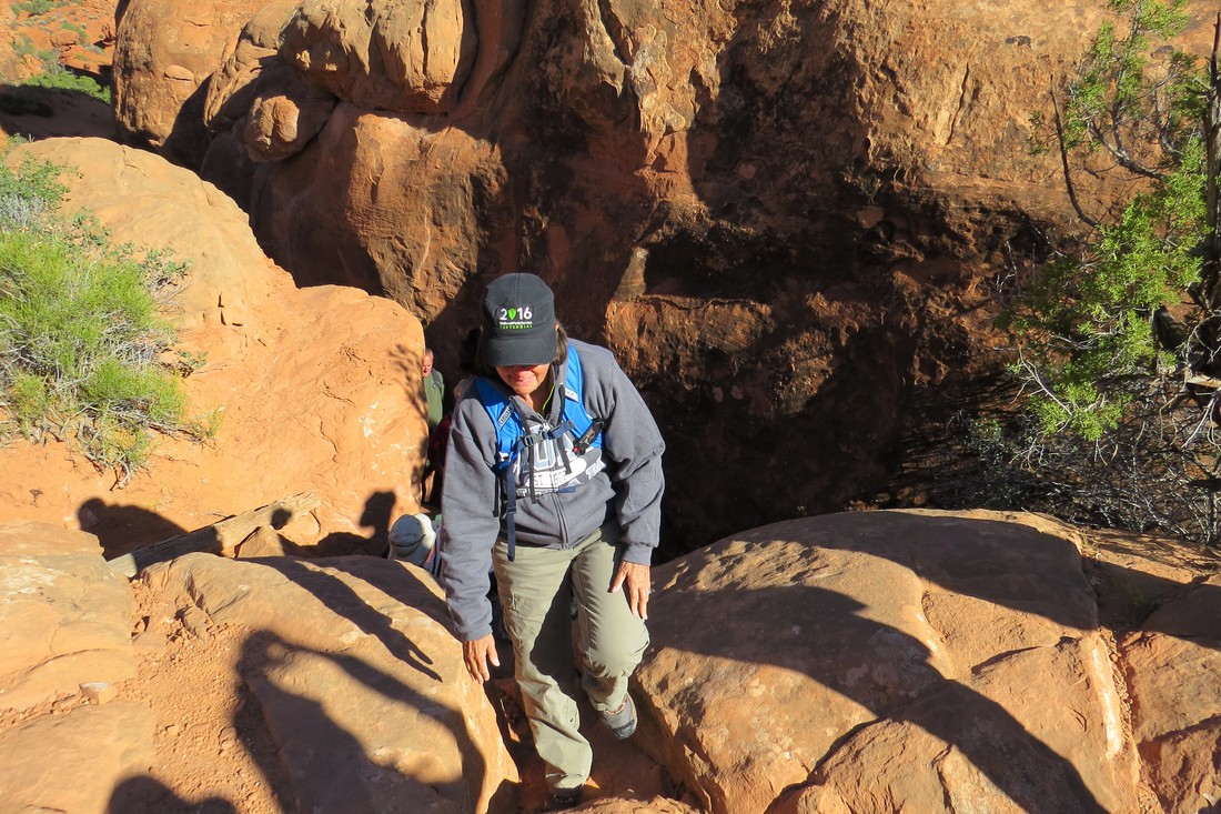
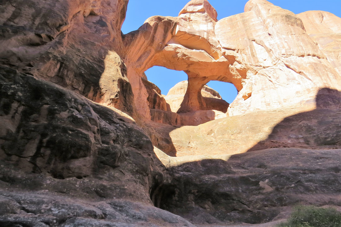
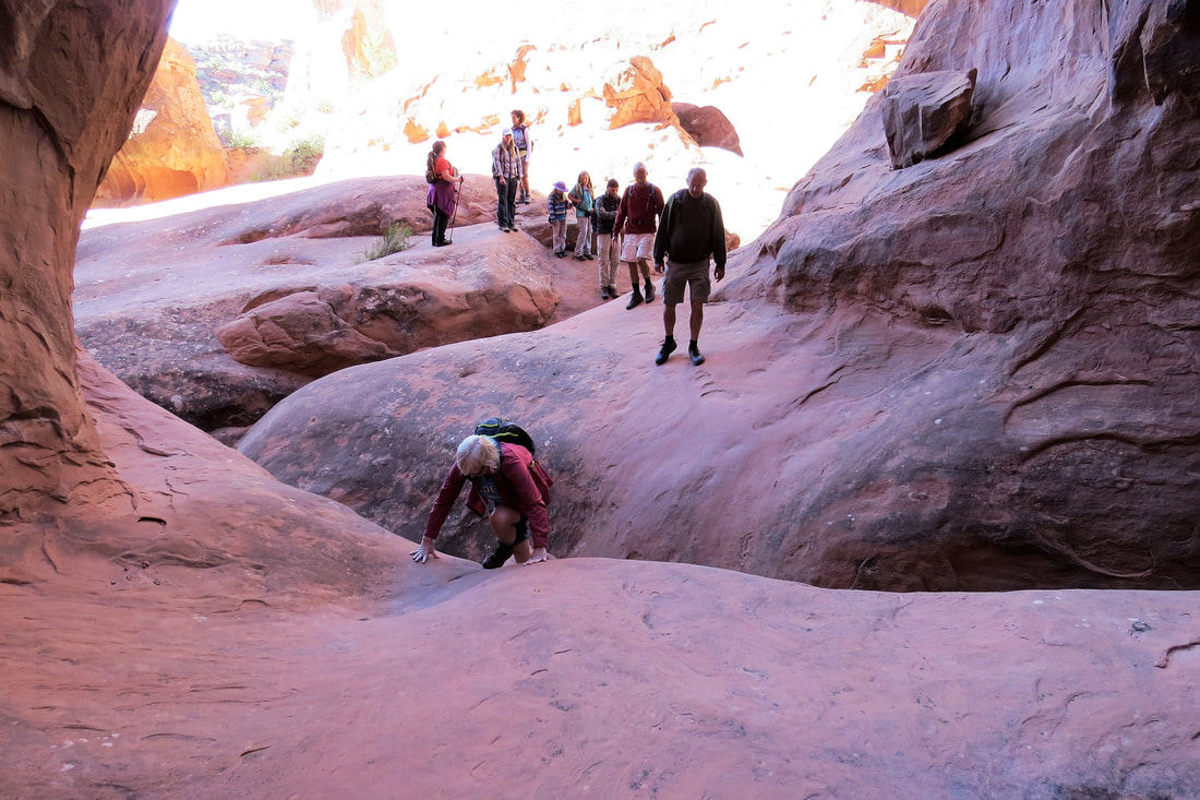
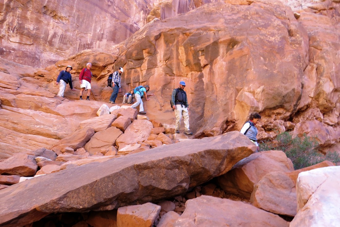
We ate at Quesidilla Mobilla, great quesadillas. Portions were huge so now we have dinner for tonight, too. We’ve eaten out a lot more than I anticipated but the restaurants at Moab are great. We relaxed the rest of the day, catching up on TV news, showers, and getting ready for tomorrow’s hard hike to Delicate Arch. We have one more day and then will be driving to Tucson for some R & R.
September 26, 2017, Arches NP, Delicate Arch
We were up early and at Arches NP gate at 7 am when they opened up. I was surprised how many people were here this early. We got to the trailhead for Delicate Arch and were on the trail by about 8:45 am. I had heard this was the best trail and arch in the park but that the trail was steep and moderately strenuous. It was steep but somehow it didn’t seem that bad. It was about 45 degrees outside but we dressed accordingly so it didn’t seem so cold. It takes 1 ½ miles to get to the arch by a very steep trail, but the reward is when you turn the corner at the top of the trail and there in all of its glory is Delicate Arch.
This free-standing arch has become a widely recognized symbol of the state of Utah and one of the most famous geologic features in the world. The light opening beneath the arch is 64 feet high and 45 feet wide, making it the largest free-standing arch in the park. It has had more than a few names in its history, from the colorful ("Cowboy's Chaps", "Old Maid's Bloomers") to the prosaic ("Salt Wash Arch"). The term "Delicate" first appeared in a January 1934 article about the Arches National Monument Scientific Expedition, which described it as "the most delicately chiseled arch in the entire area."
Already by this time the trail was getting crowded as it is one of the most popular arches in the park. I walked down near the arch, stood underneath it and Mike took photos of me. It was kind of a thrill to go under the arch. Once I got back to Mike we didn’t stay long as it was getting so crowded. When it starts getting this crowded, Mike and I always say it must be time to go. It was another 1 ½ or more miles to get back to the trailhead but it was a lot easier and took us less time going down.
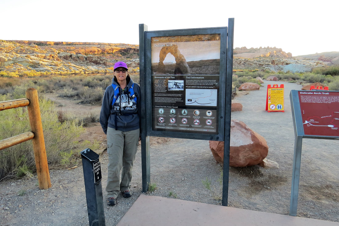
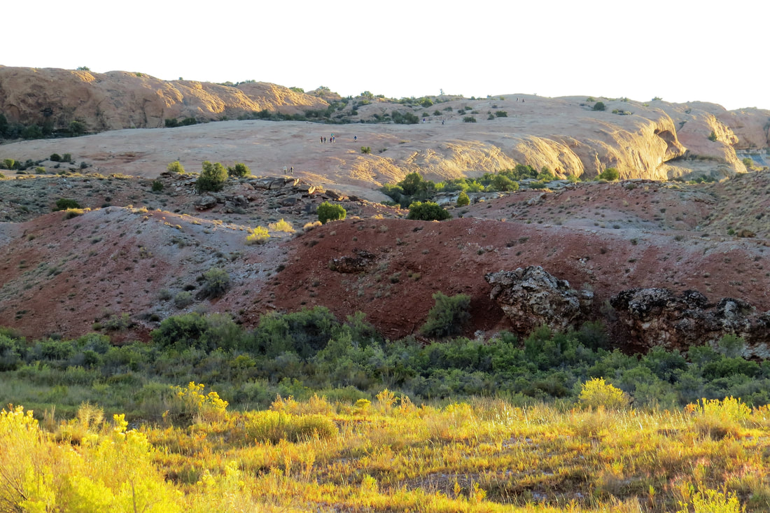
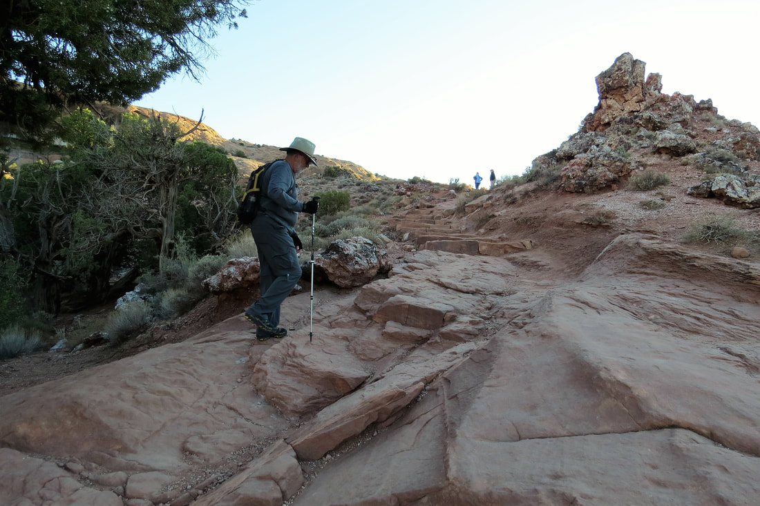
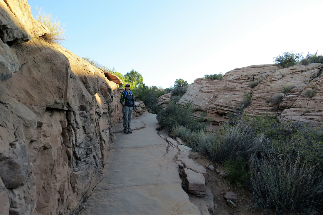
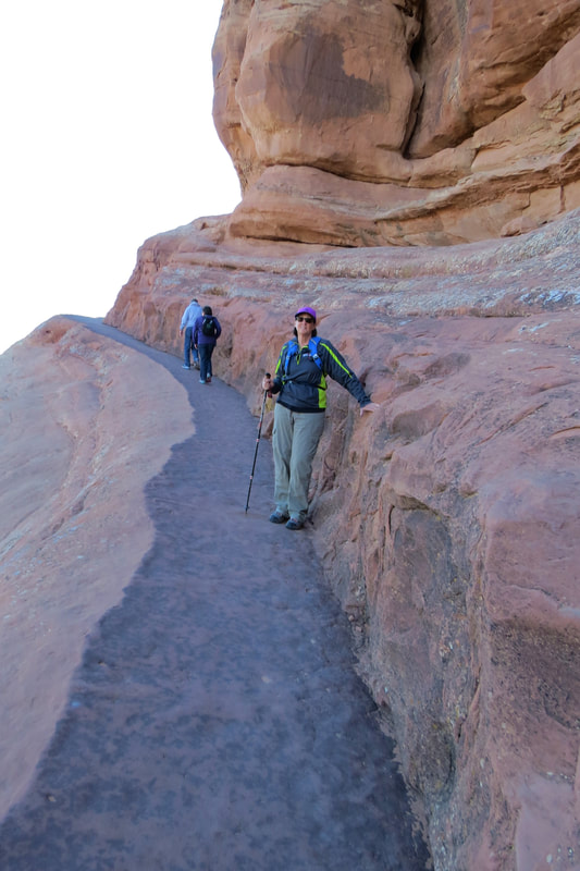
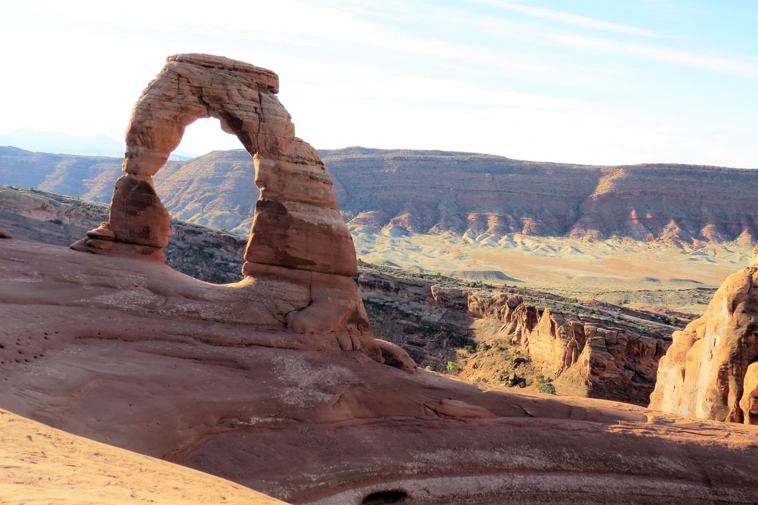
On our way back there was a short trail leading to some petroglyphs. Although we’ve seen a lot in our travels it’s always a thrill to see them and this was a pretty amazing and vivid panel. Also on the way back was another short stop to see the remaining building of the John Wolfe Ranch. The Wolfe family lived alone in this 100 acre remote ranch settling here in the late 1800s. It’s hard to imagine living in these harsh conditions.
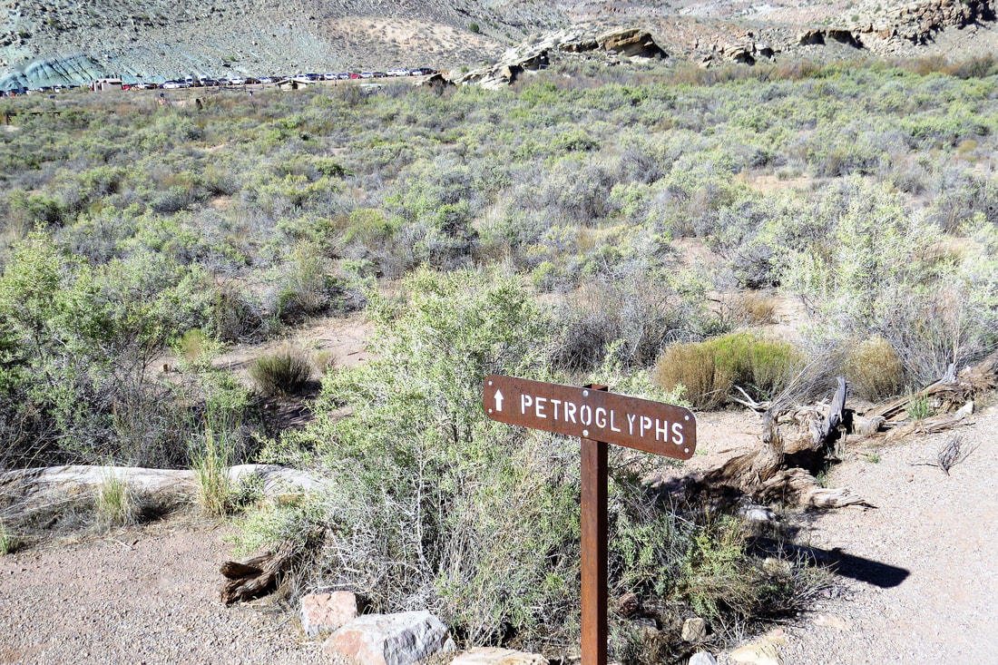
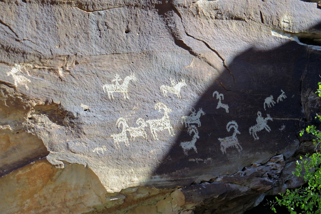
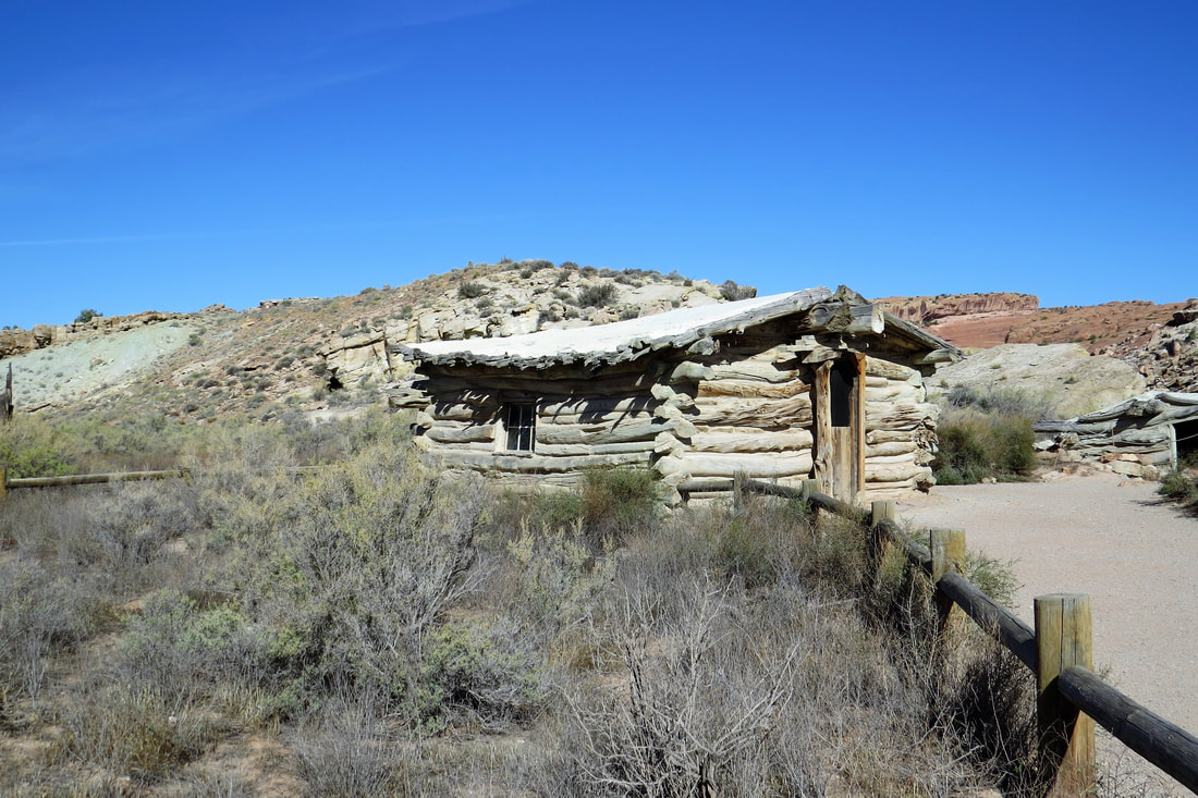
After the hike Mike and I returned to the trailer by about 11:30 am, ate lunch and spent the rest of the day packing the trailer for tomorrow’s trip. Tucson, here we come! We ate at Eddie McStiff”s for dinner in Moab. It was just average and we wish we had eaten at the trailer. Oh well, another bad choice of mine through Trip Advisor.
September 27, 2017 On our way to Tucson
We were up early and left Moab around 7:15, we’re sorry to go since we like the area so much but anxious to get to Tucson for several weeks. Nothing much today but driving to Flagstaff, AZ on our way to Tucson and Rincon West. There wasn’t even a place to stop for breakfast so when getting gas at Mexican Water, AZ we got snacks we could eat while driving and riding. The wind picked up near Kayenta, AZ so for about 45 miles Mike fought the wind with the trailer. We were glad when we got to Highway 89 that we had a tailwind. That’s the one thing I hate with the trailer and how it’s affected by the wind.
Once we got on Hwy 89 we drove to Cameron Trading Post. Cameron is a cute place, restaurant, a huge, nice gift store, hotel, and gas station. To stretch our legs we went into the gift shop (no purchases for a change). We then ate lunch in the trailer. The temperature was probably mid 60s so it was nice eating in the trailer.
We got to J & H RV Park around 2 pm and checked in. We’re not impressed with the RV Park, really nice in a lot of ways, expensive, and the sites are small. We had to unhitch the truck to fit onto the site. At first we thought we were going out to dinner at 5 pm only to realize it was 4 pm as the time had changed while we were on the road probably going into Arizona. No matter, an early dinner for us today. We went to Fat Olive’s for dinner, an Italian Restaurant that we had been to before. We were disappointed with our meal. Thr salads were good, and we love their roasted olives. We ordered a pizza, but next time we’re sticking with the pasta. We got gas while we were out and then back to the trailer for the night.
September 28, 2017, Tucson
We left this morning around 7:15 and it was 35 degrees….brrrr! Nothing unusual about the drive however we took a bypass so we could avoid pulling the trailer through the traffic in Phoenix. Probably worth it but it added about an hour to our drive to Tucson. Close to Phoenix we began to see saguaro cactus, a sure indication we are driving into the desert. Seeing these always gives us a thrill.
We arrived at Rincon West RV Resort in Tucson around 1 pm tired but really glad we were finally here! Once we were set up somewhat we took time to have a quick lunch. It took us most of the day to set the trailer up outside and inside and we still had work to do at the end of the day. Mike and I were surprised there weren’t more people here, it’s really lonely here. We’re glad Carol and Lisa will be here soon so we will have company. On top of that it’s really hot here especially in the trailer that really heats up. We have decided if we do this again we will plan on getting here mid October and go back home (Kansas) for the holidays.
We arrived at Rincon West RV Resort in Tucson around 1 pm tired but really glad we were finally here! Once we were set up somewhat we took time to have a quick lunch. It took us most of the day to set the trailer up outside and inside and we still had work to do at the end of the day. Mike and I were surprised there weren’t more people here, it’s really lonely here. We’re glad Carol and Lisa will be here soon so we will have company. On top of that it’s really hot here especially in the trailer that really heats up. We have decided if we do this again we will plan on getting here mid October and go back home (Kansas) for the holidays.
October 19, 2017 Hatch, NM
We stayed in Tucson, AZ until October 19 at Rincon West RV Resort. We spent this time playing pickleball, eating out at some pretty terrific Tucson restaurants, swimming, biking, hiking, seeing friends, and a lot of rest and relaxation.
October 19 we headed for home (Kansas) leaving our trailer in Tucson, and stopped at Hatch, NM for a few hours. I have been wanting to do this for the last few years so this was an opportune time for a visit while we weren't pulling the trailer. We'll be back to Tucson after the holidays and will be staying for the winter.
While at Hatch we ate at Sparky’s Restaurant that specializes in preparing food with chili peppers. We had chili cheeseburgers which were delicious and had chili lemonade, which I have to say wasn’t that delicious. They also serve chili milk shakes but we were too full to try these. We then explored some of the town. There were lots of little shops selling different chili products such as seasonings and bunches of red chilies. Hatch is known for its growing and production of chili peppers.
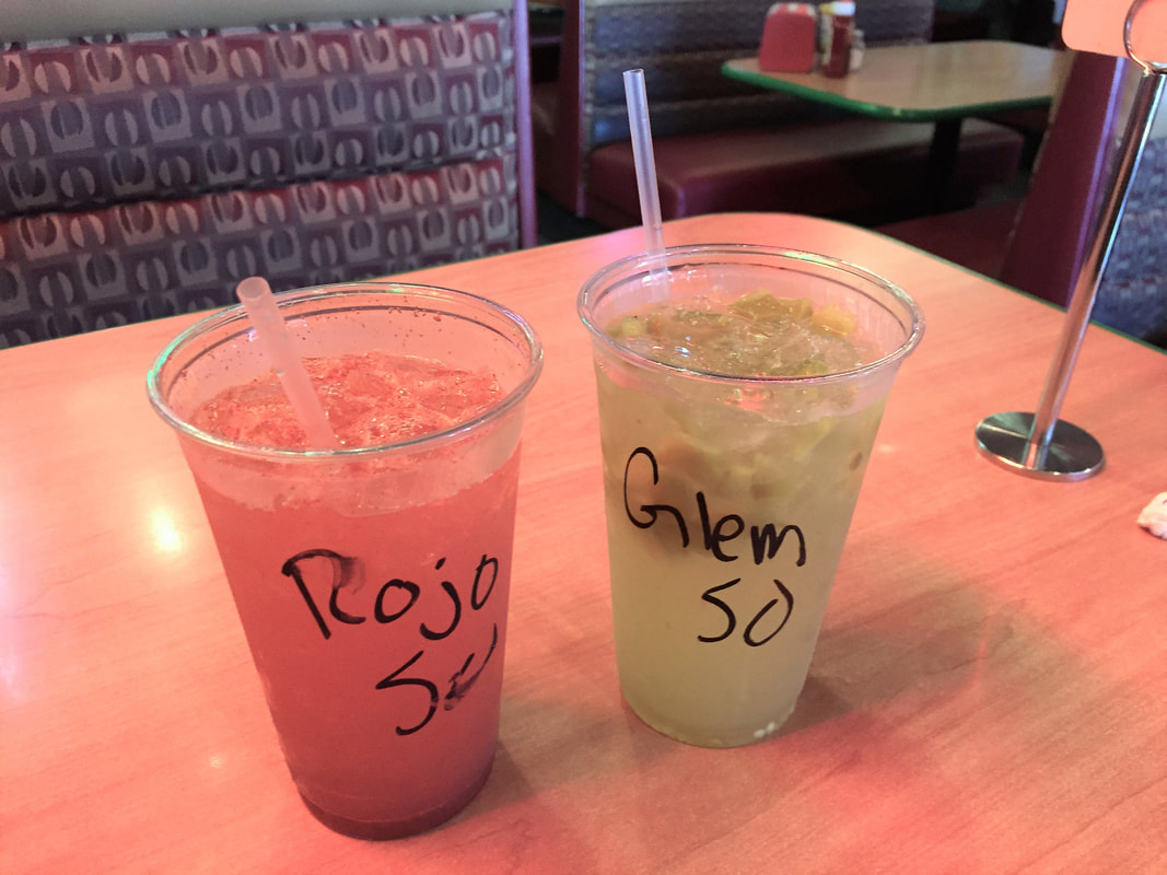
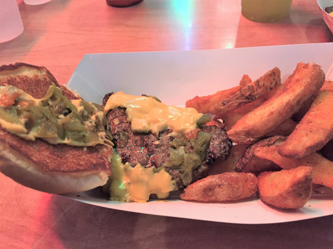
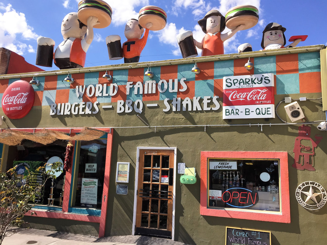
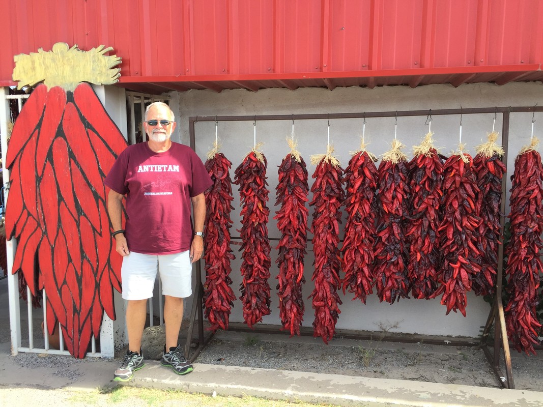
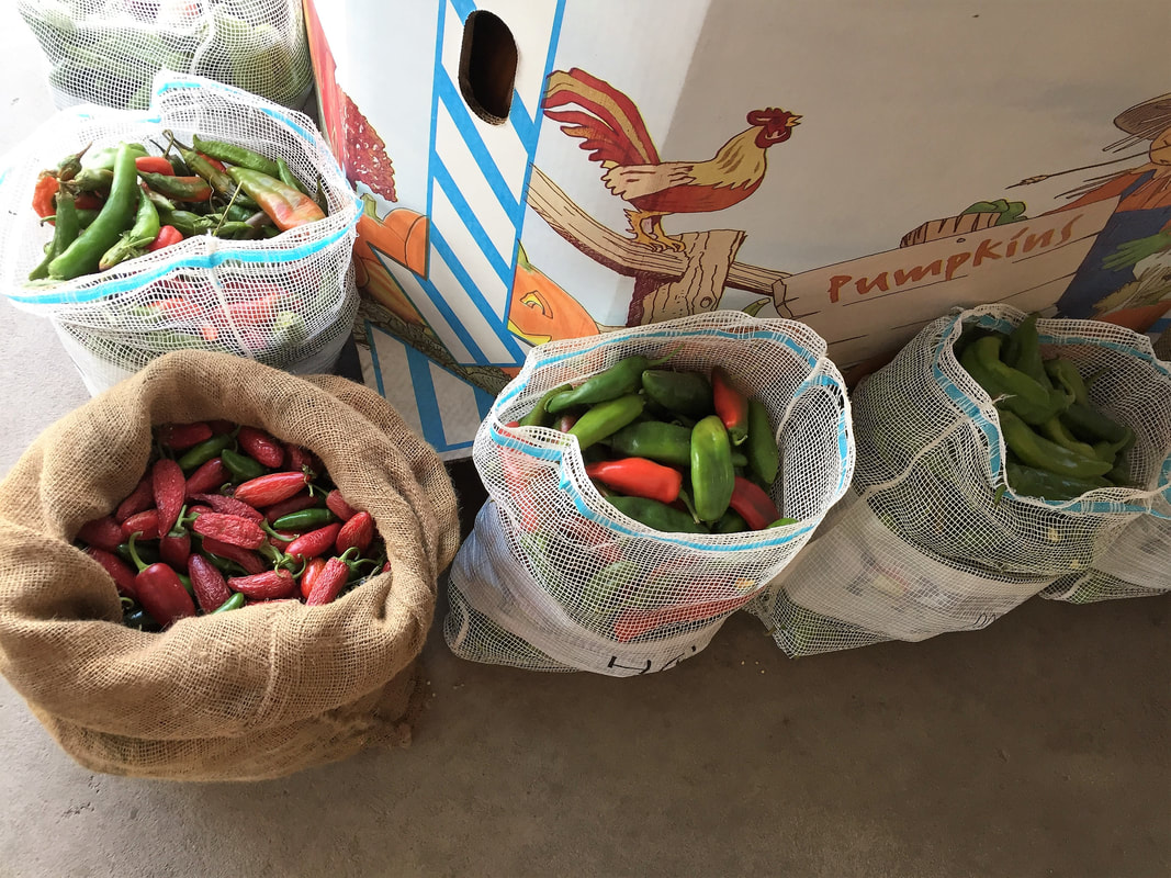
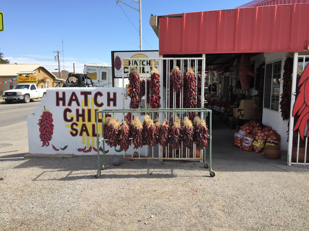
We stayed the night at Santa Fe, NM and then visited some cousins for a couple of days near Elizabeth Colorado before we arrived home on October 22. It's been a great vacation of about 6 weeks and that's the great thing about retirement! Total mileage is 5,300 miles. What a memorable trip! Now to plan for next year's trips!
